|
|
Point Mugu Nas (naval Base Ventura Co) Airport |
Naval Base Ventura County Point Mugu
Naval Base Ventura County (NBVC) |
 |
| IATA: NTD – ICAO: KNTD – FAA LID: NTD |
| Summary |
| Airport type |
Military |
| Operator |
United States Navy |
| Location |
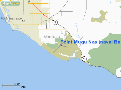
Point Mugu, Ventura County, near Oxnard, California |
| Elevation AMSL |
13 ft / 4 m |
| Coordinates |
34°07′13″N 119°07′16″W / 34.12028°N 119.12111°W / 34.12028; -119.12111Coordinates: 34°07′13″N 119°07′16″W / 34.12028°N 119.12111°W / 34.12028; -119.12111 |
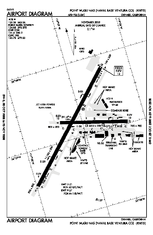
| Runways |
| Direction |
Length |
Surface |
| ft |
m |
| 3/21 |
11,102 |
3,384 |
Asphalt |
| 9/27 |
5,504 |
1,678 |
Asphalt |
Naval Base Ventura County Point Mugu or NBVC Point Mugu (IATA: NTD, ICAO: KNTD, FAA LID: NTD) is an military airbase located in Point Mugu, Ventura County, California, United States. Due to realignment actions which occurred in 2000, the base is now part of Naval Base Ventura County (NBVC), a consolidated organization that also includes Naval Base Ventura County Port Hueneme and San Nicolas Island. The facility also shares runways with the California Air National Guard at the Channel Islands Air National Guard station.
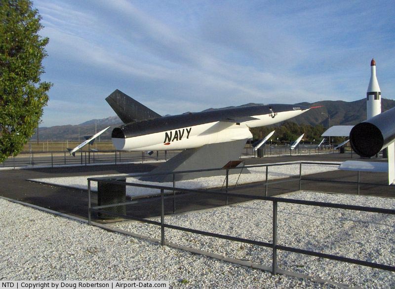
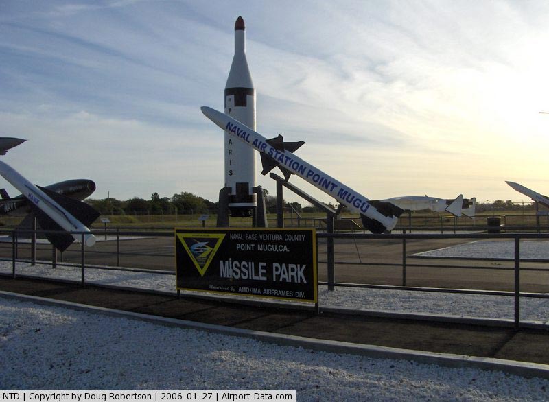
The facility adjacent to Point Mugu, California was developed in the late 1940s as the U.S. Navy's major missile development and test facility. This facility was the site where most of the Navy's missiles were developed and tested during the 1950/1960 era, including the AIM-7 Sparrow family and the AIM-54 Phoenix air-to-air, Bullpup air-to-surface, and Regulus surface-to-surface missiles.
NBVC Pt. Mugu has dominated the area since the 1940s, and is one of the few places in the area that is not agricultural. The base has been home to many ordnance testing programs, and the test range extends offshore to the Navy-owned San Nicolas Island in the Channel Islands.
In 1963 the U.S. Navy Marine Mammal Program was established on a sand spit between Mugu Lagoon and the ocean. The facility was relocated in 1967 to Point Loma in San Diego, California.
Point Mugu was the airfield used by former President Ronald Reagan during his presidency on visits to his Santa Barbara ranch. The airfield was also used during the state funeral honoring him in 2004, as the place where the former President's body was flown to Washington, D.C. to lie in state in the Capitol Rotunda. The body was flown back to Point Mugu aboard presidential aircraft SAM 28000 two days later. Until the late 1990s, the base hosted Antarctic Development Squadron SIX (VXE-6), the squadron of LC-130s equipped to land on ice in Antarctica, to supply the science stations there. Now, the New York Air National Guard's 109th Airlift Wing has assumed that responsibility.
Outside of the air station there is also Point Mugu State Park, a popular site for viewing birds, marine mammals, and wildflowers and provides about 15,000 acres (61 km²) of protected land including beaches, riparian areas, and coastal hills and canyons. Between the park and the naval base, Mugu Lagoon provides one of the largest coastal wetlands in Southern California that has not been largely developed. Tenant Squadrons
 | |
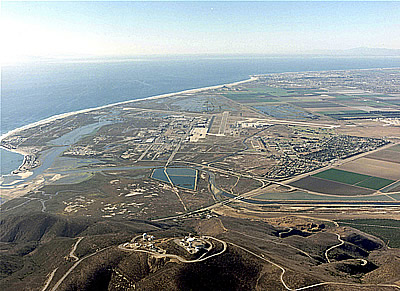
Aerial view of NAS Point Mugu |
- Carrier Airborne Early Warning Squadron 112
- Carrier Airborne Early Warning Squadron 113
- Carrier Airborne Early Warning Squadron 116
- Carrier Airborne Early Warning Squadron 117
- Fleet Logistics Support Squadron 55
- Fleet Logistics Support Squadron 30
- Air Test and Evaluation Squadron 9
- Air Test and Evaluation Squadron 30
- 146th Airlift Wing, California Air National Guard
Accidents and incidents
- On 4 August 1972, Douglas DC-3 N31538 of Mercer Airlines suffered an in-flight engine fire shortly after take-off on a cargo flight to Hollywood-Burbank Airport. The aircraft departed the runway in the emergency landing and was destroyed by the subsequent fire. All three people on board survived.
The above content comes from Wikipedia and is published under free licenses – click here to read more.
|
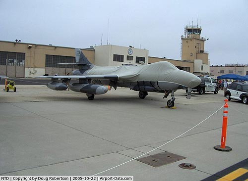 |
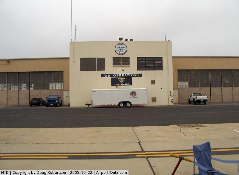
(Click on the photo to enlarge) |
|
 |
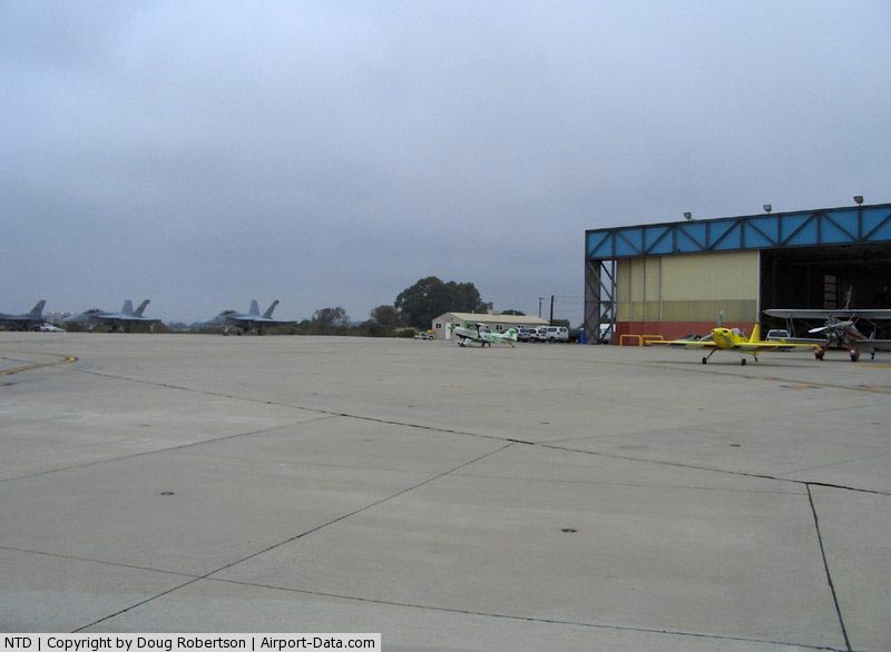
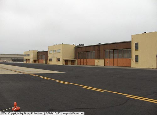
(Click on the photo to enlarge) |
|
 |
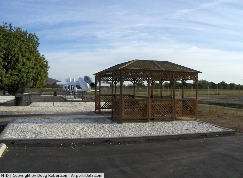
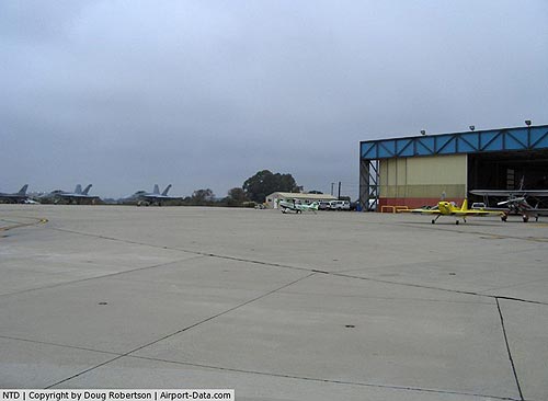
(Click on the photo to enlarge) |
|
 |
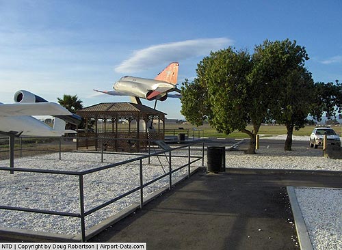
(Click on the photo to enlarge) |
|
 |
(Click on the photo to enlarge) |
|
 |
(Click on the photo to enlarge) |
|
 |
(Click on the photo to enlarge) |
|
 |
(Click on the photo to enlarge) |
Location
& QuickFacts
|
FAA
Information Effective: |
2006-09-28 |
|
Airport
Identifier: |
NTD |
|
Longitude/Latitude: |
119-07-15.6000W/34-07-13.2000N
-119.121000/34.120333 (Estimated) |
|
Elevation: |
13 ft / 3.96 m (Surveyed) |
|
Land: |
0 acres |
|
From
nearest city: |
0 nautical miles N of Point Mugu, CA |
|
Location: |
Ventura County, CA |
|
Magnetic Variation: |
14E (1985) |
Owner
& Manager
|
Ownership: |
Navy owned |
|
Owner: |
Us Navy |
|
Address: |
Oceanographic Ofc - Code 3142
Washington, DC 20373 |
|
Manager: |
Commanding Officer |
|
Address: |
Naval Air Facility
Point Mugu, CA 93042 |
Airport
Operations and Facilities
|
Airport
Use: |
Private |
|
Segmented
Circle: |
No |
|
Control
Tower: |
Yes |
|
Attendance
Schedule: |
ALL/ALL/1500-0700Z++
SEE FLIP AP/1 SUPPLEMENTARY ARPT RMK AND AP/1A. |
|
Lighting
Schedule: |
DUSK-DAWN |
|
Beacon
Color: |
Split-Clear-Green (lighted military airport) |
|
Sectional
chart: |
Los Angeles |
|
Region: |
AWP - Western-Pacific |
|
Boundary
ARTCC: |
ZLA - Los Angeles |
|
Tie-in
FSS: |
HHR - Hawthorne |
|
FSS
on Airport: |
No |
|
FSS
Phone: |
310-970-0102 |
|
FSS
Toll Free: |
1-800-WX-BRIEF |
|
NOTAMs
Facility: |
NTD (NOTAM-d service avaliable) |
|
Certification
type/date: |
?? ??/???? |
Airport
Services
|
Airframe
Repair: |
NONE |
|
Power
Plant Repair: |
NONE |
|
Bottled
Oxygen: |
NONE |
|
Bulk
Oxygen: |
NONE |
|
Runway Information
Runway 03/21
|
Dimension: |
11102 x 200 ft / 3383.9 x 61.0 m |
|
Surface: |
ASPH, |
|
Edge
Lights: |
High |
|
|
Runway 03 |
Runway 21 |
|
Longitude: |
119-08-04.1800W |
119-06-32.7500W |
|
Latitude: |
34-06-30.4100N |
34-07-49.6500N |
|
Elevation: |
11.00
ft |
13.00
ft |
|
Alignment: |
44 |
127 |
|
ILS
Type: |
|
ILS/DME |
|
Traffic
Pattern: |
Left |
Left |
|
Crossing
Height: |
47.00 ft |
45.00 ft |
|
VASI: |
4-box on left side |
4-box on right side |
|
Visual
Glide Angle: |
3.00� |
3.00� |
|
Approach
lights: |
SALS |
MALSR |
|
Centerline
Lights: |
No |
No |
|
Runway 09/27
|
Dimension: |
5504 x 200 ft / 1677.6 x 61.0 m |
|
Surface: |
ASPH, |
|
Edge
Lights: |
High |
|
|
Runway 09 |
Runway 27 |
|
Longitude: |
119-07-25.9600W |
119-06-22.7700W |
|
Latitude: |
34-07-15.1200N |
34-07-01.0200N |
|
Elevation: |
10.00
ft |
12.00
ft |
|
Alignment: |
105 |
127 |
|
Traffic
Pattern: |
Left |
Left |
|
Arresting: |
|
E28B |
|
Centerline
Lights: |
No |
No |
|
Radio Navigation
Aids
|
ID |
Type |
Name |
Ch |
Freq |
Var |
Dist |
|
PAI |
NDB |
Pacoima |
|
370.00 |
15E |
36.2 nm |
|
CPM |
NDB |
Compton |
|
378.00 |
15E |
45.7 nm |
|
NTD |
TACAN |
Point Mugu |
043X |
|
15E |
0.2 nm |
|
VTU |
VOR/DME |
Ventura |
019X |
108.20 |
15E |
3.6 nm |
|
CMA |
VOR/DME |
Camarillo |
105X |
115.80 |
15E |
5.7 nm |
|
VNY |
VOR/DME |
Van Nuys |
078X |
113.10 |
15E |
31.9 nm |
|
SMO |
VOR/DME |
Santa Monica |
045X |
110.80 |
15E |
33.7 nm |
|
FIM |
VORTAC |
Fillmore |
072X |
112.50 |
15E |
18.5 nm |
|
LAX |
VORTAC |
Los Angeles |
083X |
113.60 |
15E |
36.1 nm |
|
RZS |
VORTAC |
San Marcus |
096X |
114.90 |
14E |
39.9 nm |
|
GMN |
VORTAC |
Gorman |
108X |
116.10 |
16E |
43.1 nm |
|
LHS |
VORTAC |
Lake Hughes |
021X |
108.40 |
15E |
43.3 nm |
|
LAX |
VOT |
San Pedro Hill |
|
113.90 |
|
45.2 nm |
Remarks
- RWY-LGTS:
RWY 03 SF, OLS.
- OIL:
O-128-148.
- TRAN
ALERT: OPR 1400-0200Z++ WKD; CLSD ALTN FRI, SAT, SUN AND FEDERAL HOL.
NO TRAN
ACFT OUTSIDE THESE HR WO PPR.
- RSTD:
PPR. OPS DUTY OFFICER DSN 351-8521 C805-989-8521. PRIOR COORD OR FLT
ADVSY RQR AMC/NALO MSN.
- TFC
PAT: REDUCED RWY SEPARATION STD IN EFF USN/USMC ACFT. RWY 21 DEP DO
NOT COMMENCE TURNS TIL 500' AND 1/2 NM OFFSHORE. RWY
27 DEP DO NOT COMMENCE TURNS TIL 500'.
- NS
ABTMT: AVOID POPULATED AREAS WHEN POSSIBLE DUE TO EXTREME NOISE SENSITIVE
AREA. PRO IN EFF 0200-1600Z++. EXP RWY 3 ARR OR RWY 21 DEP BTN 0200-1600Z++
AND 24 HR WKD, ALTN FRI, SAT, SUN, AND FEDERAL HOL.
-
CSTMS/AG/IMG: CSTMS, AG, IMG AVBL DUR OPR HR WITH 24
HR PN.
- MISC
- CAT E AIRSPACE EFF 0600-1400Z++. ANG - CHANNEL ISLANDS ANGB PPR DSN
893-7577, C805-986-7577.
- CAUTION
- EXTREME MID-AIR POTENTIAL DUE HI DENSITY VFR GENERAL AVN TFC IN VCNTY.
CIV ARPT (CAMARILLO) 6 NM N UNCTL 0500-1500Z++ DLY. HI TERRAIN TO 1567'
E OF FLD. BIRD HAZ. HANG GLIDER ACT VCNTY ROUND MT 4 NM NE SR-SS.
- RWY-LGTS:
RWY 21 SF, OLS. RWY-LGTS:
RWY 27 OLS.
- A-GEAR:
RWY 03, HOOK E28(B) (2500').
- A-GEAR:
RWY 21, HOOK E28(B) (2500').
- A-GEAR:
RWY 09, HOOK E28(B) (641').
- A-GEAR:
RWY 27, HOOK E28(B) (1250').
- JASU:
3(NCPP-105) 8(A/M47A-4) 9(GTC-85).
- FUEL:
J5, J8.
- FLUID
- SP LHOX LOX.
Point Mugu Nas (naval Base Ventura Co)
Airport
Address:
Ventura County, CA
Tel:
Images
and information placed above are from
http://www.airport-data.com/airport/NTD/
We
thank them for the data!
| General
Info |
| Country |
United
States |
| State |
CALIFORNIA
|
| FAA ID |
NTD
|
| Latitude |
34-07-13.021N
|
| Longitude |
119-07-15.375W
|
| Elevation |
12 feet
|
| Near City |
POINT
MUGU |
We don't guarantee the information is fresh and accurate. The data may
be wrong or outdated.
For more up-to-date information please refer to other sources.
|
|