 |
|
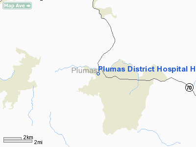
Plumas District Hospital Heliport |
|
|
Location
& QuickFacts
|
FAA
Information Effective: |
2006-09-28 |
|
Airport
Identifier: |
CL94 |
|
Longitude/Latitude: |
120-57-33.8350W/39-56-25.6100N
-120.959399/39.940447 (Estimated) |
|
Elevation: |
3425 ft / 1043.94 m (Estimated) |
|
Land: |
0 acres |
|
From
nearest city: |
1 nautical miles E of Quincy, CA |
|
Location: |
Plumas County, CA |
|
Magnetic Variation: |
17E (1985) |
Owner
& Manager
|
Ownership: |
Publicly owned |
|
Owner: |
Plumas Hospital District |
|
Address: |
1065 Bucks Lake Road
Quincy, CA 95971 |
|
Phone
number: |
916-283-2121 |
|
Manager: |
Steven C. Rosenberger |
|
Address: |
1065 Bucks Lake Road
Quincy, CA 95971 |
|
Phone number: |
916-283-2121 |
Airport
Operations and Facilities
|
Airport
Use: |
Private
MEDICAL |
|
Wind
indicator: |
Yes |
|
Segmented
Circle: |
No |
|
Control
Tower: |
No |
|
Attendance
Schedule: |
ALL/ALL/ALL |
|
Lighting
Schedule: |
PHONE REQ
FOR PERIMETER LGTS CALL 916-283-2121. |
|
Sectional
chart: |
San Francisco |
|
Region: |
AWP - Western-Pacific |
|
Boundary
ARTCC: |
ZOA - Oakland |
|
Tie-in
FSS: |
RIU - Rancho Murieta |
|
FSS
on Airport: |
No |
|
FSS
Phone: |
916-354-0161 |
|
FSS
Toll Free: |
1-800-WX-BRIEF |
|
Runway Information
Helipad H1
|
Dimension: |
65 x 65 ft / 19.8 x 19.8 m |
|
Surface: |
ASPH, |
|
|
Runway H1 |
Runway |
|
Traffic
Pattern: |
Left |
Left |
|
Radio Navigation
Aids
|
ID |
Type |
Name |
Ch |
Freq |
Var |
Dist |
|
OVE |
NDB |
Oroville |
|
212.00 |
16E |
40.7 nm |
|
CIC |
VOR/DME |
Chico |
035X |
109.80 |
16E |
41.9 nm |
|
AHC |
VOR/DME |
Amedee |
027X |
109.00 |
17E |
42.0 nm |
Remarks
Plumas District Hospital Heliport
Address:
Plumas County, CA
Tel:
916-283-2121
Images
and information placed above are from
http://www.airport-data.com/airport/CL94/
We
thank them for the data!
| General
Info |
| Country |
United
States |
| State |
CALIFORNIA
|
| FAA ID |
CL94
|
| Latitude |
39-56-25.610N
|
| Longitude |
120-57-33.835W
|
| Elevation |
3425 feet
|
| Near City |
QUINCY
|
We don't guarantee the information is fresh and accurate. The data may
be wrong or outdated.
For more up-to-date information please refer to other sources.
|
|


