 |
|
|
|
|
|
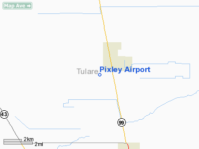
Location
& QuickFacts
|
FAA
Information Effective: |
2006-09-28 |
|
Airport
Identifier: |
P27 |
|
Longitude/Latitude: |
119-18-29.4040W/35-57-37.8330N
-119.308168/35.960509 (Estimated) |
|
Elevation: |
256 ft / 78.03 m (Surveyed) |
|
Land: |
99 acres |
|
From
nearest city: |
1 nautical miles SW of Pixley, CA |
|
Location: |
Tulare County, CA |
|
Magnetic Variation: |
15E (1985) |
Owner
& Manager
|
Ownership: |
Publicly owned |
|
Owner: |
County Of Tulare |
|
Address: |
County Civic Center
Visalia, CA 93291-4584 |
|
Phone
number: |
209-733-6612 |
|
Manager: |
Steven Larson
DIRECTOR OF BUILDINGS, SERVICES AND PARKS; LCT IN VISALIA. |
|
Address: |
County Civic Center
Visalia, CA 93291-4584 |
|
Phone number: |
209-733-6612 |
Airport
Operations and Facilities
|
Airport
Use: |
Open to public |
|
Wind
indicator: |
Yes |
|
Segmented
Circle: |
Yes |
|
Control
Tower: |
No |
|
Attendance
Schedule: |
UNATNDD |
|
Lighting
Schedule: |
DUSK-DAWN |
|
Landing
fee charge: |
No |
|
Sectional
chart: |
Los Angeles |
|
Region: |
AWP - Western-Pacific |
|
Traffic
Pattern Alt: |
800 ft |
|
Boundary
ARTCC: |
ZOA - Oakland |
|
Tie-in
FSS: |
RIU - Rancho Murieta |
|
FSS
on Airport: |
No |
|
FSS
Phone: |
916-354-0161 |
|
FSS
Toll Free: |
1-800-WX-BRIEF |
|
NOTAMs
Facility: |
RIU (NOTAM-d service avaliable) |
|
Federal Agreements: |
1 |
Airport
Communications
Airport
Services
|
Bottled
Oxygen: |
NONE |
|
Bulk
Oxygen: |
NONE |
|
Runway Information
Runway 13/31
|
Dimension: |
2050 x 60 ft / 624.8 x 18.3 m |
|
Surface: |
ASPH, Fair Condition |
|
Weight
Limit: |
Single wheel: 11000 lbs. |
|
Edge
Lights: |
Medium |
|
|
Runway 13 |
Runway 31 |
|
Elevation: |
254.00 ft |
256.00 ft |
|
Traffic
Pattern: |
Right |
Left |
|
Markings: |
Basic, Fair Condition |
Basic, Fair Condition |
|
Runway
End Identifier: |
No |
No |
|
Centerline
Lights: |
No |
No |
|
Touchdown
Lights: |
No |
No |
|
Obstruction: |
4 ft fence, 200.0 ft from runway, 100 ft left
of centerline
+3 FT FENCE 100 FT L TO 125 FT L; 180-200 FT FM RY END. |
3 ft berm, 300.0 ft from runway, 135 ft left
of centerline, 33:1 slope to clear |
|
Radio Navigation
Aids
|
ID |
Type |
Name |
Ch |
Freq |
Var |
Dist |
|
COR |
NDB |
Salyer Farms |
|
205.00 |
16E |
12.8 nm |
|
CUK |
NDB |
Academy |
|
266.00 |
14E |
48.9 nm |
|
NLC |
TACAN |
Lemoore |
080X |
|
16E |
39.4 nm |
|
TTE |
VOR/DME |
Tule |
029X |
109.20 |
16E |
14.3 nm |
|
VIS |
VOR/DME |
Visalia |
031X |
109.40 |
16E |
25.9 nm |
|
EHF |
VORTAC |
Shafter |
101X |
115.40 |
14E |
30.4 nm |
|
AVE |
VORTAC |
Avenal |
118X |
117.10 |
16E |
37.7 nm |
|
BFL |
VOT |
Bakersfield |
|
111.20 |
|
34.6 nm |
Remarks
- ARPT
ALSO KNOWN AS HARMON FIELD.
- (ARPT
STATUS) ARPT CLSD INDEFLY.
- PREDATES
1958 FA ACT.
Based Aircraft
|
Aircraft
based on field: |
7 |
|
Single
Engine Airplanes: |
6 |
|
Multi
Engine Airplanes: |
1 |
Operational Statistics
|
Aircraft
Operations: |
162/Week |
|
General
Aviation Local: |
50.0% |
|
General
Aviation Itinerant: |
50.0% |
Pixley Airport
Address:
Tulare County, CA
Tel:
209-733-6612
Images
and information placed above are from
http://www.airport-data.com/airport/P27/
We
thank them for the data!
We don't guarantee the information is fresh and accurate. The data may
be wrong or outdated.
For more up-to-date information please refer to other sources.
|
|


