 |
|
Location
& QuickFacts
|
FAA
Information Effective: |
2006-09-28 |
|
Airport
Identifier: |
CL56 |
|
Longitude/Latitude: |
121-08-06.7100W/36-30-36.8690N
-121.135197/36.510241 (Estimated) |
|
Elevation: |
1200 ft / 365.76 m (Estimated) |
|
Land: |
8 acres |
|
From
nearest city: |
20 nautical miles NW of Paicines, CA |
|
Location: |
San Benito County, CA |
|
Magnetic Variation: |
15E (1985) |
Owner
& Manager
|
Ownership: |
Privately owned |
|
Owner: |
Pinnacles Land & Cattle Co. |
|
Address: |
31300 Airline Hwy.
Paicines, CA 95043 |
|
Phone number: |
408-637-7177 |
|
Manager: |
S. K. Kingman |
|
Address: |
31300 Airline Hwy.
Paicines, CA 95043 |
|
Phone number: |
408-637-7177 |
Airport
Operations and Facilities
|
Airport
Use: |
Private |
|
Wind
indicator: |
Yes |
|
Segmented
Circle: |
No |
|
Control
Tower: |
No |
|
Attendance
Schedule: |
UNATNDD |
|
Sectional
chart: |
San Francisco |
|
Region: |
AWP - Western-Pacific |
|
Boundary
ARTCC: |
ZOA - Oakland |
|
Tie-in
FSS: |
OAK - Oakland |
|
FSS
Phone: |
510-273-6111 |
|
FSS
Toll Free: |
1-800-WX-BRIEF |
|
Runway
Information
Runway N/S
|
Dimension: |
3000 x 50 ft / 914.4 x 15.2 m |
|
Surface: |
TURF, |
|
|
Runway N |
Runway S |
|
Traffic
Pattern: |
Left |
Left |
|
Radio Navigation
Aids
|
ID |
Type |
Name |
Ch |
Freq |
Var |
Dist |
|
UAD |
NDB |
Chualar |
|
263.00 |
16E |
16.5 nm |
|
HGT |
NDB |
Hunter Liggett |
|
209.00 |
15E |
33.1 nm |
|
PDG |
NDB |
Pajar |
|
327.00 |
17E |
40.5 nm |
|
ROM |
VOR |
Priest |
|
110.00 |
16E |
31.8 nm |
|
PXN |
VORTAC |
Panoche |
073X |
112.60 |
16E |
21.2 nm |
|
SNS |
VORTAC |
Salinas |
120X |
117.30 |
17E |
24.4 nm |
|
BSR |
VORTAC |
Big Sur |
087X |
114.00 |
16E |
31.5 nm |
Remarks
- WHEN
LNDG TO N SUGGEST STD LEFT HAND TFC APCH, ABOUT 800 AGL; 2000 MSL.
- WINDS
GENERALLY FAVOR LNDG TO NORTH.
- WHEN
LNDG TO SOUTH SUGGEST RIGHT HAND TFC APCH THRU VALLEY APCHG FM NORTHWEST.
- VFR
PRIVATE USE ONLY.
Based Aircraft
|
Aircraft
based on field: |
3 |
|
Single
Engine Airplanes: |
3 |
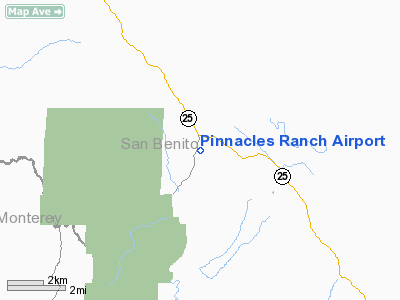
Pinnacles Ranch Airport
Address:
San Benito County, CA
Tel:
408-637-7177
Images
and information placed above are from
http://www.airport-data.com/airport/CL56/
We
thank them for the data!
| General
Info |
| Country |
United
States |
| State |
CALIFORNIA
|
| FAA ID |
CL56
|
| Latitude |
36-30-36.869N
|
| Longitude |
121-08-06.710W
|
| Elevation |
1200 feet
|
| Near City |
PAICINES
|
We don't guarantee the information is fresh and accurate. The data may
be wrong or outdated.
For more up-to-date information please refer to other sources.
|
|


