 |
|
|
|
|
|
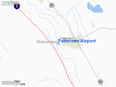
Location
& QuickFacts
|
FAA
Information Effective: |
2006-09-28 |
|
Airport
Identifier: |
CA02 |
|
Longitude/Latitude: |
121-10-09.7630W/37-28-06.7590N
-121.169379/37.468544 (Estimated) |
|
Elevation: |
168 ft / 51.21 m (Surveyed) |
|
Land: |
30 acres |
|
From
nearest city: |
2 nautical miles W of Patterson, CA |
|
Location: |
Stanislaus County, CA |
|
Magnetic Variation: |
16E (1985) |
Owner
& Manager
|
Ownership: |
Privately owned |
|
Owner: |
Warren Fink |
|
Address: |
Box 692
Patterson, CA 95363 |
|
Phone
number: |
209-892-8241 |
|
Manager: |
Warren Fink |
|
Address: |
Box 692
Patterson, CA 95363 |
|
Phone number: |
209-892-8241 |
Airport
Operations and Facilities
|
Airport
Use: |
Private |
|
Wind
indicator: |
Yes |
|
Segmented
Circle: |
Yes |
|
Control
Tower: |
No |
|
Attendance
Schedule: |
UNATNDD |
|
Landing
fee charge: |
No |
|
Sectional
chart: |
San Francisco |
|
Region: |
AWP - Western-Pacific |
|
Traffic
Pattern Alt: |
800 ft |
|
Boundary
ARTCC: |
ZOA - Oakland |
|
Tie-in
FSS: |
RIU - Rancho Murieta |
|
FSS
on Airport: |
No |
|
FSS
Phone: |
916-354-0161 |
|
FSS Toll Free: |
1-800-WX-BRIEF |
Airport
Services
|
Airframe
Repair: |
NONE |
|
Power
Plant Repair: |
NONE |
|
Bottled
Oxygen: |
NONE |
|
Bulk
Oxygen: |
NONE |
|
Runway Information
Runway 16/34
|
Dimension: |
2500 x 35 ft / 762.0 x 10.7 m |
|
Surface: |
ASPH-DIRT,
RWY 16/34 S 2500 FT ASPH & N 150 FT DIRT. |
|
|
Runway 16 |
Runway 34 |
|
Traffic
Pattern: |
Left |
Right |
|
Markings: |
Nonstandard, |
Nonstandard, |
|
Displaced
threshold: |
0.00 ft
DSPLCD THR RWY 34 MARKING ONLY. |
260.00 ft |
|
Runway
End Identifier: |
No |
No |
|
Centerline
Lights: |
No |
No |
|
Touchdown
Lights: |
No |
No |
|
Radio Navigation
Aids
|
ID |
Type |
Name |
Ch |
Freq |
Var |
Dist |
|
TCY |
NDB |
Tracy |
|
203.00 |
15E |
18.8 nm |
|
LV |
NDB |
Reiga |
|
374.00 |
16E |
28.0 nm |
|
PDG |
NDB |
Pajar |
|
327.00 |
17E |
45.3 nm |
|
NUQ |
TACAN |
Moffett |
123X |
|
17E |
42.4 nm |
|
MOD |
VOR/DME |
Modesto |
093X |
114.60 |
17E |
13.9 nm |
|
SJC |
VOR/DME |
San Jose |
088X |
114.10 |
16E |
37.4 nm |
|
HYP |
VOR/DME |
El Nido |
089X |
114.20 |
15E |
39.7 nm |
|
ECA |
VORTAC |
Manteca |
107X |
116.00 |
17E |
21.9 nm |
|
LIN |
VORTAC |
Linden |
095X |
114.80 |
17E |
37.3 nm |
|
PXN |
VORTAC |
Panoche |
073X |
112.60 |
16E |
49.0 nm |
Remarks
- FIELD
CONDITIONS RWY 16/34 DIRT PORTION SOFT WHEN WET. ARPON
GOOD.
- EXISTED
PRIOR TO 1959.
Based Aircraft
|
Aircraft
based on field: |
12 |
|
Single
Engine Airplanes: |
10 |
|
Multi
Engine Airplanes: |
1 |
|
Helicopters: |
1 |
Operational Statistics
|
Aircraft
Operations: |
231/Week |
|
General
Aviation Local: |
83.3% |
|
General
Aviation Itinerant: |
16.7% |
Patterson Airport
Address:
Stanislaus County, CA
Tel:
209-892-8241
Images
and information placed above are from
http://www.airport-data.com/airport/CA02/
We
thank them for the data!
| General
Info |
| Country |
United
States |
| State |
CALIFORNIA
|
| FAA ID |
CA02
|
| Latitude |
37-28-06.759N
|
| Longitude |
121-10-09.763W
|
| Elevation |
168 feet
|
| Near City |
PATTERSON
|
We don't guarantee the information is fresh and accurate. The data may
be wrong or outdated.
For more up-to-date information please refer to other sources.
|
|


