 |
|
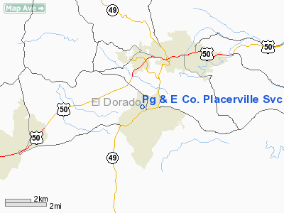
Pacific Gas and Electric Co. Placerville Svc Center Heliport |
Location
& QuickFacts
|
FAA
Information Effective: |
2006-09-28 |
|
Airport
Identifier: |
08CA |
|
Longitude/Latitude: |
120-49-37.7690W/38-41-41.6530N
-120.827158/38.694904 (Estimated) |
|
Elevation: |
1810 ft / 551.69 m (Estimated) |
|
Land: |
0 acres |
|
From
nearest city: |
1 nautical miles W of Diamond Springs, CA |
|
Location: |
El Dorado County, CA |
|
Magnetic Variation: |
16E (1985) |
Owner
& Manager
|
Ownership: |
Privately owned |
|
Owner: |
Pacific Gas & Elec Co. |
|
Address: |
343 Sacramento Street
Auburn, CA 95603 |
|
Phone
number: |
916-889-3195 |
|
Manager: |
Jim Abercrombie |
|
Address: |
4636 Missouri Flat Road
Placerville, CA 95667 |
|
Phone number: |
916-621-7274 |
Airport
Operations and Facilities
|
Airport
Use: |
Private |
|
Wind
indicator: |
Yes |
|
Segmented
Circle: |
No |
|
Control
Tower: |
No |
|
Attendance
Schedule: |
UNATNDD |
|
Landing
fee charge: |
No |
|
Sectional
chart: |
San Francisco |
|
Region: |
AWP - Western-Pacific |
|
Boundary
ARTCC: |
ZOA - Oakland |
|
Tie-in
FSS: |
OAK - Oakland |
|
FSS
Phone: |
510-273-6111 |
|
FSS
Toll Free: |
1-800-WX-BRIEF |
|
Runway Information
Helipad H1
|
Dimension: |
60 x 60 ft / 18.3 x 18.3 m |
|
Surface: |
ASPH, |
|
|
Runway H1 |
Runway |
|
Traffic
Pattern: |
Left |
Left |
|
Radio Navigation
Aids
|
ID |
Type |
Name |
Ch |
Freq |
Var |
Dist |
|
MY |
NDB |
Halow |
|
222.00 |
16E |
46.4 nm |
|
BAB |
TACAN |
Beale |
023X |
|
16E |
39.0 nm |
|
HNW |
VOR/DME |
Hangtown |
102X |
115.50 |
17E |
4.1 nm |
|
MCC |
VOR/DME |
Mc Clellan |
029X |
109.20 |
17E |
27.1 nm |
|
SWR |
VOR/DME |
Squaw Valley |
079X |
113.20 |
16E |
39.1 nm |
|
MYV |
VOR/DME |
Marysville |
045X |
110.80 |
16E |
42.5 nm |
|
SAC |
VORTAC |
Sacramento |
099X |
115.20 |
17E |
37.2 nm |
|
LIN |
VORTAC |
Linden |
095X |
114.80 |
17E |
38.2 nm |
|
SAC |
VOT |
Sacramento Executive |
|
111.40 |
|
33.4 nm |
|
SMF |
VOT |
Sacramento Metropolitan |
|
111.40 |
|
35.8 nm |
Remarks
Based Aircraft
|
Aircraft
based on field: |
1 |
|
Helicopters: |
1 |
Pg & E Co. Placerville Svc Center
Heliport
Address:
El Dorado County, CA
Tel:
916-889-3195,
916-621-7274
Images
and information placed above are from
http://www.airport-data.com/airport/08CA/
We
thank them for the data!
| General
Info |
| Country |
United
States |
| State |
CALIFORNIA
|
| FAA ID |
08CA
|
| Latitude |
38-41-41.653N
|
| Longitude |
120-49-37.769W
|
| Elevation |
1810 feet
|
| Near City |
DIAMOND
SPRINGS |
We don't guarantee the information is fresh and accurate. The data may
be wrong or outdated.
For more up-to-date information please refer to other sources.
|
|


