|
|
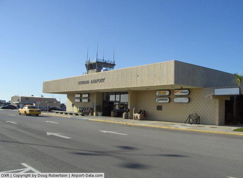
| Oxnard Airport |
 |
| IATA: OXR – ICAO: KOXR – FAA LID: OXR |
| Summary |
| Airport type |
Public |
| Owner |
Ventura County |
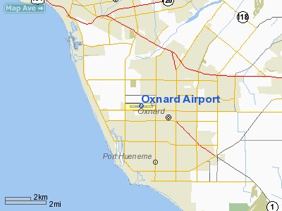
| Location |
Oxnard, California |
| Elevation AMSL |
15 ft / 13.7 m |
| Coordinates |
34°12′03″N 119°12′26″W / 34.20083°N 119.20722°W / 34.20083; -119.20722 |
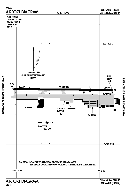
| Runways |
| Direction |
Length |
Surface |
| ft |
m |
| 7/25 |
5,953 |
1,814 |
Asphalt |
Oxnard Airport (IATA: OXR, ICAO: KOXR, FAA LID: OXR) is a public airport located one mile (1.6 km) west of the central business district (CBD) of Oxnard, a city in Ventura County, California, USA. The airport covers 216 acres (87 ha) and has one runway. Oxnard Airport is managed by the Ventura County Department of Airports. History
Ventura County opened Oxnard Airport in 1934 by clearing a 3,500 ft dirt runway. In the 1930’s, aviator Howard Hughes erected a tent at the airport to shelter his famous H-1 monoplane racer, which he tested from the dirt strip. In 1938, Ventura County paved the dirt runway and constructed a large hangar to attract more business. The year following, James McLean opened the Oxnard Flying School with a Piper J-3 Cub and a Kinner 2-seat airplane. Housing was constructed nearby to accommodate instructors and students for the school.
In late 1941, war was declared. The airport was assigned to the U.S. Navy until the Naval Air Station at Point Mugu could be completed. The Navy moved to NAS Point Mugu in 1945 and the Oxnard Flying School returned to the airport. Ventura County officially regained control of the airport from the federal government in 1948 by receiving a final quitclaim deed. The state of California issued the airport an operating permit in 1949. Scheduled airline passenger service was established in 1946 by Southwest Airlines with Douglas DC-3 airplanes. Oxnard Airport has been the only airport in the Ventura County area to support continuous airline passenger service since World War II.
The airport has been previously served by American Eagle, America West Express, California Air Shuttle and most recently United Express which ended service to LAX on June 8, 2010
Airport today
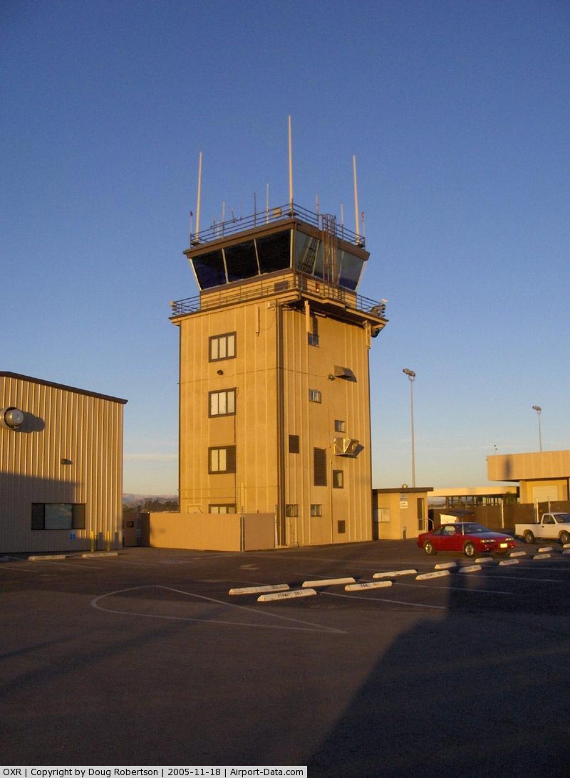
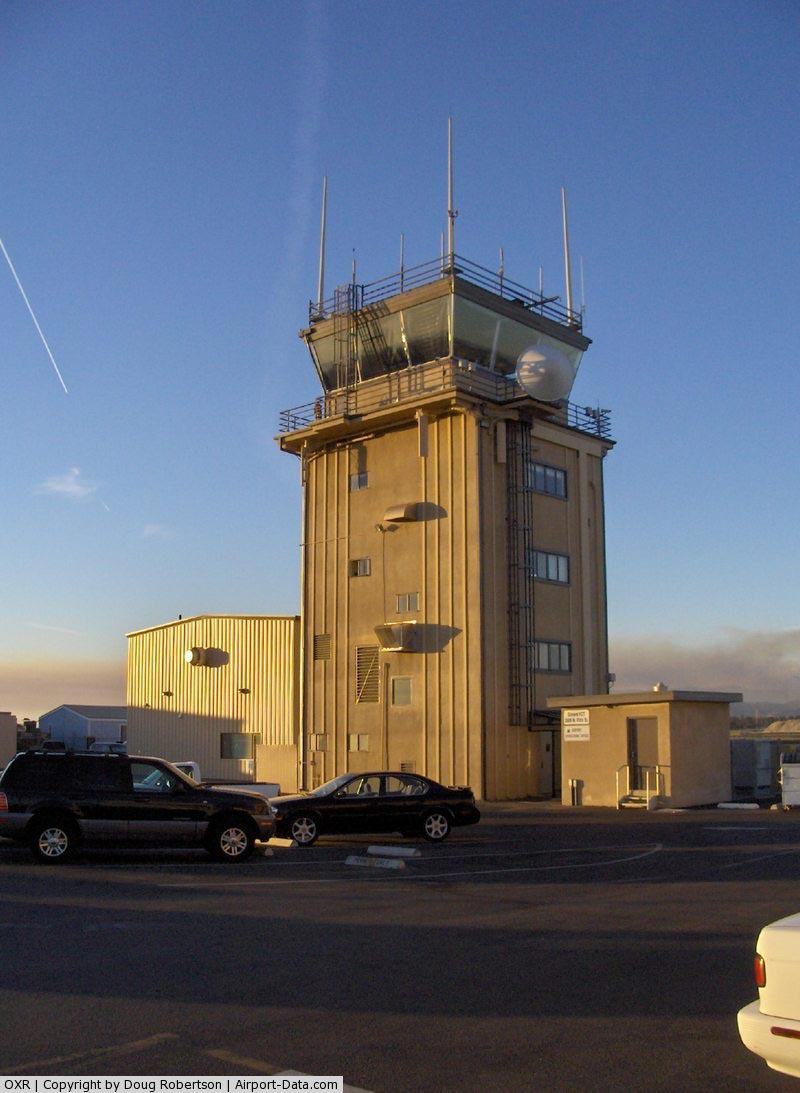
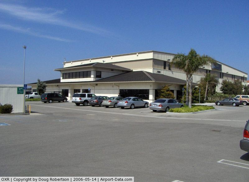
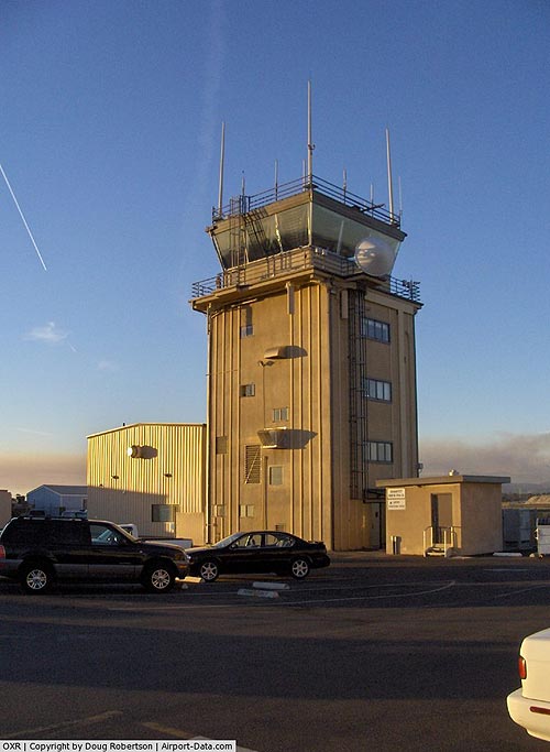
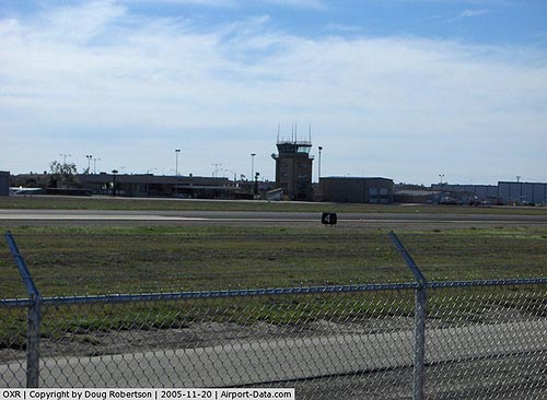
Today Oxnard Airport has a contract air traffic control tower handling approximately 100,000 arrivals and/or departures a year, and is home to over 180 individual aircraft. As of February 2007, two Fixed Base Operators, an authorized overhaul facility for Robinson helicopters, Light Helicopter Depot, and an authorized FAA Medical Examiner.
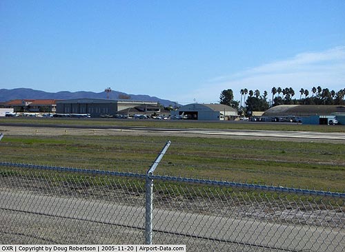
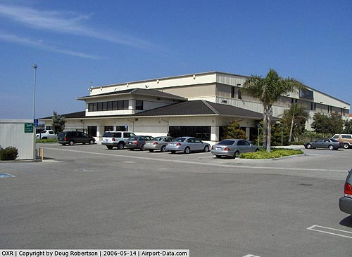
Facilities
- Aspen Helicopters is a FBO located at the airport, and is also known as the ‘’’Oxnard Jet Center’’’
- Golden West Jet Centers: Oxnard is an Oxnard-based FBO.
- Light Helicopter Depot: Oxnard is an Oxnard-based Robinson Helicopter Overhaul Facility.
The above content comes from Wikipedia and is published under free licenses – click here to read more.
|
 |
(Click on the photo to enlarge) |
|
 |
(Click on the photo to enlarge) |
|
 |
(Click on the photo to enlarge) |
|
 |
(Click on the photo to enlarge) |
|
 |
(Click on the photo to enlarge) |
|
 |
(Click on the photo to enlarge) |
Location
& QuickFacts
|
FAA
Information Effective: |
2006-09-28 |
|
Airport
Identifier: |
OXR |
|
Longitude/Latitude: |
119-12-26.0000W/34-12-02.9000N
-119.207222/34.200806 (Estimated) |
|
Elevation: |
45 ft / 13.72 m (Surveyed) |
|
Land: |
216 acres |
|
From
nearest city: |
1 nautical miles W of Oxnard, CA |
|
Location: |
Ventura County, CA |
|
Magnetic Variation: |
15E (1980) |
Owner
& Manager
|
Ownership: |
Publicly owned |
|
Owner: |
County Of Ventura |
|
Address: |
555 Airport Way
Camarillo, CA 93010 |
|
Phone
number: |
805-388-4200 |
|
Manager: |
Patrick Lammerding
DIRECTOR OF ARPTS - TODD MCNAMEE (805) 388-4200. |
|
Address: |
2889 W 5th St
Oxnard, CA 93030 |
|
Phone number: |
805-382-3024 |
Airport
Operations and Facilities
|
Airport
Use: |
Open to public |
|
Wind
indicator: |
Yes |
|
Segmented
Circle: |
Yes |
|
Control
Tower: |
Yes |
|
Attendance
Schedule: |
ALL/ALL/ALL |
|
Lighting
Schedule: |
DUSK-DAWN
ACTVT MIRL RY 07/25; MALSR RY 25 WHEN ATCT CLSD - CTAF. |
|
Beacon
Color: |
Clear-Green (lighted land airport) |
|
Sectional
chart: |
Los Angeles |
|
Region: |
AWP - Western-Pacific |
|
Traffic
Pattern Alt: |
1000 ft |
|
Boundary
ARTCC: |
ZLA - Los Angeles |
|
Tie-in
FSS: |
HHR - Hawthorne |
|
FSS
on Airport: |
No |
|
FSS
Phone: |
310-970-0102 |
|
FSS
Toll Free: |
1-800-WX-BRIEF |
|
NOTAMs
Facility: |
OXR (NOTAM-d service avaliable) |
|
Certification
type/date: |
I AU 5/1973
PPR FOR ACR OPNS WITH MORE THAN 30 PSGR SEATS CTC 805-382-3022. |
|
Federal Agreements: |
NGY3 |
Airport
Communications
Airport
Services
|
Fuel
available: |
100LLA |
|
Airframe
Repair: |
MAJOR |
|
Power
Plant Repair: |
MAJOR |
|
Bottled
Oxygen: |
NONE |
|
Bulk
Oxygen: |
HIGH/LOW |
|
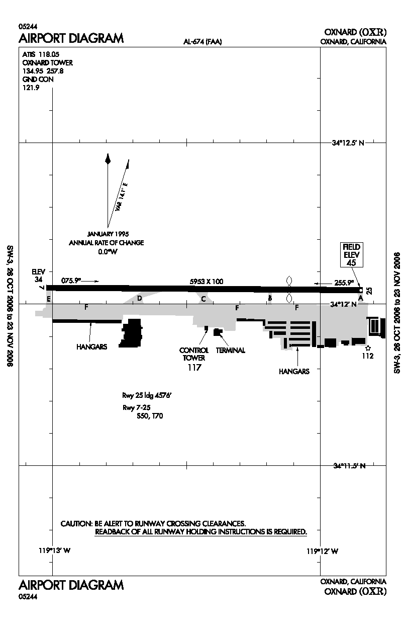
Runway Information
Runway 07/25
|
Dimension: |
5953 x 100 ft / 1814.5 x 30.5 m |
|
Surface: |
ASPH, Good Condition |
|
Weight
Limit: |
Single wheel: 50000 lbs.
Dual wheel: 70000 lbs. |
|
Edge
Lights: |
Medium |
|
|
Runway 07 |
Runway 25 |
|
Longitude: |
119-13-01.4413W |
119-11-50.5755W |
|
Latitude: |
34-12-03.1632N |
34-12-02.6264N |
|
Elevation: |
34.00 ft |
45.00 ft |
|
Alignment: |
91 |
127 |
|
ILS
Type: |
|
ILS |
|
Traffic
Pattern: |
Left |
Left |
|
Markings: |
Non-precision instrument, Good Condition |
Precision instrument, Good Condition |
|
Crossing
Height: |
25.00 ft |
0.00
ft |
|
Displaced
threshold: |
0.00
ft |
1377.00 ft |
|
VASI: |
4-box on left side |
2-light PAPI on left side |
|
Visual
Glide Angle: |
3.00� |
0.00� |
|
Approach
lights: |
|
MALSR |
|
Centerline
Lights: |
No |
No |
|
Touchdown
Lights: |
No |
No |
|
Obstruction: |
, 50:1 slope to clear |
70 ft pole, 2300.0 ft from runway, 210 ft left
of centerline, 30:1 slope to clear
45:1 DSPLCD THR. 123 FT AGL SPIRE DSPLCD 200 FT LEFT. |
|
Radio Navigation
Aids
|
ID |
Type |
Name |
Ch |
Freq |
Var |
Dist |
|
PAI |
NDB |
Pacoima |
|
370.00 |
15E |
39.6 nm |
|
NTD |
TACAN |
Point Mugu |
043X |
|
15E |
6.3 nm |
|
CMA |
VOR/DME |
Camarillo |
105X |
115.80 |
15E |
5.7 nm |
|
VTU |
VOR/DME |
Ventura |
019X |
108.20 |
15E |
9.4 nm |
|
VNY |
VOR/DME |
Van Nuys |
078X |
113.10 |
15E |
35.6 nm |
|
SMO |
VOR/DME |
Santa Monica |
045X |
110.80 |
15E |
39.1 nm |
|
FIM |
VORTAC |
Fillmore |
072X |
112.50 |
15E |
18.7 nm |
|
RZS |
VORTAC |
San Marcus |
096X |
114.90 |
14E |
33.6 nm |
|
GMN |
VORTAC |
Gorman |
108X |
116.10 |
16E |
40.1 nm |
|
LAX |
VORTAC |
Los Angeles |
083X |
113.60 |
15E |
41.8 nm |
|
LHS |
VORTAC |
Lake Hughes |
021X |
108.40 |
15E |
42.6 nm |
|
GVO |
VORTAC |
Gaviota |
085X |
113.80 |
16E |
48.1 nm |
Remarks
- NO
TOUCH & GO STOP & GO OR TAXI BACK OPNS 2000-0700 LCL.
- ARPT
OPNS LCTD AT BASE OF ATCT; CTC ON 134.95 WHEN ATCT CLSD OR CALL 805-382-3022.
- NOISE
SENSITIVE ALL QUADS PRACTICE NOISE ABATEMENT/FLY QUIET/PROCS.
NO TURNS BEFORE REACHING 743' MSL.
- TWY
C GWT RESTRICTED TO 30,000 LBS OR LESS.
Based Aircraft
|
Aircraft
based on field: |
184 |
|
Single
Engine Airplanes: |
150 |
|
Multi
Engine Airplanes: |
20 |
|
Helicopters: |
14 |
Major Carriers
Serving This Airport
Most Popular Destinations
| Los Angeles Intl (LAX) |
100.0% |
Most Popular Aircraft
|
N289YV |
4.1% |
| N296SW |
3.6% |
|
N293SW |
3.4% |
| N299SW |
3.4% |
|
N288SW |
3.4% |
| N251YV |
2.9% |
|
N233SW |
2.9% |
| N292UX |
2.9% |
|
N294SW |
2.7% |
| N290SW |
2.7% |
Operational Statistics
|
Aircraft
Operations: |
280/Day |
|
Air Taxi: |
10.3% |
|
General
Aviation Local: |
49.1% |
|
General
Aviation Itinerant: |
39.4% |
|
Military: |
1.2% |
Oxnard Airport
Address:
Ventura County, CA
Tel:
805-388-4200,
805-382-3024
Images
and information placed above are from
http://www.airport-data.com/airport/OXR/
We
thank them for the data!
| General
Info |
| Country |
United
States |
| State |
CALIFORNIA
|
| FAA ID |
OXR
|
| Latitude |
34-12-02.883N
|
| Longitude |
119-12-25.979W
|
| Elevation |
43 feet
|
| Near City |
OXNARD
|
We don't guarantee the information is fresh and accurate. The data may
be wrong or outdated.
For more up-to-date information please refer to other sources.
|
|