 |
|
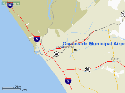
Oceanside Municipal Airport |
| Oceanside Municipal Airport |
| IATA: OCN – ICAO: KOKB – FAA LID: OKB |
| Summary |
| Airport type |
Public |
| Operator |
City of Oceanside |
| Location |
Oceanside, California |
| Elevation AMSL |
28 ft / 8.5 m |
| Coordinates |
33°13′05″N 117°21′05″W / 33.21806°N 117.35139°W / 33.21806; -117.35139Coordinates: 33°13′05″N 117°21′05″W / 33.21806°N 117.35139°W / 33.21806; -117.35139 |
| Runways |
| Direction |
Length |
Surface |
| ft |
m |
| 6/24 |
2,712 |
827 |
Asphalt |
Oceanside Municipal Airport (IATA: OCN, ICAO: KOKB, FAA LID: OKB) is a public airport located two miles (3 km) northeast of the central business district of Oceanside, a city in San Diego County, California, United States. The airport covers 43 acres (170,000 m) and has one runway. It is mostly used for general aviation.
Although most U.S. airports use the same three-letter location identifier for the FAA and IATA, Oceanside Municipal Airport is assigned OKB by the FAA and OCN by the IATA (which assigned OKB to Orchid Beach, Fraser Island, Queensland, Australia). The airport's ICAO identifier is KOKB. The FAA identifier OCN belongs to the Oceanside VORTAC 4 miles west-northwest of the Oceanside Airport.
The above content comes from Wikipedia and is published under free licenses – click here to read more.
Location
& QuickFacts
|
FAA
Information Effective: |
2006-09-28 |
|
Airport
Identifier: |
OKB |
|
Longitude/Latitude: |
117-21-05.4270W/33-13-04.7150N
-117.351508/33.217976 (Estimated) |
|
Elevation: |
28 ft / 8.53 m (Surveyed) |
|
Land: |
43 acres |
|
From
nearest city: |
2 nautical miles NE of Oceanside, CA |
|
Location: |
San Diego County, CA |
|
Magnetic Variation: |
13E (1985) |
Owner
& Manager
|
Ownership: |
Publicly owned |
|
Owner: |
City Of Oceanside |
|
Address: |
300 N. Coast Hwy
Oceanside, CA 92054 |
|
Phone number: |
760-435-5170 |
|
Manager: |
Harold Davis |
|
Address: |
480 Airport Road
Oceanside, CA 92054 |
|
Phone number: |
760-435-5187 |
Airport
Operations and Facilities
|
Airport
Use: |
Open to public |
|
Wind
indicator: |
Yes |
|
Segmented
Circle: |
Yes |
|
Control
Tower: |
No |
|
Attendance
Schedule: |
ALL/ALL/1000-1800 |
|
Lighting
Schedule: |
DUSK-DAWN
MIRL RY 06/24 PRESET LOW INTST; TO INCR INTST ACTVT - CTAF. |
|
Beacon
Color: |
Clear-Green (lighted land airport) |
|
Landing
fee charge: |
No |
|
Sectional
chart: |
Los Angeles |
|
Region: |
AWP - Western-Pacific |
|
Traffic
Pattern Alt: |
1000 ft |
|
Boundary
ARTCC: |
ZLA - Los Angeles |
|
Tie-in
FSS: |
SAN - San Diego |
|
FSS
on Airport: |
No |
|
FSS
Phone: |
858-277-7043 |
|
FSS
Toll Free: |
1-800-WX-BRIEF |
|
NOTAMs
Facility: |
OKB (NOTAM-d service avaliable) |
|
Federal Agreements: |
NGY |
Airport
Communications
|
CTAF: |
123.000 |
|
Unicom: |
123.000 |
Airport
Services
|
Fuel
available: |
100LL
FUEL AVAILABLE 0600-2100 |
|
Airframe
Repair: |
NONE |
|
Power
Plant Repair: |
NONE |
|
Bottled
Oxygen: |
NONE |
|
Bulk
Oxygen: |
NONE |
|
Runway Information
Runway 06/24
|
Dimension: |
2712 x 75 ft / 826.6 x 22.9 m |
|
Surface: |
ASPH, Good Condition |
|
Weight
Limit: |
Single wheel: 12000 lbs. |
|
Edge
Lights: |
Medium |
|
|
Runway 06 |
Runway 24 |
|
Longitude: |
117-21-21.1528W |
117-20-49.7080W |
|
Latitude: |
33-13-02.3744N |
33-13-07.0550N |
|
Elevation: |
24.00 ft |
28.00 ft |
|
Alignment: |
80 |
127 |
|
Traffic
Pattern: |
Left |
Right |
|
Markings: |
Basic, Good Condition |
Basic, Good Condition |
|
Runway
End Identifier: |
No |
Yes |
|
Centerline
Lights: |
No |
No |
|
Touchdown
Lights: |
No |
No |
|
Obstruction: |
15 ft road, 200.0 ft from runway, 25 ft left
of centerline
RY 06 APCH RATIO 36:1 FM THLD.
6' FENCE, ROAD & +8' TRAFFIC SIGNAL AT 70', +10' SIGN
AT 150'. |
160 ft hill, 4000.0 ft from runway, 23:1 slope
to clear |
|
Radio Navigation
Aids
|
ID |
Type |
Name |
Ch |
Freq |
Var |
Dist |
|
SAN |
FAN MARKER |
Encat |
|
|
15E |
33.3 nm |
|
SJY |
NDB |
San Jacinto |
|
227.00 |
14E |
38.9 nm |
|
UN |
NDB |
Tijuana |
|
381.00 |
14E |
44.2 nm |
|
NFG |
TACAN |
Camp Pendleton |
055X |
|
13E |
3.8 nm |
|
NKX |
TACAN |
Miramar |
033X |
|
15E |
23.2 nm |
|
NZY |
TACAN |
North Island |
117X |
|
14E |
31.7 nm |
|
NRS |
TACAN |
Imperial Beach |
029X |
|
14E |
41.1 nm |
|
RIV |
TACAN |
March |
077X |
|
14E |
41.6 nm |
|
NKX |
UHF/NDB |
Miramar |
|
352.00 |
15E |
23.2 nm |
|
HDF |
VOR |
Homeland |
|
113.40 |
14E |
34.6 nm |
|
RAL |
VOR |
Riverside |
|
112.40 |
15E |
44.4 nm |
|
ELB |
VOR/DME |
El Toro |
119X |
117.20 |
14E |
33.5 nm |
|
TIJ |
VOR/DME |
Tijuana |
112X |
116.50 |
14E |
45.4 nm |
|
OCN |
VORTAC |
Oceanside |
100X |
115.30 |
15E |
3.6 nm |
|
MZB |
VORTAC |
Mission Bay |
125X |
117.80 |
15E |
27.0 nm |
|
JLI |
VORTAC |
Julian |
087X |
114.00 |
15E |
38.8 nm |
|
PGY |
VORTAC |
Poggi |
035X |
109.80 |
14E |
41.1 nm |
|
PDZ |
VORTAC |
Paradise |
059X |
112.20 |
15E |
43.0 nm |
|
SLI |
VORTAC |
Seal Beach |
104X |
115.70 |
15E |
49.0 nm |
|
SAN |
VOT |
Mount Soledad |
|
109.00 |
|
23.3 nm |
|
SEE |
VOT |
Gillespie Field |
|
110.00 |
|
30.3 nm |
|
SNA |
VOT |
Santa Ana |
|
110.00 |
|
37.9 nm |
Remarks
- +40
- +90 FT TREES 75 FT - 125 FT NORTH OF RWY CNTRLN; FENCE & ROAD
WITHIN PRIMARY SFC NORTH SIDE.
- MOUNTAIN
W, NW, SW RWY 6 UP TO 280'MSL.
- UNLGTD
MTN APRX 160'MSL IN APCH ZONE AT 3500' FM W END OF PVMT RWY 6.
- ACFT
PKD 35' FM TWY CNTRLN.
- NOISE
ABATEMENT: DEPG RWY 24 RMN OVR RIVER AND CANYON UNTIL HARBOR BFR TURNING.
DEPG RWY 06 START LEFT TURN SPD & ALT PMTG TO AVOID SCHOOL &
HOMES EAST OF ARPT.
- FLOCKS
OF GEESE; WATERFOWL & SEAGULLS ON & INVOF ARPT.
- DO
NOT CONFUSE ROAD SOUTH OF ARPT WITH THE RY.
- TOUCH
AND GO LANDINGS NOT AUTHORIZED.
- ALL
TFC PAT ESTAB TO NORTH.
Based Aircraft
|
Aircraft
based on field: |
66 |
|
Single
Engine Airplanes: |
60 |
|
Multi
Engine Airplanes: |
4 |
|
Helicopters: |
2 |
Operational Statistics
|
Aircraft
Operations: |
50/Day |
|
General
Aviation Local: |
66.7% |
|
General
Aviation Itinerant: |
33.3% |
Oceanside Municipal Airport
Address:
San Diego County, CA
Tel:
760-435-5170, 760-435-5187
Images
and information placed above are from
http://www.airport-data.com/airport/OKB/
We
thank them for the data!
| General
Info |
| Country |
United
States |
| State |
CALIFORNIA
|
| FAA ID |
OKB
|
| Latitude |
33-13-04.715N
|
| Longitude |
117-21-05.427W
|
| Elevation |
28 feet
|
| Near City |
OCEANSIDE
|
We don't guarantee the information is fresh and accurate. The data may
be wrong or outdated.
For more up-to-date information please refer to other sources.
|
|


