 |
|
|
|
|
|
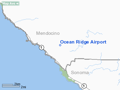
Location
& QuickFacts
|
FAA
Information Effective: |
2006-09-28 |
|
Airport
Identifier: |
E55 |
|
Longitude/Latitude: |
123-31-49.0360W/38-48-04.6760N
-123.530288/38.801299 (Estimated) |
|
Elevation: |
940 ft / 286.51 m (Estimated) |
|
Land: |
30 acres |
|
From
nearest city: |
3 nautical miles N of Gualala, CA |
|
Location: |
Mendocino County, CA |
|
Magnetic Variation: |
16E (1985) |
Owner
& Manager
|
Ownership: |
Privately owned |
|
Owner: |
John H. Bower |
|
Address: |
Box 1000
Gualala, CA 95445 |
|
Phone number: |
707-884-3573 |
|
Manager: |
John H. Bower |
|
Address: |
Box 1000
Gualala, CA 95445 |
|
Phone number: |
707-884-3573
OR 707-884-3579. |
Airport
Operations and Facilities
|
Airport
Use: |
Open to public |
|
Wind
indicator: |
Yes |
|
Segmented
Circle: |
Yes |
|
Control
Tower: |
No |
|
Attendance
Schedule: |
UNATNDD |
|
Lighting
Schedule: |
PHONE REQ
NSTD RY LGTS FOR EMERG USE ONLY CALL (707) 884-3573/3579. |
|
Landing
fee charge: |
No |
|
Sectional
chart: |
San Francisco |
|
Region: |
AWP - Western-Pacific |
|
Boundary
ARTCC: |
ZOA - Oakland |
|
Tie-in
FSS: |
OAK - Oakland |
|
FSS
on Airport: |
No |
|
FSS
Phone: |
510-273-6111 |
|
FSS
Toll Free: |
1-800-WX-BRIEF |
|
NOTAMs
Facility: |
OAK (NOTAM-d service avaliable) |
Airport
Communications
|
CTAF: |
122.800 |
|
Unicom: |
122.800 |
Airport
Services
|
Airframe
Repair: |
NONE |
|
Power
Plant Repair: |
NONE |
|
Bottled
Oxygen: |
NONE |
|
Bulk
Oxygen: |
NONE |
|
Runway Information
Runway 13/31
|
Dimension: |
2500 x 50 ft / 762.0 x 15.2 m |
|
Surface: |
ASPH, Fair Condition |
|
Weight
Limit: |
Single wheel: 8000 lbs. |
|
Edge
Lights: |
Low |
|
|
Runway 13 |
Runway 31 |
|
Traffic
Pattern: |
Left |
Right |
|
Markings: |
Nonstandard, Good Condition
/31 NSTD DSPLCD THR MARKINGS - YELLOW. |
Nonstandard, Good Condition |
|
Displaced
threshold: |
400.00 ft |
300.00 ft |
|
Obstruction: |
70 ft trees, 300.0 ft from runway, 125 ft left
of centerline, 1:1 slope to clear
APCH RATIO 10:1 TO DSPLCD THR.
+60-90 FT TREES 0-200 FT FROM THLD; 125 FT
LEFT & RIGHT. |
80 ft trees, 900.0 ft from runway, 170 ft left
of centerline, 8:1 slope to clear
APCH RATIO 15:1 TO DSPLCD THR. |
|
Radio Navigation
Aids
|
ID |
Type |
Name |
Ch |
Freq |
Var |
Dist |
|
LOP |
NDB |
Lampson |
|
217.00 |
16E |
32.4 nm |
|
STS |
VOR/DME |
Santa Rosa |
077X |
113.00 |
16E |
38.1 nm |
|
ENI |
VORTAC |
Mendocino |
070X |
112.30 |
16E |
19.3 nm |
Remarks
- CALMWIND
RWY 31.
- RY
13/31 CLSD TO JETS AND ULTRALIGHTS.
- RY
13/31 CLSD TO ACFT OVER 8,000 LBS.
- RY
13/31 CLSD TO TOUCH AND GO LANDINGS.
- RY
SAFETY AREAS HAVE PROTRUDING OR DEPRESSED DRAINAGE AREAS. SAFETY AREA
SOUTH END HAS 100+ FOOT DROPOFF.
- FULL
STOP LANDINGS ONLY; INTXN TKOFS PROHIBITED
- RY
13 +60-90 FT TREES 0-200 FT FROM THLD, 125 FT LEFT & RIGHT, AND
RY 31 +60-90 FT TREES 0-200 FT FROM THLD, 125 FT LEFT & RIGHT.
- ACFT
NOT VISABLE FM OPPOSITE ENDS OF RY DUE TO DOWNWARD SLOPING TERRAIN FM
RY MID-POINT SOUTH TO RY APCH END OF RY 31( APPROX 15 FT DROP).
- DEER
FREQUENTLY ON RY.
- RWY
13/31 UNDULATED.
- EXTREME
TURBULANCE IN WINDY CONDITIONS.
- ARPT
AVBL FOR USE FM 0600-2200 ONLY; CLSD ALL OTHER HRS.
- RY
13/31/ CLSD AT NIGHT.
Based Aircraft
|
Aircraft
based on field: |
21 |
|
Single
Engine Airplanes: |
20 |
|
Multi
Engine Airplanes: |
1 |
Operational Statistics
|
Aircraft
Operations: |
97/Week |
|
General
Aviation Local: |
30.0% |
|
General
Aviation Itinerant: |
70.0% |
Ocean Ridge Airport
Address:
Mendocino County, CA
Tel:
707-884-3573, 707-884-3579
Images
and information placed above are from
http://www.airport-data.com/airport/E55/
We
thank them for the data!
We don't guarantee the information is fresh and accurate. The data may
be wrong or outdated.
For more up-to-date information please refer to other sources.
|
|


