 |
|
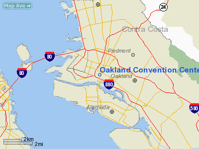
Oakland Convention Center Heliport |
|
|
Location
& QuickFacts
|
FAA
Information Effective: |
2006-09-28 |
|
Airport
Identifier: |
CL41 |
|
Longitude/Latitude: |
122-16-25.8900W/37-48-08.7400N
-122.273858/37.802428 (Estimated) |
|
Elevation: |
110 ft / 33.53 m (Estimated) |
|
Land: |
0 acres |
|
From
nearest city: |
0 nautical miles N of Oakland, CA |
|
Location: |
Alameda County, CA |
|
Magnetic Variation: |
16E (1985) |
Owner
& Manager
|
Ownership: |
Privately owned |
|
Owner: |
Occen Corp/helicopters Unltd |
|
Address: |
10th St & Broadway
Oakland, CA |
|
Phone
number: |
415-839-7500 |
|
Manager: |
John J. Mc Clelland |
|
Address: |
Po Box 4115- Airport Station
Oakland, CA 94614
9625 EARHART ROAD. |
|
Phone number: |
415-632-9422 |
Airport
Operations and Facilities
|
Airport Use: |
Private |
|
Wind indicator: |
Yes |
|
Segmented Circle: |
No |
|
Control Tower: |
No |
|
Attendance Schedule: |
ALL/ALL/0600-2200 |
|
Landing fee charge: |
Yes |
|
Sectional chart: |
San Francisco |
|
Region: |
AWP - Western-Pacific |
|
Boundary ARTCC: |
ZOA - Oakland |
|
Tie-in FSS: |
OAK - Oakland |
|
FSS Phone: |
510-273-6111 |
|
FSS Toll Free: |
1-800-WX-BRIEF |
Airport
Communications
|
Runway Information
Helipad H1
|
Dimension: |
68
x 68 ft / 20.7 x 20.7 m
ROOFTOP. |
|
Surface: |
ASPH, |
|
|
Runway H1 |
Runway |
|
Traffic
Pattern: |
Left |
Left |
|
Radio Navigation
Aids
|
ID |
Type |
Name |
Ch |
Freq |
Var |
Dist |
|
LV |
NDB |
Reiga |
|
374.00 |
16E |
28.8 nm |
|
TCY |
NDB |
Tracy |
|
203.00 |
15E |
40.0 nm |
|
NUQ |
TACAN |
Moffett |
123X |
|
17E |
24.5 nm |
|
SUU |
TACAN |
Travis |
113X |
|
17E |
30.9 nm |
|
TZZ |
VOR |
Travis |
|
116.40 |
17E |
39.3 nm |
|
SFO |
VOR/DME |
San Francisco |
105X |
115.80 |
17E |
12.0 nm |
|
CCR |
VOR/DME |
Concord |
117X |
117.00 |
17E |
18.2 nm |
|
SJC |
VOR/DME |
San Jose |
088X |
114.10 |
16E |
30.1 nm |
|
STS |
VOR/DME |
Santa Rosa |
077X |
113.00 |
16E |
49.4 nm |
|
OAK |
VORTAC |
Oakland |
115X |
116.80 |
17E |
5.2 nm |
|
SAU |
VORTAC |
Sausalito |
109X |
116.20 |
17E |
12.2 nm |
|
SGD |
VORTAC |
Scaggs Island |
058X |
112.10 |
17E |
23.1 nm |
|
OSI |
VORTAC |
Woodside |
086X |
113.90 |
17E |
24.6 nm |
|
PYE |
VORTAC |
Point Reyes |
084X |
113.70 |
17E |
32.7 nm |
|
SFO |
VOT |
San Francisco Intl |
|
111.00 |
|
12.0 nm |
Remarks
- LOCATED
WITHIN NAS ALAMEDA A.T.A.
- VFR,
PRIVATE USE, INGRESS/EGRESS RTES MEET THE 8:1 APCH/DEP & 2:1 TRSNL
SFCS, LOA WITH ALEMEDA NAS ATC FOR OPNS IN ARPT TFC AREA.
Oakland Convention Center Heliport
Address:
Alameda County, CA
Tel:
415-839-7500,
415-632-9422
Images
and information placed above are from
http://www.airport-data.com/airport/CL41/
We
thank them for the data!
| General
Info |
| Country |
United
States |
| State |
CALIFORNIA
|
| FAA ID |
CL41
|
| Latitude |
37-48-08.740N
|
| Longitude |
122-16-25.890W
|
| Elevation |
110 feet
|
| Near City |
OAKLAND
|
We don't guarantee the information is fresh and accurate. The data may
be wrong or outdated.
For more up-to-date information please refer to other sources.
|
|


