 |
|
Location
& QuickFacts
|
FAA
Information Effective: |
2006-09-28 |
|
Airport
Identifier: |
8CL0 |
|
Longitude/Latitude: |
117-49-33.2290W/34-35-19.9690N
-117.825897/34.588880 (Estimated) |
|
Elevation: |
2700 ft / 822.96 m (Estimated) |
|
Land: |
0 acres |
|
From
nearest city: |
7 nautical miles NE of Palmdale, CA |
|
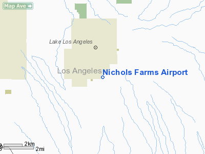
Location: |
Los Angeles County, CA |
|
Magnetic Variation: |
14E (1985) |
Owner
& Manager
|
Ownership: |
Privately owned |
|
Owner: |
Oliver Nichols |
|
Address: |
1510
Lancaster, CA 93539 |
|
Phone number: |
661-945-9223 |
|
Address: |
|
Airport
Operations and Facilities
|
Airport
Use: |
Private |
|
Wind
indicator: |
Yes |
|
Segmented
Circle: |
No |
|
Control
Tower: |
No |
|
Attendance
Schedule: |
ALL/ALL/ALL |
|
Landing
fee charge: |
No |
|
Sectional
chart: |
Los Angeles |
|
Region: |
AWP - Western-Pacific |
|
Boundary
ARTCC: |
ZLA - Los Angeles |
|
Tie-in
FSS: |
RAL - Riverside |
|
FSS
on Airport: |
No |
|
FSS
Phone: |
951-351-3020 |
|
FSS
Toll Free: |
1-800-WX-BRIEF |
|
Runway Information
Runway 10/28
|
Dimension: |
2600 x 100 ft / 792.5 x 30.5 m |
|
Surface: |
TURF, |
|
|
Runway 10 |
Runway 28 |
|
Traffic
Pattern: |
Right |
Left |
|
Obstruction: |
100 ft plines, 100.0 ft from runway |
, 500.0 ft from runway |
|
Radio Navigation
Aids
|
ID |
Type |
Name |
Ch |
Freq |
Var |
Dist |
|
GWF |
NDB |
Gen William J Fox |
|
282.00 |
15E |
21.3 nm |
|
EMT |
NDB |
El Monte |
|
359.00 |
15E |
31.8 nm |
|
PAI |
NDB |
Pacoima |
|
370.00 |
15E |
35.2 nm |
|
SB |
NDB |
Petis |
|
397.00 |
14E |
39.3 nm |
|
CPM |
NDB |
Compton |
|
378.00 |
15E |
47.0 nm |
|
RIV |
TACAN |
March |
077X |
|
14E |
49.3 nm |
|
RAL |
VOR |
Riverside |
|
112.40 |
15E |
42.6 nm |
|
VCV |
VOR/DME |
Victorville |
031X |
109.40 |
14E |
21.6 nm |
|
VNY |
VOR/DME |
Van Nuys |
078X |
113.10 |
15E |
39.7 nm |
|
SMO |
VOR/DME |
Santa Monica |
045X |
110.80 |
15E |
46.8 nm |
|
PMD |
VORTAC |
Palmdale |
092X |
114.50 |
15E |
12.0 nm |
|
EDW |
VORTAC |
Edwards |
111X |
116.40 |
15E |
24.1 nm |
|
POM |
VORTAC |
Pomona |
041X |
110.40 |
15E |
30.7 nm |
|
LHS |
VORTAC |
Lake Hughes |
021X |
108.40 |
15E |
37.6 nm |
|
PDZ |
VORTAC |
Paradise |
059X |
112.20 |
15E |
42.9 nm |
|
LAX |
VORTAC |
Los Angeles |
083X |
113.60 |
15E |
49.6 nm |
|
SLI |
VORTAC |
Seal Beach |
104X |
115.70 |
15E |
49.7 nm |
Remarks
Based Aircraft
|
Aircraft
based on field: |
1 |
|
Single
Engine Airplanes: |
1 |
Nichols Farms Airport
Address:
Los Angeles County, CA
Tel:
661-945-9223
Images
and information placed above are from
http://www.airport-data.com/airport/8CL0/
We
thank them for the data!
| General
Info |
| Country |
United
States |
| State |
CALIFORNIA
|
| FAA ID |
8CL0
|
| Latitude |
34-35-19.969N
|
| Longitude |
117-49-33.229W
|
| Elevation |
2700 feet
|
| Near City |
PALMDALE
|
We don't guarantee the information is fresh and accurate. The data may
be wrong or outdated.
For more up-to-date information please refer to other sources.
|
|


