 |
|
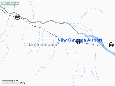
| New Cuyama Airport |
| IATA: none – ICAO: none – FAA LID: L88 |
| Summary |
| Airport type |
Public |
| Owner |
Curtis & Judie Goller |
| Location |
New Cuyama, California |
| Elevation AMSL |
2,203 ft / 671 m |
| Coordinates |
34°56′15″N 119°41′18″W / 34.9375°N 119.68833°W / 34.9375; -119.68833 |
| Runways |
| Direction |
Length |
Surface |
| ft |
m |
| 10/28 |
3,940 |
1,201 |
Asphalt |
| Source: Federal Aviation Administration |
New Cuyama Airport (FAA LID: L88) is a public-use airport located in New Cuyama, Santa Barbara County, California, United States. This general aviation airport is privately owned by Curtis & Judie Goller.
Facilities
New Cuyama Airport covers an area of 210 acres (85 ha) and has one runway:
- Runway 10/28: 3,940 x 60 ft (1,201 x 18 m), Surface: Asphalt
The above content comes from Wikipedia and is published under free licenses – click here to read more.
Location
& QuickFacts
|
FAA
Information Effective: |
2006-09-28 |
|
Airport
Identifier: |
L88 |
|
Longitude/Latitude: |
119-41-18.4710W/34-56-14.9170N
-119.688464/34.937477 (Estimated) |
|
Elevation: |
2203 ft / 671.47 m (Estimated) |
|
Land: |
210 acres |
|
From
nearest city: |
0 nautical miles S of New Cuyama, CA |
|
Location: |
Santa Barbara County, CA |
|
Magnetic Variation: |
14E (1985) |
Owner
& Manager
|
Ownership: |
Privately owned |
|
Owner: |
Curtis & Judie Goller |
|
Address: |
P.o. Box 180
New Cuyama, CA 93254 |
|
Phone
number: |
805-680-6779 |
|
Manager: |
Harry Curtis |
|
Address: |
P.o. Box 359
New Cuyama, CA 93254 |
|
Phone number: |
661-440-5022 |
Airport
Operations and Facilities
|
Airport
Use: |
Open to public |
|
Wind
indicator: |
Yes |
|
Segmented
Circle: |
Yes |
|
Control
Tower: |
No |
|
Attendance
Schedule: |
ON CALL
FOR ARPT ATTENDANT PHONE (661) 766-2591. |
|
Landing
fee charge: |
No |
|
Sectional
chart: |
Los Angeles |
|
Region: |
AWP - Western-Pacific |
|
Traffic
Pattern Alt: |
1000 ft |
|
Boundary
ARTCC: |
ZLA - Los Angeles |
|
Tie-in
FSS: |
RIU - Rancho Murieta |
|
FSS
on Airport: |
No |
|
FSS
Phone: |
916-354-0161 |
|
FSS
Toll Free: |
1-800-WX-BRIEF |
|
NOTAMs
Facility: |
RIU (NOTAM-d service avaliable) |
Airport
Communications
Airport
Services
|
Airframe
Repair: |
NONE |
|
Power
Plant Repair: |
NONE |
|
Bottled
Oxygen: |
NONE |
|
Bulk
Oxygen: |
NONE |
|
Runway Information
Runway 10/28
|
Dimension: |
3940 x 60 ft / 1200.9 x 18.3 m |
|
Surface: |
ASPH, Poor Condition
LOOSE ROCKS ON RUNWAY, CRACKED AND SPALLED SURFACE |
|
|
Runway 10 |
Runway 28 |
|
Traffic
Pattern: |
Right |
Left |
|
Markings: |
Basic, Fair Condition |
Basic, Fair Condition |
|
Runway
End Identifier: |
No |
No |
|
Centerline
Lights: |
No |
No |
|
Touchdown
Lights: |
No |
No |
|
Obstruction: |
25 ft pole, 300.0 ft from runway, 125 ft right
of centerline, 4:1 slope to clear
RWY 10 +4' WIRE FENCE, LEFT & RIGHT OF CNTRLN, 185'-230'
FROM RWY END |
4 ft fence, 200.0 ft from runway, 80 ft left
of centerline
+4 FT FENCE 100-200 FT FM RY END, 80-125 FT LEFT OF CNTRLN
DIAGONALLY THRU PRIMARY SFC. |
|
Radio Navigation
Aids
|
ID |
Type |
Name |
Ch |
Freq |
Var |
Dist |
|
VBG |
TACAN |
Vandenberg |
059Y |
|
15E |
45.8 nm |
|
GLJ |
VOR |
Guadalupe |
|
111.00 |
16E |
41.1 nm |
|
FLW |
VORTAC |
Fellows |
122X |
117.50 |
16E |
12.8 nm |
|
RZS |
VORTAC |
San Marcus |
096X |
114.90 |
14E |
26.0 nm |
|
GVO |
VORTAC |
Gaviota |
085X |
113.80 |
16E |
31.5 nm |
|
GMN |
VORTAC |
Gorman |
108X |
116.10 |
16E |
41.6 nm |
|
EHF |
VORTAC |
Shafter |
101X |
115.40 |
14E |
43.9 nm |
|
AVE |
VORTAC |
Avenal |
118X |
117.10 |
16E |
45.0 nm |
|
BFL |
VOT |
Bakersfield |
|
111.20 |
|
43.0 nm |
Remarks
- ACFT
PARKING 80 FT NORTH OF RWY CNTRLN AT APCH END RY 10.
- RY
10 +25 FT POWER POLES & PLINES RUN PARTIALLY UNDERGROUND 300 FT
FM RY END 90 FT RIGHT OF CNTRLN.
Operational Statistics
|
Aircraft
Operations: |
10/Week |
|
General
Aviation Itinerant: |
100.0% |
New Cuyama Airport
Address:
Santa Barbara County, CA
Tel:
805-680-6779,
661-440-5022
Images
and information placed above are from
http://www.airport-data.com/airport/L88/
We
thank them for the data!
| General
Info |
| Country |
United
States |
| State |
CALIFORNIA
|
| FAA ID |
L88
|
| Latitude |
34-56-14.917N
|
| Longitude |
119-41-18.471W
|
| Elevation |
2203 feet
|
| Near City |
NEW CUYAMA
|
We don't guarantee the information is fresh and accurate. The data may
be wrong or outdated.
For more up-to-date information please refer to other sources.
|
|


