 |
|
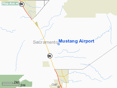
Location
& QuickFacts
|
FAA
Information Effective: |
2006-09-28 |
|
Airport
Identifier: |
2CL9 |
|
Longitude/Latitude: |
121-18-12.8160W/38-20-03.6860N
-121.303560/38.334357 (Estimated) |
|
Elevation: |
45 ft / 13.72 m (Estimated) |
|
Land: |
50 acres |
|
From
nearest city: |
6 nautical miles N of Galt, CA |
|
Location: |
San Joaquin County, CA |
|
Magnetic Variation: |
16E (1990) |
Owner
& Manager
|
Ownership: |
Privately owned |
|
Owner: |
Richard Bjelland |
|
Address: |
10565 Arno Road
Galt, CA 95632-8557 |
|
Phone number: |
209-745-6062 |
|
Manager: |
Richard Bjelland |
|
Address: |
10565 Arno Road
Galt, CA 95632-8557 |
|
Phone number: |
209-745-6062 |
Airport
Operations and Facilities
|
Airport
Use: |
Private |
|
Wind
indicator: |
Yes |
|
Segmented
Circle: |
Yes |
|
Control
Tower: |
No |
|
Attendance
Schedule: |
UNATNDD |
|
Sectional
chart: |
San Francisco |
|
Region: |
AWP - Western-Pacific |
|
Boundary
ARTCC: |
ZOA - Oakland |
|
Tie-in
FSS: |
RIU - Rancho Murieta |
|
FSS
on Airport: |
No |
|
FSS
Phone: |
916-354-0161 |
|
FSS
Toll Free: |
1-800-WX-BRIEF |
|
Runway Information
Runway 07/25
|
Dimension: |
4000 x 40 ft / 1219.2 x 12.2 m |
|
Surface: |
ASPH, |
|
|
Runway 07 |
Runway 25 |
|
Traffic
Pattern: |
Left |
Left |
|
Radio Navigation
Aids
|
ID |
Type |
Name |
Ch |
Freq |
Var |
Dist |
|
TCY |
NDB |
Tracy |
|
203.00 |
15E |
39.2 nm |
|
LV |
NDB |
Reiga |
|
374.00 |
16E |
42.6 nm |
|
SUU |
TACAN |
Travis |
113X |
|
17E |
30.7 nm |
|
BAB |
TACAN |
Beale |
023X |
|
16E |
48.5 nm |
|
TZZ |
VOR |
Travis |
|
116.40 |
17E |
23.9 nm |
|
MCC |
VOR/DME |
Mc Clellan |
029X |
109.20 |
17E |
20.6 nm |
|
HNW |
VOR/DME |
Hangtown |
102X |
115.50 |
17E |
35.1 nm |
|
CCR |
VOR/DME |
Concord |
117X |
117.00 |
17E |
39.1 nm |
|
MOD |
VOR/DME |
Modesto |
093X |
114.60 |
17E |
45.5 nm |
|
MYV |
VOR/DME |
Marysville |
045X |
110.80 |
16E |
47.6 nm |
|
SAC |
VORTAC |
Sacramento |
099X |
115.20 |
17E |
13.4 nm |
|
LIN |
VORTAC |
Linden |
095X |
114.80 |
17E |
21.1 nm |
|
ECA |
VORTAC |
Manteca |
107X |
116.00 |
17E |
30.7 nm |
|
SAC |
VOT |
Sacramento Executive |
|
111.40 |
|
14.2 nm |
|
SMF |
VOT |
Sacramento Metropolitan |
|
111.40 |
|
25.3 nm |
Remarks
- PROVIDED
VFR/PVT USE; COORDINATE OPNS WITH MGR OF SUNSET SKY RANCH ARPT; AND
OWNER INFORMS OWNER OF BOTTIMORE RANCH ARPT OF INTENDED OPNS.
Based Aircraft
|
Aircraft
based on field: |
3 |
|
Single
Engine Airplanes: |
1 |
|
Multi
Engine Airplanes: |
1 |
|
Jet Engine
Airplanes: |
1 |
Mustang Airport
Address:
San Joaquin County, CA
Tel:
209-745-6062
Images
and information placed above are from
http://www.airport-data.com/airport/2CL9/
We
thank them for the data!
| General
Info |
| Country |
United
States |
| State |
CALIFORNIA
|
| FAA ID |
2CL9
|
| Latitude |
38-20-03.686N
|
| Longitude |
121-18-12.816W
|
| Elevation |
45 feet
|
| Near City |
GALT
|
We don't guarantee the information is fresh and accurate. The data may
be wrong or outdated.
For more up-to-date information please refer to other sources.
|
|


