 |
|
| Murray Field |
| IATA: EKA – ICAO: KEKA – FAA LID: EKA |
| Summary |
| Airport type |
Public |
| Owner |
Humboldt County |
| Location |
Eureka, California |
| Elevation AMSL |
7 ft / 2 m |
| Coordinates |
40°48′12″N 124°06′46″W / 40.80333°N 124.11278°W / 40.80333; -124.11278 |
| Runways |
| Direction |
Length |
Surface |
| ft |
m |
| 11/29 |
3,000 |
914 |
Asphalt |
| Statistics (2007) |
| Aircraft operations |
65,450 |
| Based aircraft |
59 |
| Source: Federal Aviation Administration |
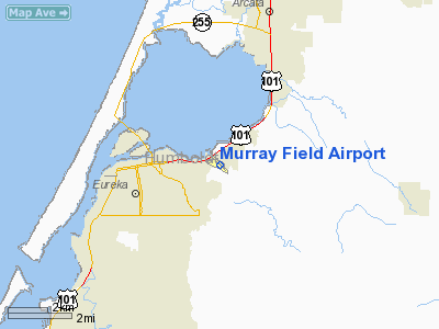
Murray Field (IATA: EKA, ICAO: KEKA, FAA LID: EKA) is a county-owned public-use airport in Humboldt County, California, United States. It is three nautical miles (6 km) east of the central business district of Eureka.
The airport is primarily used for general aviation. Also FedEx Express utilizes the small airport as a stop for package delivery from and to Humboldt County. Murray Field was first established in 1919 by pilot Dayton Murray, and was later renamed in his honor. It has a restaurant and a charter service, Northern Air, as well as a Civil Air Patrol office. Facilities and aircraft
Murray Field covers an area of 146 acres (59 ha) at an elevation of 7 feet (2 m) above mean sea level. It has one asphalt paved runway designated 11/29 which measures 3,000 by 75 feet (914 x 23 m).
For the 12-month period ending December 31, 2007, the airport had 65,450 aircraft operations, an average of 179 per day: 99% general aviation, <1% air taxi and <1% military. At that time there were 59 aircraft based at this airport: 73% single-engine, 24% multi-engine, 2% jet and 2% helicopter.
Other local airports
- Arcata-Eureka Airport
- Eureka Municipal Airport (California)
- Kneeland Airport - located ten miles (16 km) southeast of Eureka
The above content comes from Wikipedia and is published under free licenses – click here to read more.
Location
& QuickFacts
|
FAA
Information Effective: |
2006-09-28 |
|
Airport
Identifier: |
EKA |
|
Longitude/Latitude: |
124-06-46.0500W/40-48-12.2000N
-124.112792/40.803389 (Estimated) |
|
Elevation: |
7 ft / 2.13 m (Surveyed) |
|
Land: |
146 acres |
|
From
nearest city: |
3 nautical miles E of Eureka, CA |
|
Location: |
Humboldt County, CA |
|
Magnetic Variation: |
17E (1965) |
Owner
& Manager
|
Ownership: |
Publicly owned |
|
Owner: |
Humboldt County |
|
Address: |
1106 2nd St
Eureka, CA 95501 |
|
Phone
number: |
707-839-5401 |
|
Manager: |
Jacquelyn Hulsey
AIRPORT MANAGER LOCATED AT ARCATA/EUREKA AIRPORT. |
|
Address: |
3561 Boeing Ave.
Mckinleyville, CA 95519 |
|
Phone number: |
707-839-5401 |
Airport
Operations and Facilities
|
Airport
Use: |
Open to public |
|
Wind
indicator: |
Yes |
|
Segmented
Circle: |
Yes |
|
Control
Tower: |
No |
|
Attendance
Schedule: |
ALL/ALL/0830-1730
ARPT ATNDD BY NORTHERN AIR - PHONE (707) 443-3179. |
|
Lighting
Schedule: |
DUSK-DAWN
ACTVT MIRL RY 11/29 VASI RY 29 SAVASI RY 11 - CTAF. |
|
Beacon
Color: |
Clear-Green (lighted land airport) |
|
Landing
fee charge: |
No |
|
Sectional
chart: |
Klamath Falls |
|
Region: |
AWP - Western-Pacific |
|
Traffic
Pattern Alt: |
800 ft |
|
Boundary
ARTCC: |
ZSE - Seattle |
|
Tie-in
FSS: |
OAK - Oakland |
|
FSS
on Airport: |
No |
|
FSS
Phone: |
510-273-6111 |
|
FSS
Toll Free: |
1-800-WX-BRIEF |
|
NOTAMs
Facility: |
OAK (NOTAM-d service avaliable) |
|
Federal Agreements: |
NGY |
Airport
Communications
|
CTAF: |
122.700 |
|
Unicom: |
122.700 |
Airport
Services
|
Fuel
available: |
100LL |
|
Airframe
Repair: |
MAJOR |
|
Power
Plant Repair: |
MAJOR |
|
Bottled
Oxygen: |
NONE |
|
Bulk
Oxygen: |
NONE |
|
Runway Information
Runway 11/29
|
Dimension: |
3000 x 75 ft / 914.4 x 22.9 m |
|
Surface: |
ASPH, Fair Condition |
|
Weight
Limit: |
Single wheel: 19000 lbs. |
|
Edge
Lights: |
Medium |
|
|
Runway 11 |
Runway 29 |
|
Longitude: |
124-06-59.9460W |
124-06-32.2170W |
|
Latitude: |
40-48-22.6320N |
40-48-01.7790N |
|
Elevation: |
3.00
ft |
7.00
ft |
|
Alignment: |
127 |
127 |
|
Traffic
Pattern: |
Left |
Right |
|
Markings: |
Basic, Fair Condition |
Basic, Fair Condition |
|
Crossing
Height: |
26.00 ft |
26.00 ft |
|
VASI: |
2-box SAVASI on left side |
2-box on left side |
|
Visual
Glide Angle: |
3.00� |
4.00� |
|
Runway
End Identifier: |
No |
No |
|
Centerline
Lights: |
No |
No |
|
Touchdown
Lights: |
No |
No |
|
Obstruction: |
21 ft pole, 914.0 ft from runway, 120 ft left
of centerline, 34:1 slope to clear |
, 50:1 slope to clear |
|
Radio Navigation
Aids
|
ID |
Type |
Name |
Ch |
Freq |
Var |
Dist |
|
ACV |
VOR/DME |
Arcata |
039X |
110.20 |
17E |
10.7 nm |
|
FOT |
VORTAC |
Fortuna |
087X |
114.00 |
19E |
9.7 nm |
Remarks
- DEER
OCCASIONALLY ON RY.
- PREDATES
1958 FA ACT.
Based Aircraft
|
Aircraft
based on field: |
101 |
|
Single
Engine Airplanes: |
90 |
|
Multi
Engine Airplanes: |
11 |
Operational Statistics
|
Aircraft
Operations: |
180/Day |
|
Air Taxi: |
0.2% |
|
General
Aviation Local: |
68.8% |
|
General
Aviation Itinerant: |
30.6% |
|
Military: |
0.5% |
Murray Field Airport
Address:
Humboldt County, CA
Tel:
707-839-5401
Images
and information placed above are from
http://www.airport-data.com/airport/EKA/
We
thank them for the data!
| General
Info |
| Country |
United
States |
| State |
CALIFORNIA
|
| FAA ID |
EKA
|
| Latitude |
40-48-12.200N
|
| Longitude |
124-06-46.050W
|
| Elevation |
7 feet
|
| Near City |
EUREKA
|
We don't guarantee the information is fresh and accurate. The data may
be wrong or outdated.
For more up-to-date information please refer to other sources.
|
|


