 |
|
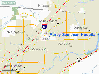
Mercy San Juan Hospital Heliport |
|
|
Location
& QuickFacts
|
FAA
Information Effective: |
2006-09-28 |
|
Airport
Identifier: |
4CL5 |
|
Longitude/Latitude: |
121-18-53.4000W/38-40-08.7000N
-121.314833/38.669083 (Estimated) |
|
Elevation: |
169 ft / 51.51 m (Estimated) |
|
Land: |
0 acres |
|
From
nearest city: |
0 nautical miles N of Carmichael, CA |
|
Location: |
Sacramento County, CA |
|
Magnetic Variation: |
16E (1995) |
Owner
& Manager
|
Ownership: |
Privately owned |
|
Owner: |
Mercy San Juan Hospital |
|
Address: |
6501 Coyle Avenue
Carmichael, CA 95608 |
|
Phone
number: |
916-537-5000 |
|
Manager: |
Colleen Burton, Dir Emerg Services |
|
Address: |
6501 Coyle Avenue
Carmichael, CA 95608 |
|
Phone number: |
916-537-5000 |
Airport
Operations and Facilities
|
Airport
Use: |
Private
MEDICAL USE. |
|
Wind
indicator: |
Yes |
|
Segmented
Circle: |
No |
|
Control
Tower: |
No |
|
Attendance
Schedule: |
ALL/ALL/ALL |
|
Lighting
Schedule: |
RDO-CTL
ACTVT RY H1 PERIMETER LGTS AND HELIPORT BCN - UNICOM. |
|
Beacon Color: |
Clear-Green-Yellow (heliport) |
|
Sectional chart: |
San Francisco |
|
Region: |
AWP - Western-Pacific |
|
Boundary ARTCC: |
ZOA - Oakland |
|
Tie-in FSS: |
RIU - Rancho Murieta |
|
FSS Phone: |
916-354-0161 |
|
FSS Toll Free: |
1-800-WX-BRIEF |
Airport
Communications
|
Runway Information
Helipad H1
|
Dimension: |
40 x 40 ft / 12.2 x 12.2 m |
|
Surface: |
CONC, |
|
|
Runway H1 |
Runway |
|
Traffic
Pattern: |
Left |
Left |
|
Radio Navigation
Aids
|
ID |
Type |
Name |
Ch |
Freq |
Var |
Dist |
|
MY |
NDB |
Halow |
|
222.00 |
16E |
33.1 nm |
|
BAB |
TACAN |
Beale |
023X |
|
16E |
28.6 nm |
|
SUU |
TACAN |
Travis |
113X |
|
17E |
39.1 nm |
|
TZZ |
VOR |
Travis |
|
116.40 |
17E |
30.4 nm |
|
MCC |
VOR/DME |
Mc Clellan |
029X |
109.20 |
17E |
4.2 nm |
|
HNW |
VOR/DME |
Hangtown |
102X |
115.50 |
17E |
26.7 nm |
|
MYV |
VOR/DME |
Marysville |
045X |
110.80 |
16E |
28.5 nm |
|
SAC |
VORTAC |
Sacramento |
099X |
115.20 |
17E |
17.5 nm |
|
LIN |
VORTAC |
Linden |
095X |
114.80 |
17E |
38.6 nm |
|
ILA |
VORTAC |
Williams |
091X |
114.40 |
18E |
41.2 nm |
|
SAC |
VOT |
Sacramento Executive |
|
111.40 |
|
12.7 nm |
|
SMF |
VOT |
Sacramento Metropolitan |
|
111.40 |
|
13.0 nm |
Remarks
- ROOFTOP
HELIPAD.
- FINAL
APCH & TKOF AREA 108 FT IN DIAMETER.
- PROVIDED
VFR PRIVATE USE.
Mercy San Juan Hospital Heliport
Address:
Sacramento County, CA
Tel:
916-537-5000
Images
and information placed above are from
http://www.airport-data.com/airport/4CL5/
We
thank them for the data!
| General
Info |
| Country |
United
States |
| State |
CALIFORNIA
|
| FAA ID |
4CL5
|
| Latitude |
38-40-08.700N
|
| Longitude |
121-18-53.400W
|
| Elevation |
169 feet
|
| Near City |
CARMICHAEL
|
We don't guarantee the information is fresh and accurate. The data may
be wrong or outdated.
For more up-to-date information please refer to other sources.
|
|


