 |
|
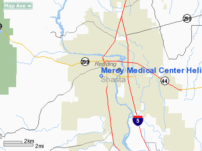
Mercy Medical Center Heliport |
|
|
Location & QuickFacts
|
FAA
Information Effective: |
2006-09-28 |
|
Airport Identifier: |
7CA3 |
|
Longitude/Latitude: |
122-23-42.0310W/40-34-19.5420N
-122.395009/40.572095 (Estimated) |
|
Elevation: |
715
ft / 217.93 m (Estimated) |
|
Land: |
0
acres |
|
From nearest city: |
1 nautical miles W of Redding, CA |
|
Location: |
Shasta County, CA |
|
Magnetic
Variation: |
17E (1985) |
Owner & Manager
|
Ownership: |
Privately owned |
|
Owner: |
Mercy
Medical Center |
|
Address: |
Clairmont Heights
Redding, CA 96001 |
|
Phone number: |
916-225-6290 |
|
Manager: |
Richard
Robertson |
|
Address: |
Mercy Medical Center
Redding, CA 96001 |
|
Phone
number: |
916-225-6290 |
Airport
Operations and Facilities
|
Airport
Use: |
Private
MEDICAL. |
|
Wind
indicator: |
Yes |
|
Segmented
Circle: |
No |
|
Control
Tower: |
No |
|
Attendance
Schedule: |
ALL/ALL/ALL |
|
Lighting
Schedule: |
RDO-CTL
ACTVT FLOODLGTS - 123.05. |
|
Landing
fee charge: |
No |
|
Sectional
chart: |
Klamath Falls |
|
Region: |
AWP - Western-Pacific |
|
Boundary
ARTCC: |
ZOA - Oakland |
|
Tie-in
FSS: |
RIU - Rancho Murieta |
|
FSS
on Airport: |
No |
|
FSS
Phone: |
916-354-0161 |
|
FSS
Toll Free: |
1-800-WX-BRIEF |
Airport Communications
|
Runway Information
Helipad H1
|
Dimension: |
75 x 75 ft / 22.9 x 22.9
m |
|
Surface: |
CONC,
|
|
|
Runway H1 |
Runway |
|
Traffic Pattern: |
Left |
Left |
|
Radio Navigation Aids
|
ID |
Type |
Name |
Ch |
Freq |
Var |
Dist |
|
PBT |
NDB |
Proberta |
|
338.00 |
16E |
28.5
nm |
|
RDD |
VOR/DME |
Redding |
021X |
108.40 |
18E |
6.2
nm |
|
RBL |
VORTAC |
Red
Bluff |
104X |
115.70 |
18E |
29.4
nm |
Remarks
Mercy Medical Center Heliport
Address:
Shasta County, CA
Tel:
916-225-6290
Images
and information placed above are from
http://www.airport-data.com/airport/7CA3/
We
thank them for the data!
| General
Info |
| Country |
United
States |
| State |
CALIFORNIA
|
| FAA ID |
7CA3 |
| Latitude |
40-34-19.542N
|
| Longitude |
122-23-42.031W
|
| Elevation |
715 feet
|
| Near City |
REDDING
|
We don't guarantee the information is fresh and accurate. The data may
be wrong or outdated.
For more up-to-date information please refer to other sources.
|
|


