 |
|
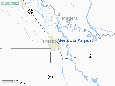
| Mendota Airport |
| IATA: none – ICAO: none – FAA LID: M90 |
| Summary |
| Airport type |
Public |
| Operator |
City of Mendota |
| Location |
Mendota, California |
| Elevation AMSL |
162 ft / 49.4 m |
| Coordinates |
36°45′31″N 120°22′17″W / 36.75861°N 120.37139°W / 36.75861; -120.37139Coordinates: 36°45′31″N 120°22′17″W / 36.75861°N 120.37139°W / 36.75861; -120.37139 |
| Runways |
| Direction |
Length |
Surface |
| ft |
m |
| 15/33 |
3,499 |
1,066 |
Asphalt |
Mendota Airport (FAA LID: M90), formerly Q84, is a public airport located in Mendota, serving Fresno County, California, USA. The airport is mostly used for general aviation.
Facilities
Mendota Airport covers 130 acres (53 ha) and has one runway:
- Runway 15/33: 3,499 x 50 ft. (1,066 x 15 m), Surface: Asphalt
The above content comes from Wikipedia and is published under free licenses – click here to read more.
Location
& QuickFacts
|
FAA
Information Effective: |
2006-09-28 |
|
Airport
Identifier: |
M90 |
|
Longitude/Latitude: |
120-22-17.0000W/36-45-31.0000N
-120.371389/36.758611 (Estimated) |
|
Elevation: |
162 ft / 49.38 m (Estimated) |
|
Land: |
130 acres |
|
From
nearest city: |
0 nautical miles E of Mendota, CA |
|
Location: |
Fresno County, CA |
|
Magnetic Variation: |
15E (1985) |
Owner
& Manager
|
Ownership: |
Publicly owned |
|
Owner: |
City Of Mendota |
|
Address: |
643 Quince St
Mendota, CA 93640 |
|
Phone
number: |
559-655-4298 |
|
Manager: |
Gabriel Gonzales
CITY MANAGER X15. |
|
Address: |
643 Quince St
Mendota, CA 93640 |
|
Phone number: |
559-655-4298
EXT 15 |
Airport
Operations and Facilities
|
Airport
Use: |
Open to public |
|
Wind
indicator: |
Yes |
|
Segmented
Circle: |
Yes |
|
Control
Tower: |
No |
|
Attendance
Schedule: |
UNATNDD |
|
Lighting
Schedule: |
NONE |
|
Landing
fee charge: |
No |
|
Sectional
chart: |
San Francisco |
|
Region: |
AWP - Western-Pacific |
|
Traffic
Pattern Alt: |
1000 ft |
|
Boundary
ARTCC: |
ZOA - Oakland |
|
Tie-in
FSS: |
RIU - Rancho Murieta |
|
FSS
on Airport: |
No |
|
FSS
Phone: |
916-354-0161 |
|
FSS
Toll Free: |
1-800-WX-BRIEF |
|
NOTAMs
Facility: |
RIU (NOTAM-d service avaliable) |
|
Federal Agreements: |
NGY |
Airport
Communications
|
Runway Information
Runway 15/33
|
Dimension: |
3499 x 50 ft / 1066.5 x 15.2 m |
|
Surface: |
ASPH, |
|
Weight
Limit: |
Single wheel: 12500 lbs. |
|
|
Runway 15 |
Runway 33 |
|
Longitude: |
120-22-24.2800W |
120-22-10.6300W |
|
Latitude: |
36-45-47.9000N |
36-45-15.0900N |
|
Traffic
Pattern: |
Left |
Right |
|
Markings: |
Basic, Good Condition |
Basic, Good Condition |
|
Displaced
threshold: |
0.00
ft |
777.00 ft |
|
Runway
End Identifier: |
No |
No |
|
Centerline
Lights: |
No |
No |
|
Touchdown
Lights: |
No |
No |
|
Obstruction: |
, 50:1 slope to clear |
17 ft bldg, 423.0 ft from runway, 190 ft left
of centerline, 13:1 slope to clear
APCH RATIO TO DSPLCD THR 50:1. |
|
Radio Navigation
Aids
|
ID |
Type |
Name |
Ch |
Freq |
Var |
Dist |
|
FCH |
NDB |
Chandler |
|
344.00 |
15E |
26.0 nm |
|
CUK |
NDB |
Academy |
|
266.00 |
14E |
35.5 nm |
|
NLC |
TACAN |
Lemoore |
080X |
|
16E |
31.7 nm |
|
ROM |
VOR |
Priest |
|
110.00 |
16E |
39.8 nm |
|
HYP |
VOR/DME |
El Nido |
089X |
114.20 |
15E |
27.7 nm |
|
VIS |
VOR/DME |
Visalia |
031X |
109.40 |
16E |
49.0 nm |
|
PXN |
VORTAC |
Panoche |
073X |
112.60 |
16E |
19.8 nm |
|
CZQ |
VORTAC |
Clovis |
076X |
112.90 |
15E |
27.8 nm |
|
FRA |
VORTAC |
Friant |
103X |
115.60 |
17E |
42.7 nm |
Remarks
Based Aircraft
|
Aircraft
based on field: |
4 |
|
Single
Engine Airplanes: |
3 |
|
Ultralights: |
1 |
Operational Statistics
|
Aircraft
Operations: |
250/Week |
|
General
Aviation Local: |
40.0% |
|
General
Aviation Itinerant: |
60.0% |
Mendota Airport
Address:
Fresno County, CA
Tel:
559-655-4298
Images
and information placed above are from
http://www.airport-data.com/airport/M90/
We
thank them for the data!
| General
Info |
| Country |
United
States |
| State |
CALIFORNIA
|
| FAA ID |
M90
|
| Latitude |
36.758611
36� 45' 31.00" N |
| Longitude |
-120.371389
120� 22' 17.00" W |
| Elevation |
162 feet
49 meters |
| Magnetic
Variation |
014� E
(01/06) |
| Beacon |
Yes
|
| Operating
Agency |
U.S.CIVIL
AIRPORT WHEREIN PERMIT COVERS USE BY TRANSIT MILITARY AIRCRAFT
|
| Daylight
Savings Time |
First
Sunday in April at 0200 to last Sunday in October at 0200 local time
(Exception Arizona and that portion of Indiana in the Eastern Time
Zone) |
We don't guarantee the information is fresh and accurate. The data may
be wrong or outdated.
For more up-to-date information please refer to other sources.
|
|


