 |
|
| Mefford Field |
| IATA: TLR – ICAO: KTLR – FAA LID: TLR |
| Summary |
| Airport type |
Public |
| Operator |
City of Tulare |
| Location |
Tulare, California |
| Elevation AMSL |
271 ft / 82.6 m |
| Coordinates |
36°09′23″N 119°19′34″W / 36.15639°N 119.32611°W / 36.15639; -119.32611Coordinates: 36°09′23″N 119°19′34″W / 36.15639°N 119.32611°W / 36.15639; -119.32611 |
| Runways |
| Direction |
Length |
Surface |
| ft |
m |
| 13/31 |
3,914 |
1,193 |
Asphalt |
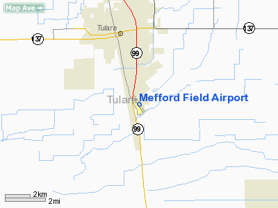
Mefford Field (IATA: TLR, ICAO: KTLR, FAA LID: TLR) is a public airport located three miles (3.8 km) southeast of Tulare, serving Tulare County, California, USA. This general aviation airport covers 206 acres (83 ha) and has one runway. History
On the outskirts of Visalia Army Air Field, California, where many U.S. pilots received basic flight training. Tex Rankin was president of the Hollywood Motion Picture Pilots Association in December 1940 when he signed a War Department contract to open a school to train U.S. Army pilots. First flights began the following February at Mefford Field, on the outskirts of Tulare, where a B-17 now looks out on U.S. Highway 99. Construction work on Rankin Field, about 6 miles east, began the same month and finished in late spring. Rankin Field became one of the 62 civilian-owned flying schools in the U.S. that taught 1.4 million WW II Army pilots to fly.
In 1939, when war broke out in Europe, Army schools had the capacity to train only 750 pilots a year. Recognizing the need to drastically expand, Hap Arnold initiated a program under which civilian schools provided the first 60 hours of flight time to Army Aviation Cadets. The new program was so successful that the U.S. was able to train pilots faster than it could produce aircraft. While Germany lost air superiority because it was not able to replace pilots killed in combat, Arnold’s program began tapering off nine months before D-Day.
The Visalia Municipal airport was in existence when construction of another nearby field, Sequoia Field, was started. In the late summer of 1941, a detachment of U.S. Army personnel was sent to Visalia to supervise operations at Sequoia Field. On August 28, 1941, its initial headquarters was set up at Visalia Municipal Airport, and qualification of Sequoia Field’s first contingent of flight instructors began.
The above content comes from Wikipedia and is published under free licenses – click here to read more.
Location
& QuickFacts
|
FAA
Information Effective: |
2006-09-28 |
|
Airport
Identifier: |
TLR |
|
Longitude/Latitude: |
119-19-34.2000W/36-09-22.7000N
-119.326167/36.156306 (Estimated) |
|
Elevation: |
271 ft / 82.60 m (Estimated) |
|
Land: |
206 acres |
|
From
nearest city: |
3 nautical miles SE of Tulare, CA |
|
Location: |
Tulare County, CA |
|
Magnetic Variation: |
15E (1985) |
Owner
& Manager
|
Ownership: |
Publicly owned |
|
Owner: |
City Of Tulare |
|
Address: |
830 S. Blackstone St.
Tulare, CA 93274 |
|
Phone
number: |
559-685-2300 |
|
Manager: |
Rich Lujan
DIRECTOR OF RECREATION/PARKS/ LIBRARY/AIRPORT MANAGER |
|
Address: |
830 S. Blackstone St.
Tulare, CA 93274 |
|
Phone number: |
559-684-4310 |
Airport
Operations and Facilities
|
Airport
Use: |
Open to public |
|
Wind
indicator: |
Yes |
|
Segmented
Circle: |
Yes |
|
Control
Tower: |
No |
|
Attendance
Schedule: |
ALL/ALL/0800-DUSK |
|
Lighting
Schedule: |
DUSK-DAWN
ACTVT MIRL RY 13/31 - CTAF. |
|
Beacon
Color: |
Clear-Green (lighted land airport) |
|
Landing
fee charge: |
No |
|
Sectional
chart: |
San Francisco |
|
Region: |
AWP - Western-Pacific |
|
Traffic
Pattern Alt: |
1000 ft |
|
Boundary
ARTCC: |
ZOA - Oakland |
|
Tie-in
FSS: |
RIU - Rancho Murieta |
|
FSS
on Airport: |
No |
|
FSS
Phone: |
916-354-0161 |
|
FSS
Toll Free: |
1-800-WX-BRIEF |
|
NOTAMs
Facility: |
RIU (NOTAM-d service avaliable) |
|
Federal Agreements: |
NGY |
Airport
Communications
|
CTAF: |
122.700 |
|
Unicom: |
122.700 |
Airport
Services
|
Fuel
available: |
100LLA |
|
Airframe
Repair: |
MAJOR |
|
Power
Plant Repair: |
MAJOR |
|
Bottled
Oxygen: |
NONE |
|
Bulk
Oxygen: |
NONE |
|
Runway Information
Runway 13/31
|
Dimension: |
3914 x 75 ft / 1193.0 x 22.9 m |
|
Surface: |
ASPH, Good Condition |
|
Weight
Limit: |
Single wheel: 12500 lbs. |
|
Edge
Lights: |
Medium |
|
|
Runway 13 |
Runway 31 |
|
Longitude: |
119-19-48.4200W |
119-19-22.4100W |
|
Latitude: |
36-09-38.0500N |
36-09-05.6000N |
|
Elevation: |
271.00 ft |
269.00 ft |
|
Alignment: |
127 |
127 |
|
Traffic
Pattern: |
Left |
Left |
|
Markings: |
Basic, Good Condition |
Basic, Good Condition |
|
Crossing
Height: |
30.00 ft |
26.00 ft |
|
VASI: |
2-box on left side |
2-box on left side |
|
Visual
Glide Angle: |
3.50� |
3.00� |
|
Runway
End Identifier: |
No |
No |
|
Centerline
Lights: |
No |
No |
|
Touchdown
Lights: |
No |
No |
|
Obstruction: |
15 ft road, 500.0 ft from runway, 295 ft right
of centerline, 20:1 slope to clear |
18 ft trees, 530.0 ft from runway, 86 ft left
of centerline, 18:1 slope to clear |
|
Radio Navigation
Aids
|
ID |
Type |
Name |
Ch |
Freq |
Var |
Dist |
|
COR |
NDB |
Salyer Farms |
|
205.00 |
16E |
11.6 nm |
|
CUK |
NDB |
Academy |
|
266.00 |
14E |
37.6 nm |
|
FCH |
NDB |
Chandler |
|
344.00 |
15E |
42.0 nm |
|
NLC |
TACAN |
Lemoore |
080X |
|
16E |
33.0 nm |
|
VIS |
VOR/DME |
Visalia |
031X |
109.40 |
16E |
14.8 nm |
|
TTE |
VOR/DME |
Tule |
029X |
109.20 |
16E |
20.8 nm |
|
EHF |
VORTAC |
Shafter |
101X |
115.40 |
14E |
41.9 nm |
|
AVE |
VORTAC |
Avenal |
118X |
117.10 |
16E |
44.1 nm |
|
CZQ |
VORTAC |
Clovis |
076X |
112.90 |
15E |
49.7 nm |
|
BFL |
VOT |
Bakersfield |
|
111.20 |
|
46.0 nm |
Based Aircraft
|
Aircraft
based on field: |
62 |
|
Single
Engine Airplanes: |
57 |
|
Multi
Engine Airplanes: |
4 |
|
Gliders: |
1 |
Operational Statistics
|
Aircraft
Operations: |
72/Day |
|
General
Aviation Local: |
50.0% |
|
General
Aviation Itinerant: |
50.0% |
Mefford Field Airport
Address:
Tulare County, CA
Tel:
559-685-2300,
559-684-4310
Images
and information placed above are from
http://www.airport-data.com/airport/TLR/
We
thank them for the data!
| General
Info |
| Country |
United
States |
| State |
CALIFORNIA
|
| FAA ID |
TLR
|
| Latitude |
36-09-22.700N
|
| Longitude |
119-19-34.200W
|
| Elevation |
271 feet
|
| Near City |
TULARE
|
We don't guarantee the information is fresh and accurate. The data may
be wrong or outdated.
For more up-to-date information please refer to other sources.
|
|


