 |
|
Location
& QuickFacts
|
FAA
Information Effective: |
2006-09-28 |
|
Airport
Identifier: |
CA62 |
|
Longitude/Latitude: |
120-46-04.6290W/35-43-08.8860N
-120.767953/35.719135 (Estimated) |
|
Elevation: |
920 ft / 280.42 m (Estimated) |
|
Land: |
0 acres |
|
From
nearest city: |
5 nautical miles SW of Camp Roberts, CA |
|
Location: |
San Luis Obispo County, CA |
|
Magnetic Variation: |
15E (1985) |
Owner
& Manager
|
Ownership: |
Army owned |
|
Owner: |
Cdr 7th Inf Div |
|
Address: |
Afzw - Deh
Ft Ord, CA 93941 |
|
Phone number: |
408-242-3525 |
|
Manager: |
Heinz Hormann |
|
Address: |
|
Airport
Operations and Facilities
|
Airport
Use: |
Private |
|
Segmented
Circle: |
No |
|
Control
Tower: |
No |
|
Attendance
Schedule: |
UNATNDD |
|
Sectional
chart: |
Los Angeles |
|
Region: |
AWP - Western-Pacific |
|
Boundary
ARTCC: |
ZOA - Oakland |
|
Tie-in
FSS: |
HHR - Hawthorne |
|
FSS
Phone: |
310-970-0102 |
|
FSS
Toll Free: |
1-800-WX-BRIEF |
|
Runway
Information
Runway N/S
|
Dimension: |
3500 x 60 ft / 1066.8 x 18.3 m |
|
Surface: |
GRAVEL, |
|
|
Runway N |
Runway S |
|
Traffic
Pattern: |
Left |
Left |
|
Radio Navigation
Aids
|
ID |
Type |
Name |
Ch |
Freq |
Var |
Dist |
|
HGT |
NDB |
Hunter Liggett |
|
209.00 |
15E |
25.2 nm |
|
ROM |
VOR |
Priest |
|
110.00 |
16E |
25.8 nm |
|
GLJ |
VOR |
Guadalupe |
|
111.00 |
16E |
47.6 nm |
|
PRB |
VORTAC |
Paso Robles |
090X |
114.30 |
16E |
7.4 nm |
|
MQO |
VORTAC |
Morro Bay |
071X |
112.40 |
16E |
28.1 nm |
|
AVE |
VORTAC |
Avenal |
118X |
117.10 |
16E |
38.8 nm |
Remarks
- AIRSTRIP
LIMITED TO 8 TAKEOFFS & LDGS PER MONTH FM 1 OCT THRU 31 APR UNLIMITED
1MAY - 31 SEP
- (ARPT
STATUS) ARPT CLSD INDEFLY.
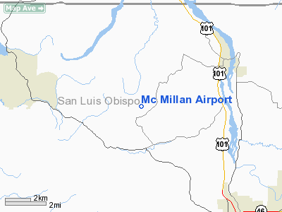
Mc Millan Airport
Address:
San Luis Obispo County, CA
Tel:
408-242-3525
Images
and information placed above are from
http://www.airport-data.com/airport/CA62/
We
thank them for the data!
| General
Info |
| Country |
United
States |
| State |
CALIFORNIA
|
| FAA ID |
CA62
|
| Latitude |
35-43-08.886N
|
| Longitude |
120-46-04.629W
|
| Elevation |
920 feet
|
| Near City |
CAMP ROBERTS
|
We don't guarantee the information is fresh and accurate. The data may
be wrong or outdated.
For more up-to-date information please refer to other sources.
|
|


