 |
|
Mc Clellan Airfield Airport |
Coordinates: 38°40′04″N 121°24′02″W / 38.66778°N 121.40056°W / 38.66778; -121.40056
- For the United States Air Force use of this faciity before 2001, see McClellan Air Force Base
McClellan Airfield (IATA: MCC, ICAO: KMCC, FAA LID: MCC), known officially as McClellan Airport, is a county-owned public-use airport located six miles (10 km) northeast of the central business district of Sacramento, a city in Sacramento County, California, United States.
The airport is on the former site of McClellan Air Force Base, which existed as a military base from 1939 to 2000. It was transferred to Sacramento County in 2000, as part of its conversion into McClellan Business Park. The airport is a public-use facility which operates as an uncontrolled airfield in what the FAA designates as Class "E" Airspace. Current airport tenants include the California Department of Forestry, the United States Coast Guard and the Sacramento Metropolitan Fire District.
Facilities and aircraft
McClellan Airfield has one concrete paved runway (16/34) measuring 10,600 x 200 ft. (3,231 x 61 m). For the 12-month period ending April 10, 2004, the airport had 10,000 aircraft operations, an average of 27 per day: 40% military, 40% air taxi and 20% general aviation. There are 84 aircraft based at this airport: 4% single-engine, 64% multi-engine, 23% jet and 5% helicopter and 5% military.
The above content comes from Wikipedia and is published under free licenses – click here to read more.
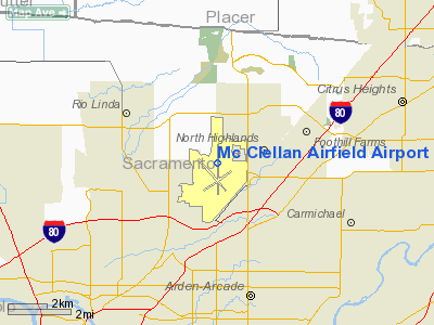
Location
& QuickFacts
|
FAA
Information Effective: |
2006-09-28 |
|
Airport
Identifier: |
MCC |
|
Longitude/Latitude: |
121-24-02.2000W/38-40-03.5000N
-121.400611/38.667639 (Estimated) |
|
Elevation: |
75 ft / 22.86 m (Surveyed) |
|
Land: |
0 acres |
|
From
nearest city: |
6 nautical miles NE of Sacramento, CA |
|
Location: |
Sacramento County, CA |
|
Magnetic Variation: |
16E (1985) |
Owner
& Manager
|
Ownership: |
Publicly owned |
|
Owner: |
Sacramento County |
|
Address: |
3331 Peacekeeper Way, 3331 Peacekeeper Way
Mcclellan, CA 95827 |
|
Phone
number: |
916-646-1746 |
|
Manager: |
Jerry W. Lee
RANDY LEE, ASST. MGR. |
|
Address: |
2818 James Way, Suite 100
Mcclellan, CA 95827 |
|
Phone number: |
916-643-5611 |
Airport
Operations and Facilities
|
Airport
Use: |
Open to public |
|
Wind
indicator: |
Yes |
|
Segmented
Circle: |
Yes |
|
Control
Tower: |
No |
|
Attendance
Schedule: |
ALL/ALL/0800-2000 |
|
Lighting
Schedule: |
DUSK-DAWN
ACTVT HIRL RY 16/34, ALSF-1 AND TWY LGTS - CTAF. |
|
Beacon
Color: |
Clear-Green (lighted land airport) |
|
Landing
fee charge: |
Yes |
|
Sectional
chart: |
San Francisco |
|
Region: |
AWP - Western-Pacific |
|
Boundary
ARTCC: |
ZOA - Oakland |
|
Tie-in
FSS: |
RIU - Rancho Murieta |
|
FSS
on Airport: |
No |
|
FSS
Phone: |
916-354-0161 |
|
FSS
Toll Free: |
1-800-WX-BRIEF |
|
NOTAMs
Facility: |
MCC (NOTAM-d service avaliable) |
|
Certification type/date: |
?? ??/???? |
Airport
Communications
|
CTAF: |
122.975 |
|
Unicom: |
122.975 |
Airport
Services
|
Runway Information
Runway 16/34
|
Dimension: |
10600
x 200 ft / 3230.9 x 61.0 m
RUNWAY MARKED FOR 150 FOOT WIDTH |
|
Surface: |
CONC, Good Condition |
|
Surface
Treatment: |
Saw-cut or plastic Grooved |
|
Weight
Limit: |
Single wheel: 155000 lbs.
Dual wheel: 300000 lbs.
Dual
tandem wheel: 500000 lbs. |
|
Edge
Lights: |
High
NSTD HIRL LCTD 25 FT FM RY EDGE MARKINGS. |
|
|
Runway 16 |
Runway 34 |
|
Longitude: |
121-24-02.0789W |
121-24-02.2422W |
|
Latitude: |
38-40-55.8779N |
38-39-11.1089N |
|
Elevation: |
77.00 ft |
70.00 ft |
|
Alignment: |
127 |
0 |
|
ILS
Type: |
ILS |
ILS |
|
Traffic
Pattern: |
Right |
Left |
|
Markings: |
Precision instrument, Good Condition |
Precision instrument, Good Condition |
|
Crossing
Height: |
51.00 ft |
52.00 ft |
|
VASI: |
4-light PAPI on left side |
4-light PAPI on left side |
|
Visual
Glide Angle: |
3.00� |
3.00� |
|
Approach
lights: |
ALSF1 |
|
|
Runway
End Identifier: |
No |
No |
|
Centerline
Lights: |
No |
No |
|
Touchdown
Lights: |
No |
No |
|
Obstruction: |
, 50:1 slope to clear |
90 ft tower, 4000.0 ft from runway, 175 ft
left of centerline, 42:1 slope to clear |
|
Radio Navigation
Aids
|
ID |
Type |
Name |
Ch |
Freq |
Var |
Dist |
|
MY |
NDB |
Halow |
|
222.00 |
16E |
31.7 nm |
|
BAB |
TACAN |
Beale |
023X |
|
16E |
28.1 nm |
|
SUU |
TACAN |
Travis |
113X |
|
17E |
36.1 nm |
|
TZZ |
VOR |
Travis |
|
116.40 |
17E |
27.4 nm |
|
MCC |
VOR/DME |
Mc Clellan |
029X |
109.20 |
17E |
0.2 nm |
|
MYV |
VOR/DME |
Marysville |
045X |
110.80 |
16E |
27.1 nm |
|
HNW |
VOR/DME |
Hangtown |
102X |
115.50 |
17E |
30.7 nm |
|
CCR |
VOR/DME |
Concord |
117X |
117.00 |
17E |
48.2 nm |
|
SAC |
VORTAC |
Sacramento |
099X |
115.20 |
17E |
15.2 nm |
|
ILA |
VORTAC |
Williams |
091X |
114.40 |
18E |
38.1 nm |
|
LIN |
VORTAC |
Linden |
095X |
114.80 |
17E |
40.3 nm |
|
SMF |
VOT |
Sacramento Metropolitan |
|
111.40 |
|
9.0 nm |
|
SAC |
VOT |
Sacramento Executive |
|
111.40 |
|
10.3 nm |
Remarks
- <900'
ASPH OVRN SE END RWY 16 & 1000' ASPH OVRN NW END RWY 34.
- MILITARY
USE: TRAN ACFT PPR FOR USCG RAMP C916-643-7659, WITH CREW LIST FOR ARR/DEP
PAX.
- FLD
CONDS-RWY, TWY & APRON GOOD.
- STRICT
COMPLIANCE RQR WITH NOISE ABATEMENT PROGRAM.
- TOUCH/GO
LNDG FOR C5 PROHIBITED.
- DURG
INCREASED BIRD CONDITIONS THE POTENTIAL FOR BIRD CONGESTION EXIST AT
BOTH ARR/DEP ENDS RY 16/34.
- ALL
ACFT EXIT RY TO THE EAST, NO SERVICES WEST SIDE.
- MILITARY
USE: FUEL - A+ (MCCLELLAN JET SVC, C916-570-5356.)
Based Aircraft
|
Aircraft
based on field: |
84 |
|
Single
Engine Airplanes: |
3 |
|
Multi
Engine Airplanes: |
54 |
|
Jet Engine
Airplanes: |
19 |
|
Helicopters: |
4 |
|
Military: |
4 |
Operational Statistics
|
Aircraft
Operations: |
193/Week |
|
Air Taxi: |
40.0% |
|
General
Aviation Local: |
2.5% |
|
General
Aviation Itinerant: |
17.5% |
|
Military: |
40.0% |
Mc Clellan Airfield Airport
Address:
Sacramento County, CA
Tel:
916-646-1746,
916-643-5611
Images
and information placed above are from
http://www.airport-data.com/airport/MCC/
We
thank them for the data!
| General
Info |
| Country |
United
States |
| State |
CALIFORNIA
|
| FAA ID |
MCC
|
| Latitude |
38-40-03.446N
|
| Longitude |
121-24-02.144W
|
| Elevation |
75 feet
|
| Near City |
SACRAMENTO
|
We don't guarantee the information is fresh and accurate. The data may
be wrong or outdated.
For more up-to-date information please refer to other sources.
|
|


