 |
|
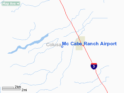
Location
& QuickFacts
|
FAA
Information Effective: |
2006-09-28 |
|
Airport
Identifier: |
2CL2 |
|
Longitude/Latitude: |
122-05-51.8940W/39-00-39.6260N
-122.097748/39.011007 (Estimated) |
|
Elevation: |
65 ft / 19.81 m (Estimated) |
|
Land: |
0 acres |
|
From
nearest city: |
3 nautical miles W of Arbuckle, CA |
|
Location: |
Colusa County, CA |
|
Magnetic Variation: |
16E (1990) |
Owner
& Manager
|
Ownership: |
Privately owned |
|
Owner: |
Harold M. Mc Cabe |
|
Address: |
6314 Hillgate
Arbuckle, CA 95912 |
|
Phone number: |
916-476-2454 |
|
Manager: |
Harold M. Mc Cabe |
|
Address: |
6314 Hillgate
Arbuckle, CA 95912 |
|
Phone number: |
916-476-2454 |
Airport
Operations and Facilities
|
Airport
Use: |
Private |
|
Wind
indicator: |
Yes |
|
Segmented
Circle: |
No |
|
Control
Tower: |
No |
|
Attendance
Schedule: |
UNATNDD |
|
Sectional
chart: |
San Francisco |
|
Region: |
AWP - Western-Pacific |
|
Boundary
ARTCC: |
ZOA - Oakland |
|
Tie-in
FSS: |
RIU - Rancho Murieta |
|
FSS
on Airport: |
No |
|
FSS
Phone: |
916-354-0161 |
|
FSS
Toll Free: |
1-800-WX-BRIEF |
|
Runway Information
Runway 14/32
|
Dimension: |
1500 x 36 ft / 457.2 x 11.0 m |
|
Surface: |
GRVL-TRTD, |
|
|
Runway 14 |
Runway 32 |
|
Traffic
Pattern: |
Left |
Left |
|
Radio Navigation
Aids
|
ID |
Type |
Name |
Ch |
Freq |
Var |
Dist |
|
MY |
NDB |
Halow |
|
222.00 |
16E |
24.7 nm |
|
OVE |
NDB |
Oroville |
|
212.00 |
16E |
36.5 nm |
|
LOP |
NDB |
Lampson |
|
217.00 |
16E |
36.7 nm |
|
BAB |
TACAN |
Beale |
023X |
|
16E |
31.6 nm |
|
SUU |
TACAN |
Travis |
113X |
|
17E |
46.6 nm |
|
TZZ |
VOR |
Travis |
|
116.40 |
17E |
42.3 nm |
|
MYV |
VOR/DME |
Marysville |
045X |
110.80 |
16E |
25.1 nm |
|
MCC |
VOR/DME |
Mc Clellan |
029X |
109.20 |
17E |
38.5 nm |
|
STS |
VOR/DME |
Santa Rosa |
077X |
113.00 |
16E |
45.1 nm |
|
CIC |
VOR/DME |
Chico |
035X |
109.80 |
16E |
48.2 nm |
|
ILA |
VORTAC |
Williams |
091X |
114.40 |
18E |
4.9 nm |
|
MXW |
VORTAC |
Maxwell |
037X |
110.00 |
18E |
19.3 nm |
|
SAC |
VORTAC |
Sacramento |
099X |
115.20 |
17E |
42.6 nm |
|
SMF |
VOT |
Sacramento Metropolitan |
|
111.40 |
|
30.6 nm |
|
SAC |
VOT |
Sacramento Executive |
|
111.40 |
|
41.0 nm |
Remarks
- PROVIDED
ARPT IS OPERATED FOR PR USE VFR ONLY.
Based Aircraft
|
Aircraft
based on field: |
1 |
|
Single
Engine Airplanes: |
1 |
Mc Cabe Ranch Airport
Address:
Colusa County, CA
Tel:
916-476-2454
Images
and information placed above are from
http://www.airport-data.com/airport/2CL2/
We
thank them for the data!
| General
Info |
| Country |
United
States |
| State |
CALIFORNIA
|
| FAA ID |
2CL2
|
| Latitude |
39-00-39.626N
|
| Longitude |
122-05-51.894W
|
| Elevation |
65 feet
|
| Near City |
ARBUCKLE
|
We don't guarantee the information is fresh and accurate. The data may
be wrong or outdated.
For more up-to-date information please refer to other sources.
|
|


