 |
|
Location
& QuickFacts
|
FAA
Information Effective: |
2006-09-28 |
|
Airport
Identifier: |
5CL3 |
|
Longitude/Latitude: |
121-11-54.7790W/37-40-04.7460N
-121.198550/37.667985 (Estimated) |
|
Elevation: |
34 ft / 10.36 m (Estimated) |
|
Land: |
0 acres |
|
From
nearest city: |
12 nautical miles W of Modesto, CA |
|
Location: |
Stanislaus County, CA |
|
Magnetic Variation: |
16E (1990) |
Owner
& Manager
|
Ownership: |
Privately owned |
|
Owner: |
W.j. Lyons |
|
Address: |
10555 Maze Rd
Modesto, CA 95358 |
|
Phone number: |
209-522-1762 |
|
Manager: |
W.j. Lyons |
|
Address: |
10555 Maze Rd
Modesto, CA 95358 |
|
Phone number: |
209-522-1762 |
Airport
Operations and Facilities
|
Airport
Use: |
Private |
|
Wind
indicator: |
Yes |
|
Segmented
Circle: |
No |
|
Control
Tower: |
No |
|
Attendance
Schedule: |
UNATNDD |
|
Sectional
chart: |
San Francisco |
|
Region: |
AWP - Western-Pacific |
|
Boundary
ARTCC: |
ZOA - Oakland |
|
Tie-in
FSS: |
RIU - Rancho Murieta |
|
FSS
on Airport: |
No |
|
FSS
Phone: |
916-354-0161 |
|
FSS
Toll Free: |
1-800-WX-BRIEF |
|
Runway Information
Runway 11/29
|
Dimension: |
1800 x 125 ft / 548.6 x 38.1 m |
|
Surface: |
DIRT, |
|
|
Runway 11 |
Runway 29 |
|
Traffic
Pattern: |
Left |
Left |
|
Radio Navigation
Aids
|
ID |
Type |
Name |
Ch |
Freq |
Var |
Dist |
|
TCY |
NDB |
Tracy |
|
203.00 |
15E |
11.8 nm |
|
LV |
NDB |
Reiga |
|
374.00 |
16E |
23.1 nm |
|
NUQ |
TACAN |
Moffett |
123X |
|
17E |
43.3 nm |
|
SUU |
TACAN |
Travis |
113X |
|
17E |
49.6 nm |
|
TZZ |
VOR |
Travis |
|
116.40 |
17E |
49.9 nm |
|
MOD |
VOR/DME |
Modesto |
093X |
114.60 |
17E |
11.7 nm |
|
SJC |
VOR/DME |
San Jose |
088X |
114.10 |
16E |
39.7 nm |
|
CCR |
VOR/DME |
Concord |
117X |
117.00 |
17E |
46.1 nm |
|
HYP |
VOR/DME |
El Nido |
089X |
114.20 |
15E |
46.7 nm |
|
ECA |
VORTAC |
Manteca |
107X |
116.00 |
17E |
10.0 nm |
|
LIN |
VORTAC |
Linden |
095X |
114.80 |
17E |
26.1 nm |
|
OAK |
VORTAC |
Oakland |
115X |
116.80 |
17E |
48.9 nm |
|
SAC |
VORTAC |
Sacramento |
099X |
115.20 |
17E |
49.5 nm |
Remarks
Based Aircraft
|
Aircraft
based on field: |
2 |
|
Single
Engine Airplanes: |
2 |
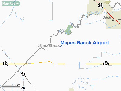
Mapes Ranch Airport
Address:
Stanislaus County, CA
Tel:
209-522-1762
Images
and information placed above are from
http://www.airport-data.com/airport/5CL3/
We
thank them for the data!
| General
Info |
| Country |
United
States |
| State |
CALIFORNIA
|
| FAA ID |
5CL3
|
| Latitude |
37-40-04.746N
|
| Longitude |
121-11-54.779W
|
| Elevation |
34 feet
|
| Near City |
MODESTO
|
We don't guarantee the information is fresh and accurate. The data may
be wrong or outdated.
For more up-to-date information please refer to other sources.
|
|


