 |
|
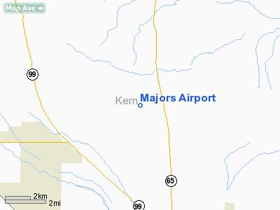
Location
& QuickFacts
|
FAA
Information Effective: |
2006-09-28 |
|
Airport
Identifier: |
6CL0 |
|
Longitude/Latitude: |
119-06-06.0000W/35-31-34.0000N
-119.101667/35.526111 (Estimated) |
|
Elevation: |
640 ft / 195.07 m (Estimated) |
|
Land: |
0 acres |
|
From
nearest city: |
0 nautical miles N of Bakersfield, CA |
|
Location: |
Kern County, CA |
|
Magnetic Variation: |
15E (1990) |
Owner
& Manager
|
Ownership: |
Privately owned |
|
Owner: |
Forrest E Majors |
|
Address: |
34357 Merced Ave
Bakersfield, CA 93308 |
|
Phone number: |
909-763-7600 |
|
Manager: |
Forrest E Majors |
|
Address: |
34357 Merced Ave
Bakersfield, CA 93308 |
|
Phone number: |
909-763-7600 |
Airport
Operations and Facilities
|
Airport
Use: |
Private |
|
Segmented
Circle: |
No |
|
Control
Tower: |
No |
|
Attendance
Schedule: |
UNATNDD |
|
Sectional
chart: |
Los Angeles |
|
Region: |
AWP - Western-Pacific |
|
Boundary
ARTCC: |
ZLA - Los Angeles |
|
Tie-in
FSS: |
RIU - Rancho Murieta |
|
FSS
on Airport: |
No |
|
FSS
Phone: |
916-354-0161 |
|
FSS
Toll Free: |
1-800-WX-BRIEF |
|
Runway Information
Runway 12/30
|
Dimension: |
1000 x 150 ft / 304.8 x 45.7 m |
|
Surface: |
DIRT, |
|
|
Runway 12 |
Runway 30 |
|
Traffic
Pattern: |
Left |
Left |
|
Radio Navigation
Aids
|
ID |
Type |
Name |
Ch |
Freq |
Var |
Dist |
|
COR |
NDB |
Salyer Farms |
|
205.00 |
16E |
38.8 nm |
|
TTE |
VOR/DME |
Tule |
029X |
109.20 |
16E |
23.6 nm |
|
EHF |
VORTAC |
Shafter |
101X |
115.40 |
14E |
2.5 nm |
|
AVE |
VORTAC |
Avenal |
118X |
117.10 |
16E |
43.5 nm |
|
GMN |
VORTAC |
Gorman |
108X |
116.10 |
16E |
45.0 nm |
|
FLW |
VORTAC |
Fellows |
122X |
117.50 |
16E |
45.6 nm |
|
BFL |
VOT |
Bakersfield |
|
111.20 |
|
6.6 nm |
Remarks
- VFR;
PRIVATE DAYLIGHT OPNS ONLY.
Majors Airport
Address:
Kern County, CA
Tel:
909-763-7600
Images
and information placed above are from
http://www.airport-data.com/airport/6CL0/
We
thank them for the data!
| General
Info |
| Country |
United
States |
| State |
CALIFORNIA
|
| FAA ID |
6CL0
|
| Latitude |
35-31-34.000N
|
| Longitude |
119-06-06.000W
|
| Elevation |
640 feet
|
| Near City |
BAKERSFIELD
|
We don't guarantee the information is fresh and accurate. The data may
be wrong or outdated.
For more up-to-date information please refer to other sources.
|
|


