 |
|
|
|
|
|
Location
& QuickFacts
|
FAA
Information Effective: |
2006-09-28 |
|
Airport
Identifier: |
13CL |
|
Longitude/Latitude: |
121-49-24.8610W/38-22-52.6760N
-121.823572/38.381299 (Estimated) |
|
Elevation: |
40 ft / 12.19 m (Estimated) |
|
Land: |
20 acres |
|
From
nearest city: |
3 nautical miles S of Dixon, CA |
|
Location: |
Solano County, CA |
|
Magnetic Variation: |
16E (1985) |
Owner
& Manager
|
Ownership: |
Privately owned |
|
Owner: |
Chialo Properties |
|
Address: |
2880 Tennant Ave
Morgan Hill, CA 95037 |
|
Phone
number: |
916-678-2038 |
|
Manager: |
W D Josun |
|
Address: |
P O Box 609
Dixon, CA 95620 |
|
Phone number: |
916-678-2038 |
Airport
Operations and Facilities
|
Airport
Use: |
Private |
|
Wind
indicator: |
Yes |
|
Segmented
Circle: |
No |
|
Control
Tower: |
No |
|
Attendance
Schedule: |
ALL/ALL/ALL |
|
Landing
fee charge: |
No |
|
Sectional
chart: |
San Francisco |
|
Region: |
AWP - Western-Pacific |
|
Traffic Pattern Alt: |
800 ft |
|
Boundary ARTCC: |
ZOA - Oakland |
|
Tie-in FSS: |
RIU - Rancho Murieta |
|
FSS on Airport: |
No |
|
FSS Phone: |
916-354-0161 |
|
FSS Toll Free: |
1-800-WX-BRIEF |
Airport
Services
|
Airframe
Repair: |
NONE |
|
Power
Plant Repair: |
NONE |
|
Bottled
Oxygen: |
NONE |
|
Bulk
Oxygen: |
NONE |
|
Runway Information
Runway 16/34
|
Dimension: |
1950 x 50 ft / 594.4 x 15.2 m |
|
Surface: |
GRAVEL, |
|
|
Runway 16 |
Runway 34 |
|
Traffic
Pattern: |
Right |
Left |
|
Runway
End Identifier: |
No |
No |
|
Centerline
Lights: |
No |
No |
|
Touchdown
Lights: |
No |
No |
|
Radio Navigation
Aids
|
ID |
Type |
Name |
Ch |
Freq |
Var |
Dist |
|
LV |
NDB |
Reiga |
|
374.00 |
16E |
41.9 nm |
|
TCY |
NDB |
Tracy |
|
203.00 |
15E |
45.1 nm |
|
MY |
NDB |
Halow |
|
222.00 |
16E |
48.4 nm |
|
SUU |
TACAN |
Travis |
113X |
|
17E |
10.0 nm |
|
BAB |
TACAN |
Beale |
023X |
|
16E |
48.7 nm |
|
TZZ |
VOR |
Travis |
|
116.40 |
17E |
2.3 nm |
|
CCR |
VOR/DME |
Concord |
117X |
117.00 |
17E |
22.8 nm |
|
MCC |
VOR/DME |
Mc Clellan |
029X |
109.20 |
17E |
26.2 nm |
|
MYV |
VOR/DME |
Marysville |
045X |
110.80 |
16E |
44.7 nm |
|
STS |
VOR/DME |
Santa Rosa |
077X |
113.00 |
16E |
47.1 nm |
|
SAC |
VORTAC |
Sacramento |
099X |
115.20 |
17E |
13.3 nm |
|
SGD |
VORTAC |
Scaggs Island |
058X |
112.10 |
17E |
28.6 nm |
|
ILA |
VORTAC |
Williams |
091X |
114.40 |
18E |
42.6 nm |
|
LIN |
VORTAC |
Linden |
095X |
114.80 |
17E |
42.9 nm |
|
OAK |
VORTAC |
Oakland |
115X |
116.80 |
17E |
43.7 nm |
|
ECA |
VORTAC |
Manteca |
107X |
116.00 |
17E |
45.1 nm |
|
SAU |
VORTAC |
Sausalito |
109X |
116.20 |
17E |
45.7 nm |
|
SAC |
VOT |
Sacramento Executive |
|
111.40 |
|
17.3 nm |
|
SMF |
VOT |
Sacramento Metropolitan |
|
111.40 |
|
21.6 nm |
Remarks
- ONLY
AGRICULTURE AIRCRAFT BASED AT ARPT.
Based Aircraft
|
Aircraft
based on field: |
9 |
|
Single
Engine Airplanes: |
9 |
Operational Statistics
|
Aircraft
Operations: |
277/Day |
|
General
Aviation Local: |
99.0%
AGRICULTURE AIRCRAFT OPNS. |
|
General
Aviation Itinerant: |
1.0% |
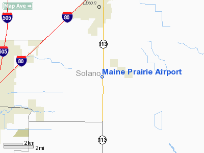
Maine Prairie Airport
Address:
Solano County, CA
Tel:
916-678-2038
Images
and information placed above are from
http://www.airport-data.com/airport/13CL/
We
thank them for the data!
| General
Info |
| Country |
United
States |
| State |
CALIFORNIA
|
| FAA ID |
13CL
|
| Latitude |
38-22-52.676N
|
| Longitude |
121-49-24.861W
|
| Elevation |
40 feet
|
| Near City |
DIXON
|
We don't guarantee the information is fresh and accurate. The data may
be wrong or outdated.
For more up-to-date information please refer to other sources.
|
|


