 |
|
|
|
|
|
Location
& QuickFacts
|
FAA
Information Effective: |
2006-09-28 |
|
Airport
Identifier: |
37CL |
|
Longitude/Latitude: |
116-59-25.0980W/33-19-28.1220N
-116.990305/33.324478 (Estimated) |
|
Elevation: |
925 ft / 281.94 m (Estimated) |
|
Land: |
0 acres |
|
From
nearest city: |
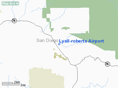
13 nautical miles N of Escondido, CA |
|
Location: |
San Diego County, CA |
|
Magnetic Variation: |
13E (1985) |
Owner
& Manager
|
Ownership: |
Privately owned |
|
Owner: |
Lyall Enter. & Robts Orchards |
|
Address: |
15524 Hwy 76
Pauma Valley, CA 92061 |
|
Phone number: |
760-742-3207 |
|
Manager: |
Warren C Lyall |
|
Address: |
15524 Hwy 76
Pauma Valley, CA 92061 |
|
Phone number: |
760-742-3256 |
Airport
Operations and Facilities
|
Airport Use: |
Private |
|
Wind indicator: |
Yes |
|
Segmented Circle: |
No |
|
Control Tower: |
No |
|
Attendance Schedule: |
UNATNDD |
|
Landing fee charge: |
No |
|
Sectional chart: |
Los Angeles |
|
Region: |
AWP - Western-Pacific |
|
Boundary ARTCC: |
ZLA - Los Angeles |
|
Tie-in FSS: |
SAN - San Diego |
|
FSS on Airport: |
No |
|
FSS Phone: |
858-277-7043 |
|
FSS Toll Free: |
1-800-WX-BRIEF |
Airport
Services
|
Airframe
Repair: |
NONE |
|
Power
Plant Repair: |
NONE |
|
Runway Information
Runway 04/22
|
Dimension: |
1700 x 50 ft / 518.2 x 15.2 m |
|
Surface: |
TRTD-DIRT, |
|
|
Runway 04 |
Runway 22 |
|
Traffic
Pattern: |
Left |
Left |
|
Radio Navigation
Aids
|
ID |
Type |
Name |
Ch |
Freq |
Var |
Dist |
|
SAN |
FAN MARKER |
Encat |
|
|
15E |
37.3 nm |
|
SJY |
NDB |
San Jacinto |
|
227.00 |
14E |
28.3 nm |
|
UN |
NDB |
Tijuana |
|
381.00 |
14E |
47.6 nm |
|
SB |
NDB |
Petis |
|
397.00 |
14E |
47.8 nm |
|
NFG |
TACAN |
Camp Pendleton |
055X |
|
13E |
20.2 nm |
|
NKX |
TACAN |
Miramar |
033X |
|
15E |
28.6 nm |
|
RIV |
TACAN |
March |
077X |
|
14E |
37.8 nm |
|
NZY |
TACAN |
North Island |
117X |
|
14E |
39.1 nm |
|
NRS |
TACAN |
Imperial Beach |
029X |
|
14E |
46.1 nm |
|
NKX |
UHF/NDB |
Miramar |
|
352.00 |
15E |
28.1 nm |
|
HDF |
VOR |
Homeland |
|
113.40 |
14E |
28.9 nm |
|
RAL |
VOR |
Riverside |
|
112.40 |
15E |
44.2 nm |
|
ELB |
VOR/DME |
El Toro |
119X |
117.20 |
14E |
42.7 nm |
|
TIJ |
VOR/DME |
Tijuana |
112X |
116.50 |
14E |
47.2 nm |
|
OCN |
VORTAC |
Oceanside |
100X |
115.30 |
15E |
22.1 nm |
|
JLI |
VORTAC |
Julian |
087X |
114.00 |
15E |
23.1 nm |
|
MZB |
VORTAC |
Mission Bay |
125X |
117.80 |
15E |
34.7 nm |
|
PGY |
VORTAC |
Poggi |
035X |
109.80 |
14E |
42.9 nm |
|
PSP |
VORTAC |
Palm Springs |
102X |
115.50 |
13E |
43.2 nm |
|
PDZ |
VORTAC |
Paradise |
059X |
112.20 |
15E |
44.8 nm |
|
TRM |
VORTAC |
Thermal |
109X |
116.20 |
13E |
45.4 nm |
|
SEE |
VOT |
Gillespie Field |
|
110.00 |
|
30.0 nm |
|
SAN |
VOT |
Mount Soledad |
|
109.00 |
|
32.0 nm |
|
SNA |
VOT |
Santa Ana |
|
110.00 |
|
48.9 nm |
Remarks
- TKOF
ON RWY 22 AND LAND ON RWY 04.
- PVT
USE.
Based Aircraft
|
Aircraft
based on field: |
1 |
|
Single
Engine Airplanes: |
1 |
Lyall-roberts Airport
Address:
San Diego County, CA
Tel:
760-742-3207, 760-742-3256
Images
and information placed above are from
http://www.airport-data.com/airport/37CL/
We
thank them for the data!
| General
Info |
| Country |
United
States |
| State |
CALIFORNIA
|
| FAA ID |
37CL
|
| Latitude |
33-19-28.122N
|
| Longitude |
116-59-25.098W
|
| Elevation |
925 feet
|
| Near City |
ESCONDIDO
|
We don't guarantee the information is fresh and accurate. The data may
be wrong or outdated.
For more up-to-date information please refer to other sources.
|
|


