 |
|
|
|
|
|
Location
& QuickFacts
|
FAA
Information Effective: |
2006-09-28 |
|
Airport
Identifier: |
S74 |
|
Longitude/Latitude: |
121-27-23.8230W/38-00-14.7200N
-121.456617/38.004089 (Estimated) |
|
Elevation: |
0 ft / 0.00 m (Estimated) |
|
Land: |
0 acres |
|
From
nearest city: |
8 nautical miles NW of Stockton, CA |
|
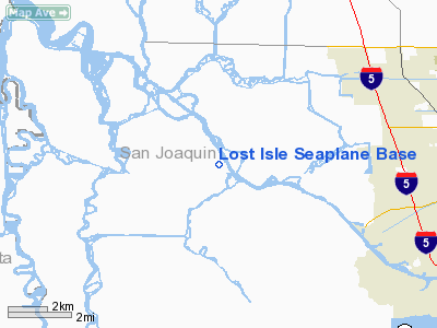
Location: |
San Joaquin County, CA |
|
Magnetic Variation: |
16E (1985) |
Owner
& Manager
|
Ownership: |
Publicly owned |
|
Owner: |
California State Lands Comm |
|
Address: |
1807 13th Street
Sacramento, CA 95814 |
|
Phone
number: |
916-322-7777 |
|
Manager: |
Chuck Riggs
REPRESENTING: LOST ISLE PARTNERS. |
|
Address: |
River Route 24
Stockton, CA 95219
11050 W. ACKER ISL., LGT. 24 STOCKTON DEEP WATER CHANNEL |
|
Phone number: |
209-948-4135 |
Airport
Operations and Facilities
|
Airport
Use: |
Open to public |
|
Wind
indicator: |
No |
|
Segmented
Circle: |
No |
|
Control
Tower: |
No |
|
Attendance
Schedule: |
ALL/ALL/0800-DUSK |
|
Landing
fee charge: |
No |
|
Sectional
chart: |
San Francisco |
|
Region: |
AWP - Western-Pacific |
|
Traffic
Pattern Alt: |
800 ft |
|
Boundary
ARTCC: |
ZOA - Oakland |
|
Tie-in
FSS: |
RIU - Rancho Murieta |
|
FSS
on Airport: |
No |
|
FSS
Phone: |
916-354-0161 |
|
FSS
Toll Free: |
1-800-WX-BRIEF |
|
NOTAMs
Facility: |
RIU (NOTAM-d service avaliable) |
Airport
Communications
Airport
Services
|
Airframe
Repair: |
NONE |
|
Power
Plant Repair: |
NONE |
|
Bottled
Oxygen: |
NONE |
|
Bulk
Oxygen: |
NONE |
|
Runway Information
Runway NW/SE
|
Dimension: |
4000 x 300 ft / 1219.2 x 91.4 m |
|
Surface: |
WATER, Good Condition |
|
|
Runway NW |
Runway SE |
|
Traffic
Pattern: |
Left |
Left |
|
Markings: |
None, |
None, |
|
Runway
End Identifier: |
No |
No |
|
Centerline
Lights: |
No |
No |
|
Touchdown
Lights: |
No |
No |
|
Radio Navigation
Aids
|
ID |
Type |
Name |
Ch |
Freq |
Var |
Dist |
|
TCY |
NDB |
Tracy |
|
203.00 |
15E |
18.7 nm |
|
LV |
NDB |
Reiga |
|
374.00 |
16E |
21.6 nm |
|
SUU |
TACAN |
Travis |
113X |
|
17E |
27.3 nm |
|
NUQ |
TACAN |
Moffett |
123X |
|
17E |
44.7 nm |
|
TZZ |
VOR |
Travis |
|
116.40 |
17E |
26.4 nm |
|
CCR |
VOR/DME |
Concord |
117X |
117.00 |
17E |
28.0 nm |
|
MOD |
VOR/DME |
Modesto |
093X |
114.60 |
17E |
32.8 nm |
|
MCC |
VOR/DME |
Mc Clellan |
029X |
109.20 |
17E |
39.9 nm |
|
SJC |
VOR/DME |
San Jose |
088X |
114.10 |
16E |
44.4 nm |
|
SFO |
VOR/DME |
San Francisco |
105X |
115.80 |
17E |
49.3 nm |
|
ECA |
VORTAC |
Manteca |
107X |
116.00 |
17E |
17.0 nm |
|
LIN |
VORTAC |
Linden |
095X |
114.80 |
17E |
21.8 nm |
|
SAC |
VORTAC |
Sacramento |
099X |
115.20 |
17E |
26.8 nm |
|
OAK |
VORTAC |
Oakland |
115X |
116.80 |
17E |
40.1 nm |
|
SGD |
VORTAC |
Scaggs Island |
058X |
112.10 |
17E |
44.6 nm |
|
SAC |
VOT |
Sacramento Executive |
|
111.40 |
|
30.7 nm |
|
SMF |
VOT |
Sacramento Metropolitan |
|
111.40 |
|
41.7 nm |
|
SFO |
VOT |
San Francisco Intl |
|
111.00 |
|
49.4 nm |
Remarks
Operational Statistics
|
Aircraft
Operations: |
13/Week |
|
General
Aviation Itinerant: |
100.0% |
Lost Isle Seaplane Base
Address:
San Joaquin County, CA
Tel:
916-322-7777,
209-948-4135
Images
and information placed above are from
http://www.airport-data.com/airport/S74/
We thank them for the
data!
We don't guarantee the information is fresh and accurate. The data may
be wrong or outdated.
For more up-to-date information please refer to other sources.
|
|


