 |
|
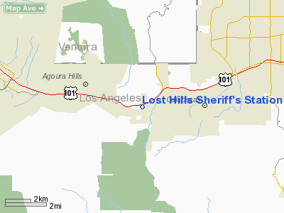
Lost Hills Sheriff's Station Heliport |
Location
& QuickFacts
|
FAA
Information Effective: |
2006-09-28 |
|
Airport
Identifier: |
05CA |
|
Longitude/Latitude: |
118-42-52.0000W/34-08-16.0000N
-118.714444/34.137778 (Estimated) |
|
Elevation: |
888 ft / 270.66 m (Estimated) |
|
Land: |
0 acres |
|
From
nearest city: |
4 nautical miles W of Calabasas, CA |
|
Location: |
Los Angeles County, CA |
|
Magnetic Variation: |
14E (1985) |
Owner
& Manager
|
Ownership: |
Publicly owned |
|
Owner: |
Los Angeles County |
|
Address: |
4700 Ramona Blvd
Monterey Park, CA 91754-2169 |
|
Phone
number: |
818-878-1808 |
|
Manager: |
James Digiovanna |
|
Address: |
4324 Donald Douglas Drive
Long Beach, CA 90808 |
|
Phone number: |
310-421-2701 |
Airport
Operations and Facilities
|
Airport
Use: |
Private |
|
Wind
indicator: |
Yes |
|
Segmented
Circle: |
No |
|
Control
Tower: |
No |
|
Attendance
Schedule: |
ALL/ALL/ALL |
|
Lighting
Schedule: |
DUSK-DAWN |
|
Sectional
chart: |
Los Angeles |
|
Region: |
AWP - Western-Pacific |
|
Boundary
ARTCC: |
ZLA - Los Angeles |
|
Tie-in
FSS: |
HHR - Hawthorne |
|
FSS
Phone: |
310-970-0102 |
|
FSS
Toll Free: |
1-800-WX-BRIEF |
|
Runway Information
Helipad H1
|
Dimension: |
78 x 78 ft / 23.8 x 23.8 m |
|
Surface: |
CONC, Good Condition |
|
|
Runway H1 |
Runway |
|
Traffic
Pattern: |
Left |
Left |
|
Radio Navigation
Aids
|
ID |
Type |
Name |
Ch |
Freq |
Var |
Dist |
|
PAI |
NDB |
Pacoima |
|
370.00 |
15E |
16.7 nm |
|
CPM |
NDB |
Compton |
|
378.00 |
15E |
27.7 nm |
|
EMT |
NDB |
El Monte |
|
359.00 |
15E |
34.1 nm |
|
GWF |
NDB |
Gen William J Fox |
|
282.00 |
15E |
43.7 nm |
|
NTD |
TACAN |
Point Mugu |
043X |
|
15E |
20.3 nm |
|
VNY |
VOR/DME |
Van Nuys |
078X |
113.10 |
15E |
12.2 nm |
|
SMO |
VOR/DME |
Santa Monica |
045X |
110.80 |
15E |
14.9 nm |
|
VTU |
VOR/DME |
Ventura |
019X |
108.20 |
15E |
16.7 nm |
|
CMA |
VOR/DME |
Camarillo |
105X |
115.80 |
15E |
19.4 nm |
|
FIM |
VORTAC |
Fillmore |
072X |
112.50 |
15E |
15.6 nm |
|
LAX |
VORTAC |
Los Angeles |
083X |
113.60 |
15E |
18.7 nm |
|
LHS |
VORTAC |
Lake Hughes |
021X |
108.40 |
15E |
33.5 nm |
|
SLI |
VORTAC |
Seal Beach |
104X |
115.70 |
15E |
39.2 nm |
|
GMN |
VORTAC |
Gorman |
108X |
116.10 |
16E |
40.7 nm |
|
PMD |
VORTAC |
Palmdale |
092X |
114.50 |
15E |
43.8 nm |
|
POM |
VORTAC |
Pomona |
041X |
110.40 |
15E |
46.3 nm |
|
SXC |
VORTAC |
Santa Catalina |
051X |
111.40 |
15E |
48.2 nm |
|
LAX |
VOT |
San Pedro Hill |
|
113.90 |
|
30.2 nm |
Remarks
- PROVIDED
PRIVATE USE AND CONDUCTED IN VFR CONDITIONS ONLY AND IF USED BETWEEN
SS AND SR LIGHTING QWILL BE INSTALLED.
Based Aircraft
|
Aircraft
based on field: |
1 |
|
Helicopters: |
1 |
Lost Hills Sheriff's Station Heliport
Address:
Los Angeles County, CA
Tel:
818-878-1808,
310-421-2701
Images
and information placed above are from
http://www.airport-data.com/airport/05CA/
We
thank them for the data!
| General
Info |
| Country |
United
States |
| State |
CALIFORNIA
|
| FAA ID |
05CA
|
| Latitude |
34-08-16.000N
|
| Longitude |
118-42-52.000W
|
| Elevation |
888 feet
|
| Near City |
CALABASAS
|
We don't guarantee the information is fresh and accurate. The data may
be wrong or outdated.
For more up-to-date information please refer to other sources.
|
|


