 |
|
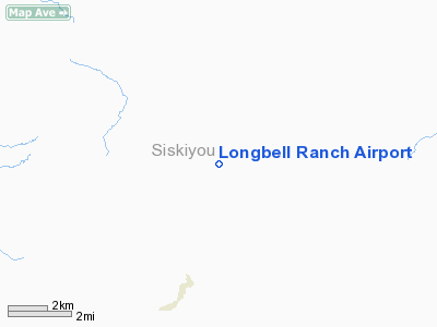
Location
& QuickFacts
|
FAA
Information Effective: |
2006-09-28 |
|
Airport
Identifier: |
2CL3 |
|
Longitude/Latitude: |
121-53-25.0100W/41-38-31.5220N
-121.890281/41.642089 (Estimated) |
|
Elevation: |
4607 ft / 1404.21 m (Estimated) |
|
Land: |
320 acres |
|
From
nearest city: |
4 nautical miles N of Tennant, CA |
|
Location: |
Siskiyou County, CA |
|
Magnetic Variation: |
17E (1995) |
Owner
& Manager
|
Ownership: |
Privately owned |
|
Owner: |
Bill Oetting |
|
Address: |
17471 Long Prairie Road
Macdoel, CA 96058 |
|
Phone
number: |
530-398-4651 |
|
Manager: |
Bill Oetting |
|
Address: |
17471 Long Prairie Road
Macdoel, CA 96058 |
|
Phone number: |
530-398-4651 |
Airport
Operations and Facilities
|
Airport
Use: |
Private |
|
Wind
indicator: |
Yes |
|
Segmented
Circle: |
No |
|
Control
Tower: |
No |
|
Attendance
Schedule: |
UNATNDD |
|
Sectional
chart: |
Klamath Falls |
|
Region: |
AWP - Western-Pacific |
|
Boundary
ARTCC: |
ZSE - Seattle |
|
Tie-in
FSS: |
RIU - Rancho Murieta |
|
FSS
Phone: |
916-354-0161 |
|
FSS
Toll Free: |
1-800-WX-BRIEF |
|
Runway Information
Runway 15/33
|
Dimension: |
5000 x 60 ft / 1524.0 x 18.3 m |
|
Surface: |
TURF, |
|
|
Runway 15 |
Runway 33 |
|
Traffic
Pattern: |
Left |
Left |
|
Radio Navigation
Aids
|
ID |
Type |
Name |
Ch |
Freq |
Var |
Dist |
|
LFA |
NDB |
Merrill |
|
347.00 |
17E |
23.4 nm |
|
MOG |
NDB |
Montague |
|
404.00 |
19E |
27.0 nm |
|
FJS |
VOR/DME |
Fort Jones |
033X |
109.60 |
19E |
42.8 nm |
|
LMT |
VORTAC |
Klamath Falls |
106X |
115.90 |
17E |
31.6 nm |
Remarks
- MOUNTAIN
6,000 FT AGL 3.5 MILES NORTH OF ARPT; MOUNTAIN 5900 FT AGL 4 MILES NW
OF ARPT.
- PROVIDED
VFR, PRIVATE USE, AND SPONSOR SHALL ENSURE OBSTRUCTION FREE INGRESS/EGRESS.
Longbell Ranch Airport
Address:
Siskiyou County, CA
Tel:
530-398-4651
Images
and information placed above are from
http://www.airport-data.com/airport/2CL3/
We
thank them for the data!
| General
Info |
| Country |
United
States |
| State |
CALIFORNIA
|
| FAA ID |
2CL3
|
| Latitude |
41-38-31.522N
|
| Longitude |
121-53-25.010W
|
| Elevation |
4607 feet
|
| Near City |
TENNANT
|
We don't guarantee the information is fresh and accurate. The data may
be wrong or outdated.
For more up-to-date information please refer to other sources.
|
|


