 |
|
|
|
|
|
Location
& QuickFacts
|
FAA
Information Effective: |
2006-09-28 |
|
Airport
Identifier: |
3CL6 |
|
Longitude/Latitude: |
118-23-37.2630W/33-44-13.0620N
-118.393684/33.736962 (Estimated) |
|
Elevation: |
85 ft / 25.91 m (Estimated) |
|
Land: |
0 acres |
|
From
nearest city: |
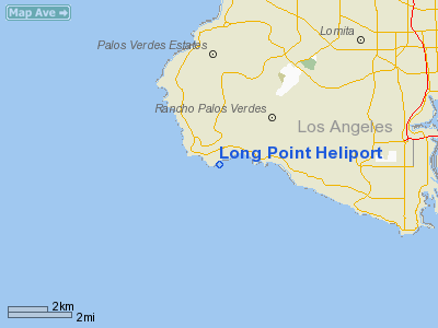
0 nautical miles N of Rancho Palos Verdes,
CA |
|
Location: |
Los Angeles County, CA |
|
Magnetic Variation: |
14E (1990) |
Owner
& Manager
|
Ownership: |
Privately owned |
|
Owner: |
Monaghan Company Long Point |
|
Address: |
6610 Palos Verdes Drive South
Rancho Palos Verdes, CA 90274 |
|
Phone
number: |
213-377-1571 |
|
Manager: |
James G. Monagham |
|
Address: |
6610 Palos Verdes Drive South
Rancho Palos Verdes, CA 90274 |
|
Phone number: |
213-377-1571 |
Airport
Operations and Facilities
|
Airport
Use: |
Private |
|
Segmented
Circle: |
No |
|
Control
Tower: |
No |
|
Attendance
Schedule: |
UNATNDD |
|
Lighting
Schedule: |
PHONE REQ
FOR PERIMETER LGTS CALL (213) 377-1571. |
|
Sectional
chart: |
Los Angeles |
|
Region: |
AWP - Western-Pacific |
|
Boundary
ARTCC: |
ZLA - Los Angeles |
|
Tie-in
FSS: |
HHR - Hawthorne |
|
FSS
on Airport: |
No |
|
FSS
Phone: |
310-970-0102 |
|
FSS
Toll Free: |
1-800-WX-BRIEF |
|
Runway Information
Helipad H1
|
Dimension: |
25
x 20 ft / 7.6 x 6.1 m |
|
Surface: |
CONC, |
|
|
Runway H1 |
Runway |
|
Traffic
Pattern: |
Left |
Left |
|
Radio Navigation
Aids
|
ID |
Type |
Name |
Ch |
Freq |
Var |
Dist |
|
CPM |
NDB |
Compton |
|
378.00 |
15E |
11.7 nm |
|
EMT |
NDB |
El Monte |
|
359.00 |
15E |
27.8 nm |
|
PAI |
NDB |
Pacoima |
|
370.00 |
15E |
31.4 nm |
|
NUC |
NDB |
San Clemente |
|
350.00 |
15E |
43.6 nm |
|
NTD |
TACAN |
Point Mugu |
043X |
|
15E |
43.1 nm |
|
NUC |
TACAN |
San Clemente |
123X |
|
15E |
43.7 nm |
|
RAL |
VOR |
Riverside |
|
112.40 |
15E |
48.9 nm |
|
SMO |
VOR/DME |
Santa Monica |
045X |
110.80 |
15E |
16.7 nm |
|
VNY |
VOR/DME |
Van Nuys |
078X |
113.10 |
15E |
29.6 nm |
|
ELB |
VOR/DME |
El Toro |
119X |
117.20 |
14E |
33.3 nm |
|
VTU |
VOR/DME |
Ventura |
019X |
108.20 |
15E |
39.8 nm |
|
CMA |
VOR/DME |
Camarillo |
105X |
115.80 |
15E |
45.1 nm |
|
LAX |
VORTAC |
Los Angeles |
083X |
113.60 |
15E |
11.9 nm |
|
SLI |
VORTAC |
Seal Beach |
104X |
115.70 |
15E |
17.2 nm |
|
SXC |
VORTAC |
Santa Catalina |
051X |
111.40 |
15E |
21.8 nm |
|
POM |
VORTAC |
Pomona |
041X |
110.40 |
15E |
36.6 nm |
|
FIM |
VORTAC |
Fillmore |
072X |
112.50 |
15E |
44.5 nm |
|
PDZ |
VORTAC |
Paradise |
059X |
112.20 |
15E |
44.5 nm |
|
LAX |
VOT |
San Pedro Hill |
|
113.90 |
|
2.9 nm |
|
SNA |
VOT |
Santa Ana |
|
110.00 |
|
26.4 nm |
Remarks
- PROVIDED
PVT VFR; DALGT USE ONLY; LDG AREA DHOULD BE WEIGHT LTD.
Long Point Heliport
Address:
Los Angeles County, CA
Tel:
213-377-1571
Images
and information placed above are from
http://www.airport-data.com/airport/3CL6/
We
thank them for the data!
| General
Info |
| Country |
United
States |
| State |
CALIFORNIA
|
| FAA ID |
3CL6
|
| Latitude |
33-44-13.062N
|
| Longitude |
118-23-37.263W
|
| Elevation |
85 feet
|
| Near City |
RANCHO
PALOS VERDES |
We don't guarantee the information is fresh and accurate. The data may
be wrong or outdated.
For more up-to-date information please refer to other sources.
|
|


