 |
|
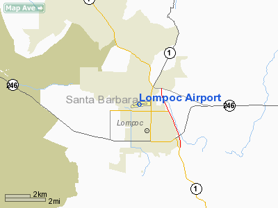
| Lompoc Airport |
| IATA: LPC – ICAO: KLPC |
| Summary |
| Airport type |
Public |
| Operator |
City of Lompoc |
| Location |
Lompoc, California |
| Elevation AMSL |
88 ft / 26.8 m |
| Coordinates |
34°39′56.23″N 120°28′03.01″W / 34.6656194°N 120.4675028°W / 34.6656194; -120.4675028Coordinates: 34°39′56.23″N 120°28′03.01″W / 34.6656194°N 120.4675028°W / 34.6656194; -120.4675028 |
| Runways |
| Direction |
Length |
Surface |
| ft |
m |
| 7/25 |
4,600 |
1,402 |
Asphalt |
Lompoc Airport (IATA: LPC, ICAO: KLPC) is a public airport located just north of the city of Lompoc in Santa Barbara County, California, USA. Facilities
Lompoc Airport covers 194 acres (79 ha) and has one runway:
- Runway 7/25: 4,600 x 100 ft. (1,402 x 30 m), Surface: Asphalt
- Skydiving: Operations held 7days/week during daylight hours at Skydive Santa Barbara (http://www.skydivesantabarbara.com/) 877-652-5867
- AWOS: 805-735-3057
Uses
Average of 82 operations per day.
| Commercial |
Air Taxi |
GA Local |
GA Transient |
Military |
| 0 |
0 |
41 |
41 |
0 |
76 aircraft based at airport
| Single Engine |
Multi Engine |
Jet |
Helicopter |
Glider/ Ultralight |
Military |
| 71 |
0 |
0 |
1 |
4 |
0 |
The above content comes from Wikipedia and is published under free licenses – click here to read more.
Location
& QuickFacts
|
FAA
Information Effective: |
2006-09-28 |
|
Airport
Identifier: |
LPC |
|
Longitude/Latitude: |
120-28-03.0100W/34-39-56.2300N
-120.467503/34.665619 (Estimated) |
|
Elevation: |
88 ft / 26.82 m (Estimated) |
|
Land: |
194 acres |
|
From
nearest city: |
2 nautical miles N of Lompoc, CA |
|
Location: |
Santa Barbara County, CA |
|
Magnetic Variation: |
15E (1985) |
Owner
& Manager
|
Ownership: |
Publicly owned |
|
Owner: |
City Of Lompoc |
|
Address: |
Po Box 8001
Lompoc, CA 93438-8001 |
|
Phone
number: |
805-875-8268 |
|
Manager: |
Richard Fernbaugh |
|
Address: |
City Of Lompoc, Po Box 8001
Lompoc, CA 93438-8001 |
|
Phone number: |
805-315-7095 |
Airport
Operations and Facilities
|
Airport
Use: |
Open to public |
|
Wind
indicator: |
Yes |
|
Segmented
Circle: |
Yes |
|
Control
Tower: |
No |
|
Attendance
Schedule: |
ALL/ALL/0800-1700
ATNDD BY FBO: MARSHALL AVIATION CO 805-736-0034. |
|
Lighting
Schedule: |
DUSK-DAWN
ACTVT MIRL RY 07/25 VASI & REIL RY 25 - CTAF. |
|
Beacon
Color: |
Clear-Green (lighted land airport) |
|
Landing
fee charge: |
No |
|
Sectional
chart: |
Los Angeles |
|
Region: |
AWP - Western-Pacific |
|
Traffic
Pattern Alt: |
813 ft |
|
Boundary
ARTCC: |
ZLA - Los Angeles |
|
Tie-in
FSS: |
HHR - Hawthorne |
|
FSS
on Airport: |
No |
|
FSS
Phone: |
310-970-0102 |
|
FSS
Toll Free: |
1-800-WX-BRIEF |
|
NOTAMs
Facility: |
LPC (NOTAM-d service avaliable) |
|
Federal Agreements: |
NGSY |
Airport
Communications
|
CTAF: |
122.700 |
|
Unicom: |
122.700 |
Airport
Services
|
Fuel
available: |
100LL
FUEL AVBL 24 HRS; SELF-SERVICE CREDIT CARD ONLY. |
|
Airframe
Repair: |
MAJOR |
|
Power
Plant Repair: |
MAJOR |
|
Bottled
Oxygen: |
HIGH |
|
Bulk
Oxygen: |
HIGH |
|
Runway Information
Runway 07/25
|
Dimension: |
4600 x 100 ft / 1402.1 x 30.5 m |
|
Surface: |
ASPH, Good Condition |
|
Weight
Limit: |
Single wheel: 17000 lbs. |
|
Edge
Lights: |
Medium |
|
|
Runway 07 |
Runway 25 |
|
Longitude: |
120-28-30.5400W |
120-27-35.4800W |
|
Latitude: |
34-39-56.6100N |
34-39-55.8500N |
|
Elevation: |
78.00 ft |
88.00 ft |
|
Alignment: |
91 |
127 |
|
Traffic
Pattern: |
Left |
Right |
|
Markings: |
Basic, Good Condition |
Basic, Good Condition |
|
Crossing
Height: |
0.00
ft |
26.00 ft |
|
Displaced
threshold: |
0.00
ft |
395.00 ft |
|
VASI: |
|
4-box on left side |
|
Visual
Glide Angle: |
0.00� |
3.00� |
|
Runway
End Identifier: |
No |
Yes |
|
Centerline
Lights: |
No |
No |
|
Touchdown
Lights: |
No |
No |
|
Obstruction: |
20 ft brush, 720.0 ft from runway, 26:1 slope
to clear |
34 ft trees, 1060.0 ft from runway, 25:1 slope
to clear
38:1 TO DISPLACED THRESHOLD |
|
Radio Navigation
Aids
|
ID |
Type |
Name |
Ch |
Freq |
Var |
Dist |
|
VBG |
TACAN |
Vandenberg |
059Y |
|
15E |
7.0 nm |
|
GLJ |
VOR |
Guadalupe |
|
111.00 |
16E |
17.4 nm |
|
GVO |
VORTAC |
Gaviota |
085X |
113.80 |
16E |
20.3 nm |
|
RZS |
VORTAC |
San Marcus |
096X |
114.90 |
14E |
35.7 nm |
|
MQO |
VORTAC |
Morro Bay |
071X |
112.40 |
16E |
38.1 nm |
|
FLW |
VORTAC |
Fellows |
122X |
117.50 |
16E |
39.3 nm |
Remarks
- DEER
ON & INVOF ARPT.
- MODEL
AIRCRAFT FLYING, ULTRALIGHT, AND SKY DIVING ACTIVITY INVOF OF ARPT DALGT
HRS FRI-SUN.
Based Aircraft
|
Aircraft
based on field: |
77 |
|
Single
Engine Airplanes: |
75 |
|
Multi
Engine Airplanes: |
1 |
|
Ultralights: |
1 |
Operational Statistics
|
Aircraft
Operations: |
83/Day |
|
Air Taxi: |
0.3% |
|
General
Aviation Local: |
49.7% |
|
General
Aviation Itinerant: |
49.7% |
|
Military: |
0.3% |
Lompoc Airport
Address:
Santa Barbara County, CA
Tel:
805-875-8268,
805-315-7095
Images
and information placed above are from
http://www.airport-data.com/airport/LPC/
We
thank them for the data!
| General
Info |
| Country |
United
States |
| State |
CALIFORNIA
|
| FAA ID |
LPC
|
| Latitude |
34-39-56.197N
|
| Longitude |
120-28-00.438W
|
| Elevation |
87 feet
|
| Near City |
LOMPOC
|
We don't guarantee the information is fresh and accurate. The data may
be wrong or outdated.
For more up-to-date information please refer to other sources.
|
|


