|
|
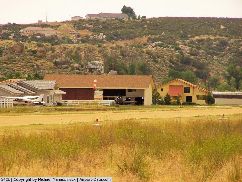
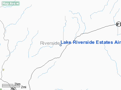
Lake Riverside Estates Airport |
|
 |
(Click on the photo to enlarge) |
Location
& QuickFacts
|
FAA
Information Effective: |
2006-09-28 |
|
Airport
Identifier: |
54CL |
|
Longitude/Latitude: |
116-47-48.0760W/33-31-15.1050N
-116.796688/33.520862 (Estimated) |
|
Elevation: |
3410 ft / 1039.37 m (Estimated) |
|
Land: |
0 acres |
|
From
nearest city: |
6 nautical miles SW of Anza, CA |
|
Location: |
Riverside County, CA |
|
Magnetic Variation: |
13E (1985) |
Owner
& Manager
|
Ownership: |
Privately owned |
|
Owner: |
Lake Riverside Estates |
|
Address: |
41610 Lakeshore Blvd
Aguanga, CA 92302 |
|
Phone
number: |
951-763-4192 |
|
Manager: |
Roger Chastain |
|
Address: |
49380 Sky Harbor Way
Aguanga, CA 92536 |
|
Phone number: |
951-763-0464 |
Airport
Operations and Facilities
|
Airport Use: |
Private |
|
Wind indicator: |
Yes |
|
Segmented Circle: |
No |
|
Control Tower: |
No |
|
Attendance Schedule: |
IREG/ALL/DALGT |
|
Lighting Schedule: |
DUSK-2200 |
|
Landing fee charge: |
No |
|
Sectional chart: |
Los Angeles |
|
Region: |
AWP - Western-Pacific |
|
Boundary ARTCC: |
ZLA - Los Angeles |
|
Tie-in FSS: |
RAL - Riverside |
|
FSS on Airport: |
No |
|
FSS Phone: |
951-351-3020 |
|
FSS Toll Free: |
1-800-WX-BRIEF |
Airport
Services
|
Airframe
Repair: |
NONE |
|
Power
Plant Repair: |
NONE |
|
Runway Information
Runway 10/28
|
Dimension: |
3500 x 100 ft / 1066.8 x 30.5 m |
|
Surface: |
DIRT,
RWY SFC IS WELL COMPACTED DECOMPOSED GRANITE. |
|
|
Runway 10 |
Runway 28 |
|
Traffic
Pattern: |
Left |
Left |
|
Obstruction: |
200 ft hill, 1000.0 ft from runway |
, 300.0 ft from runway |
|
Radio Navigation
Aids
|
ID |
Type |
Name |
Ch |
Freq |
Var |
Dist |
|
SJY |
NDB |
San Jacinto |
|
227.00 |
14E |
19.3 nm |
|
SB |
NDB |
Petis |
|
397.00 |
14E |
43.0 nm |
|
NFG |
TACAN |
Camp Pendleton |
055X |
|
13E |
33.1 nm |
|
RIV |
TACAN |
March |
077X |
|
14E |
33.3 nm |
|
NKX |
TACAN |
Miramar |
033X |
|
15E |
43.1 nm |
|
NKX |
UHF/NDB |
Miramar |
|
352.00 |
15E |
42.5 nm |
|
HDF |
VOR |
Homeland |
|
113.40 |
14E |
24.8 nm |
|
RAL |
VOR |
Riverside |
|
112.40 |
15E |
41.7 nm |
|
ELB |
VOR/DME |
El Toro |
119X |
117.20 |
14E |
47.7 nm |
|
JLI |
VORTAC |
Julian |
087X |
114.00 |
15E |
25.2 nm |
|
PSP |
VORTAC |
Palm Springs |
102X |
115.50 |
13E |
27.9 nm |
|
TRM |
VORTAC |
Thermal |
109X |
116.20 |
13E |
32.5 nm |
|
OCN |
VORTAC |
Oceanside |
100X |
115.30 |
15E |
35.4 nm |
|
PDZ |
VORTAC |
Paradise |
059X |
112.20 |
15E |
43.8 nm |
|
MZB |
VORTAC |
Mission Bay |
125X |
117.80 |
15E |
49.4 nm |
|
SEE |
VOT |
Gillespie Field |
|
110.00 |
|
42.8 nm |
|
SAN |
VOT |
Mount Soledad |
|
109.00 |
|
46.9 nm |
Remarks
Based Aircraft
|
Aircraft
based on field: |
28 |
|
Single
Engine Airplanes: |
24 |
|
Multi
Engine Airplanes: |
2 |
|
Gliders: |
2 |
Lake Riverside Estates Airport
Address:
Riverside County, CA
Tel:
951-763-4192,
951-763-0464
Images
and information placed above are from
http://www.airport-data.com/airport/54CL/
We
thank them for the data!
| General
Info |
| Country |
United
States |
| State |
CALIFORNIA
|
| FAA ID |
54CL
|
| Latitude |
33-31-15.105N
|
| Longitude |
116-47-48.076W
|
| Elevation |
3410 feet
|
| Near City |
ANZA
|
We don't guarantee the information is fresh and accurate. The data may
be wrong or outdated.
For more up-to-date information please refer to other sources.
|
|