 |
|
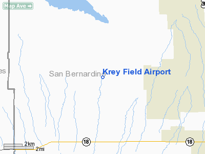
Location
& QuickFacts
|
FAA
Information Effective: |
2006-09-28 |
|
Airport
Identifier: |
0CL1 |
|
Longitude/Latitude: |
117-33-20.0000W/34-34-09.9700N
-117.555556/34.569436 (Estimated) |
|
Elevation: |
3042 ft / 927.20 m (Estimated) |
|
Land: |
140 acres |
|
From
nearest city: |
9 nautical miles SW of Adelanto, CA |
|
Location: |
San Bernardino County, CA |
|
Magnetic Variation: |
14E (1985) |
Owner
& Manager
|
Ownership: |
Privately owned |
|
Owner: |
John F. Krey |
|
Address: |
20188 Gray Mt Road
El Mirage, CA 92301 |
|
Phone
number: |
619-388-4354 |
|
Manager: |
John Krey |
|
Address: |
20188 Gray Mt Road
El Mirage, CA 92301 |
|
Phone number: |
619-388-4354 |
Airport
Operations and Facilities
|
Airport
Use: |
Private |
|
Wind
indicator: |
Yes |
|
Segmented
Circle: |
No |
|
Control
Tower: |
No |
|
Attendance
Schedule: |
ALL/SAT-SUN/1100-1700 |
|
Sectional
chart: |
Los Angeles |
|
Region: |
AWP - Western-Pacific |
|
Boundary
ARTCC: |
ZLA - Los Angeles |
|
Tie-in
FSS: |
RAL - Riverside |
|
FSS
Phone: |
951-351-3020 |
|
FSS
Toll Free: |
1-800-WX-BRIEF |
|
Runway Information
Runway 07/25
|
Dimension: |
3360 x 100 ft / 1024.1 x 30.5 m |
|
Surface: |
DIRT, |
|
|
Runway 07 |
Runway 25 |
|
Traffic
Pattern: |
Left |
Left |
|
Runway 16/34
|
Dimension: |
2040 x 100 ft / 621.8 x 30.5 m |
|
Surface: |
DIRT, |
|
|
Runway 16 |
Runway 34 |
|
Traffic
Pattern: |
Left |
Left |
|
Radio Navigation
Aids
|
ID |
Type |
Name |
Ch |
Freq |
Var |
Dist |
|
SB |
NDB |
Petis |
|
397.00 |
14E |
32.2 nm |
|
GWF |
NDB |
Gen William J Fox |
|
282.00 |
15E |
34.2 nm |
|
EMT |
NDB |
El Monte |
|
359.00 |
15E |
37.3 nm |
|
PAI |
NDB |
Pacoima |
|
370.00 |
15E |
46.4 nm |
|
RIV |
TACAN |
March |
077X |
|
14E |
42.2 nm |
|
RAL |
VOR |
Riverside |
|
112.40 |
15E |
37.5 nm |
|
VCV |
VOR/DME |
Victorville |
031X |
109.40 |
14E |
8.3 nm |
|
PMD |
VORTAC |
Palmdale |
092X |
114.50 |
15E |
25.4 nm |
|
EDW |
VORTAC |
Edwards |
111X |
116.40 |
15E |
26.3 nm |
|
POM |
VORTAC |
Pomona |
041X |
110.40 |
15E |
31.7 nm |
|
PDZ |
VORTAC |
Paradise |
059X |
112.20 |
15E |
39.2 nm |
Remarks
Based Aircraft
|
Aircraft
based on field: |
14 |
|
Single
Engine Airplanes: |
2 |
|
Gliders: |
12 |
Krey Field Airport
Address:
San Bernardino County, CA
Tel:
619-388-4354
Images
and information placed above are from
http://www.airport-data.com/airport/0CL1/
We
thank them for the data!
| General
Info |
| Country |
United
States |
| State |
CALIFORNIA
|
| FAA ID |
0CL1
|
| Latitude |
34-34-09.970N
|
| Longitude |
117-33-20.000W
|
| Elevation |
3042 feet
|
| Near City |
ADELANTO
|
We don't guarantee the information is fresh and accurate. The data may
be wrong or outdated.
For more up-to-date information please refer to other sources.
|
|


