 |
|
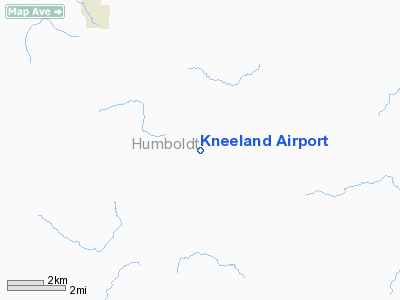
| Kneeland Airport |
| IATA: none – ICAO: none – FAA LID: O19 |
| Summary |
| Airport type |
Public |
| Operator |
Humboldt County |
| Location |
Eureka, California |
| Elevation AMSL |
2,737 ft / 834.2 m |
| Coordinates |
40°43′09″N 123°55′39″W / 40.71917°N 123.9275°W / 40.71917; -123.9275Coordinates: 40°43′09″N 123°55′39″W / 40.71917°N 123.9275°W / 40.71917; -123.9275 |
| Runways |
| Direction |
Length |
Surface |
| ft |
m |
| 15/33 |
2,270 |
692 |
Asphalt |
Kneeland Airport (FAA LID: O19) is a public airport operated by Humboldt County and located 10 miles (16 km) southeast of the central business district (CBD) of Eureka, USA. The airport is co-located with a California Dept. of Forestry (CDF) Helitack Station. Located on a mountain ridge line at over 2,700 ft. above sea level, this key airfield is mostly used by general aviation aircraft, which sometimes seek an alternate airport when nearby low lying airports (i.e. Eureka, Arcata and Fortuna) are obscured or closed by recurrent dense coastal fog. Facilities
Kneeland Airport covers 14 acres (57,000 m) and has one runway:
- Runway 15/33: 2,270 x 50 ft (692 x 15 m), Surface: Asphalt
Other local airports
- Arcata-Eureka Airport
- Eureka Municipal Airport (California)
- Murray Field - located in Eureka
The above content comes from Wikipedia and is published under free licenses – click here to read more.
Location
& QuickFacts
|
FAA
Information Effective: |
2006-09-28 |
|
Airport
Identifier: |
O19 |
|
Longitude/Latitude: |
123-55-39.1910W/40-43-09.4800N
-123.927553/40.719300 (Estimated) |
|
Elevation: |
2737 ft / 834.24 m (Surveyed) |
|
Land: |
14 acres |
|
From
nearest city: |
10 nautical miles SE of Eureka, CA |
|
Location: |
Humboldt County, CA |
|
Magnetic Variation: |
17E (1985) |
Owner
& Manager
|
Ownership: |
Publicly owned |
|
Owner: |
Humboldt County |
|
Address: |
961021
Eureka, CA 95501 |
|
Phone number: |
707-839-5401 |
|
Manager: |
Jacquelyn Hulsey |
|
Address: |
3561 Boeing Ave.
Mckinleyville, CA 95519 |
|
Phone number: |
707-839-5401 |
Airport
Operations and Facilities
|
Airport
Use: |
Open to public |
|
Wind
indicator: |
Yes |
|
Segmented
Circle: |
No |
|
Control
Tower: |
No |
|
Attendance
Schedule: |
UNATNDD |
|
Landing
fee charge: |
No |
|
Sectional
chart: |
Klamath Falls |
|
Region: |
AWP - Western-Pacific |
|
Traffic
Pattern Alt: |
800 ft |
|
Boundary
ARTCC: |
ZSE - Seattle |
|
Tie-in
FSS: |
OAK - Oakland |
|
FSS
on Airport: |
No |
|
FSS
Phone: |
510-273-6111 |
|
FSS
Toll Free: |
1-800-WX-BRIEF |
|
NOTAMs
Facility: |
OAK (NOTAM-d service avaliable) |
|
Federal Agreements: |
N |
Airport
Communications
Airport
Services
|
Airframe
Repair: |
NONE |
|
Power
Plant Repair: |
NONE |
|
Bottled
Oxygen: |
NONE |
|
Bulk
Oxygen: |
NONE |
|
Runway Information
Runway 15/33
|
Dimension: |
2270 x 50 ft / 691.9 x 15.2 m |
|
Surface: |
ASPH, Poor Condition
UNDULATING SFC ON NW END. |
|
Weight
Limit: |
Single wheel: 13000 lbs. |
|
|
Runway 15 |
Runway 33 |
|
Traffic
Pattern: |
Left |
Left |
|
Markings: |
Nonstandard, Fair Condition
/33 NON-STD DSPLCD THR MARKINGS; YELLOW DIAMONDS PAINTED UNDER
CNTRLN. |
Nonstandard, Fair Condition |
|
Displaced
threshold: |
60.00 ft |
40.00 ft |
|
Runway
End Identifier: |
No |
No |
|
Centerline
Lights: |
No |
No |
|
Touchdown
Lights: |
No |
No |
|
Obstruction: |
8 ft trees, 230.0 ft from runway, 70 ft right
of centerline, 3:1 slope to clear
APCH RATIO 28:1 TO DSPLCD THLD. |
79 ft trees, 2500.0 ft from runway, 200 ft
right of centerline, 29:1 slope to clear
APCH RATIO 32:1 TO DSPLCD THR. |
|
Radio Navigation
Aids
|
ID |
Type |
Name |
Ch |
Freq |
Var |
Dist |
|
ACV |
VOR/DME |
Arcata |
039X |
110.20 |
17E |
17.8 nm |
|
FOT |
VORTAC |
Fortuna |
087X |
114.00 |
19E |
14.3 nm |
Remarks
- CA
DEPT OF FORESTRY HELIPORT ADJACENT TO ARPT ON WEST SIDE.
- DAY
USE ONLY; CLSD NGTS.
- 500
FT DROP OFF 25 FT FM RY 15 THR; 40 FT DROP OFF 40 FT FM RY 33 THR.
Based Aircraft
|
Aircraft
based on field: |
1 |
|
Helicopters: |
1 |
Operational Statistics
|
Aircraft
Operations: |
193/Week |
|
General
Aviation Local: |
10.0% |
|
General
Aviation Itinerant: |
90.0% |
Kneeland Airport
Address:
Humboldt County, CA
Tel:
707-839-5401
Images
and information placed above are from
http://www.airport-data.com/airport/O19/
We
thank them for the data!
| General
Info |
| Country |
United
States |
| State |
CALIFORNIA
|
| FAA ID |
O19
|
| Latitude |
40-43-09.480N
|
| Longitude |
123-55-39.191W
|
| Elevation |
2737 feet
|
| Near City |
EUREKA
|
We don't guarantee the information is fresh and accurate. The data may
be wrong or outdated.
For more up-to-date information please refer to other sources.
|
|


