 |
|
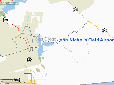
John Nichol's Field Airport |
Location
& QuickFacts
|
FAA
Information Effective: |
2006-09-28 |
|
Airport
Identifier: |
0CL3 |
|
Longitude/Latitude: |
116-53-35.0810W/32-37-59.2030N
-116.893078/32.633112 (Estimated) |
|
Elevation: |
490 ft / 149.35 m (Estimated) |
|
Land: |
75 acres |
|
From
nearest city: |
10 nautical miles E of Chula Vista, CA |
|
Location: |
San Diego County, CA |
|
Magnetic Variation: |
13E (1985) |
Owner
& Manager
|
Ownership: |
Privately owned |
|
Owner: |
San Diego Air Sports Center |
|
Address: |
13531 Otay Lakes Road
Jamul, CA 92035 |
|
Phone
number: |
619-421-0968 |
|
Manager: |
Olen D. Mumma, Pres. |
|
Address: |
7987 Calico St
San Diego, CA 92035 |
|
Phone number: |
619-421-0968 |
Airport
Operations and Facilities
|
Airport
Use: |
Private |
|
Segmented
Circle: |
Yes |
|
Control
Tower: |
No |
|
Attendance
Schedule: |
ALL/TUE-SUN/0800-SS |
|
Sectional
chart: |
Los Angeles |
|
Region: |
AWP - Western-Pacific |
|
Boundary
ARTCC: |
ZLA - Los Angeles |
|
Tie-in
FSS: |
SAN - San Diego |
|
FSS
Phone: |
858-277-7043 |
|
FSS
Toll Free: |
1-800-WX-BRIEF |
|
Runway Information
Runway 05/23
|
Dimension: |
1800 x 50 ft / 548.6 x 15.2 m |
|
Surface: |
DIRT, |
|
|
Runway 05 |
Runway 23 |
|
Traffic
Pattern: |
Left |
Left |
|
Runway 09/27
|
Dimension: |
2400 x 50 ft / 731.5 x 15.2 m |
|
Surface: |
DIRT, |
|
|
Runway 09 |
Runway 27 |
|
Traffic
Pattern: |
Left |
Left |
|
Radio Navigation
Aids
|
ID |
Type |
Name |
Ch |
Freq |
Var |
Dist |
|
SAN |
FAN MARKER |
Encat |
|
|
15E |
11.0 nm |
|
UN |
NDB |
Tijuana |
|
381.00 |
14E |
9.3 nm |
|
NRS |
TACAN |
Imperial Beach |
029X |
|
14E |
11.7 nm |
|
NZY |
TACAN |
North Island |
117X |
|
14E |
16.9 nm |
|
NKX |
TACAN |
Miramar |
033X |
|
15E |
19.4 nm |
|
NFG |
TACAN |
Camp Pendleton |
055X |
|
13E |
45.9 nm |
|
NKX |
UHF/NDB |
Miramar |
|
352.00 |
15E |
19.2 nm |
|
TIJ |
VOR/DME |
Tijuana |
112X |
116.50 |
14E |
6.4 nm |
|
PGY |
VORTAC |
Poggi |
035X |
109.80 |
14E |
4.6 nm |
|
MZB |
VORTAC |
Mission Bay |
125X |
117.80 |
15E |
19.0 nm |
|
JLI |
VORTAC |
Julian |
087X |
114.00 |
15E |
34.2 nm |
|
OCN |
VORTAC |
Oceanside |
100X |
115.30 |
15E |
45.1 nm |
|
SEE |
VOT |
Gillespie Field |
|
110.00 |
|
12.3 nm |
|
SAN |
VOT |
Mount Soledad |
|
109.00 |
|
22.0 nm |
Remarks
- SEE
AIRSPACE LETTER DATED 11/30/84.
Based Aircraft
|
Aircraft
based on field: |
24 |
|
Single
Engine Airplanes: |
3 |
|
Gliders: |
1 |
|
Ultralights: |
20 |
John Nichol's Field Airport
Address:
San Diego County, CA
Tel:
619-421-0968
Images
and information placed above are from
http://www.airport-data.com/airport/0CL3/
We
thank them for the data!
| General
Info |
| Country |
United
States |
| State |
CALIFORNIA
|
| FAA ID |
0CL3
|
| Latitude |
32-37-59.203N
|
| Longitude |
116-53-35.081W
|
| Elevation |
490 feet
|
| Near City |
CHULA
VISTA |
We don't guarantee the information is fresh and accurate. The data may
be wrong or outdated.
For more up-to-date information please refer to other sources.
|
|


