 |
|
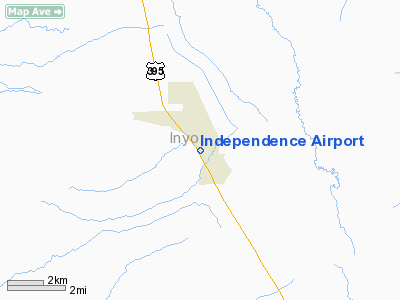
| Independence Airport |
| IATA: none – ICAO: none – FAA LID: 2O7 |
| Summary |
| Airport type |
Public |
| Location |
Independence, California |
| Elevation AMSL |
3,900 ft / 1,189 m |
| Coordinates |
36°48′49.756″N 118°12′18.344″W / 36.81382111°N 118.20509556°W / 36.81382111; -118.20509556Coordinates: 36°48′49.756″N 118°12′18.344″W / 36.81382111°N 118.20509556°W / 36.81382111; -118.20509556 |
| Runways |
| Direction |
Length |
Surface |
| ft |
m |
| 14/32 |
3,722 |
1,134 |
Asphalt |
| 5/23 |
1,610 |
30 |
Dirt |
Independence Airport (FAA LID: 2O7) is a public airport located one mile (1.6 km) north of Independence, serving Inyo County, California, USA. The airport has two runways and is mostly used for general aviation.
Facilities
Independence Airport has two runways:
- Runway 14/32: 3,722 x 60 ft (1,134 x 18 m). Surface: Asphalt
- Runway 5/23: 1,610 x 30 ft (491 x 9 m). Surface: Dirt
The above content comes from Wikipedia and is published under free licenses – click here to read more.
Location
& QuickFacts
|
FAA
Information Effective: |
2006-09-28 |
|
Airport
Identifier: |
2O7 |
|
Longitude/Latitude: |
118-12-18.3440W/36-48-49.7560N
-118.205096/36.813821 (Estimated) |
|
Elevation: |
3900 ft / 1188.72 m (Estimated) |
|
Land: |
20 acres |
|
From
nearest city: |
1 nautical miles N of Independence, CA |
|
Location: |
Inyo County, CA |
|
Magnetic Variation: |
15E (1985) |
Owner
& Manager
|
Ownership: |
Publicly owned |
|
Owner: |
City Of Los Angeles
LEASED & MAINTAINED BY INYO COUNTY. |
|
Address: |
|
|
Manager: |
Steven Ivey
DIRECTOR OF PUBLIC WORKS INYO COUNTY. |
|
Address: |
P.o. Drawer Q
Independence, CA 93526 |
|
Phone number: |
760-878-0201 |
Airport
Operations and Facilities
|
Airport
Use: |
Open to public |
|
Wind
indicator: |
Yes |
|
Segmented
Circle: |
Yes
TFC PAT INDICATORS FOR RWY 14/32 ONLY. |
|
Control
Tower: |
No |
|
Attendance
Schedule: |
UNATNDD |
|
Lighting
Schedule: |
RDO-CTL
ACTVT MIRL RY 14/32 - CTAF. |
|
Landing
fee charge: |
No |
|
Sectional
chart: |
San Francisco |
|
Region: |
AWP - Western-Pacific |
|
Traffic
Pattern Alt: |
800 ft |
|
Boundary
ARTCC: |
ZLA - Los Angeles |
|
Tie-in
FSS: |
RAL - Riverside |
|
FSS
on Airport: |
No |
|
FSS
Phone: |
951-351-3020 |
|
FSS
Toll Free: |
1-800-WX-BRIEF |
|
NOTAMs
Facility: |
RAL (NOTAM-d service avaliable) |
|
Federal Agreements: |
N |
Airport
Communications
Airport
Services
|
Airframe
Repair: |
NONE |
|
Power
Plant Repair: |
NONE |
|
Bottled
Oxygen: |
NONE |
|
Bulk
Oxygen: |
NONE |
|
Runway Information
Runway 05/23
|
Dimension: |
1610 x 30 ft / 490.7 x 9.1 m |
|
Surface: |
DIRT, Fair Condition |
|
|
Runway 05 |
Runway 23 |
|
Traffic
Pattern: |
Left |
Left |
|
Markings: |
Nonstandard, Poor Condition
& RY 23 MARKED WITH AN R ON EACH END; NO NUMBERS OR CNTRLN
MARKINGS; MARKINGS FADED. |
Nonstandard, Poor Condition |
|
Runway
End Identifier: |
No |
No |
|
Centerline
Lights: |
No |
No |
|
Touchdown
Lights: |
No |
No |
|
Obstruction: |
15 ft road, 210.0 ft from runway, 14:1 slope
to clear |
6 ft fence, 150.0 ft from runway, 140 ft right
of centerline, 25:1 slope to clear |
|
Runway 14/32
|
Dimension: |
3722 x 60 ft / 1134.5 x 18.3 m |
|
Surface: |
ASPH, Good Condition |
|
Weight
Limit: |
Single wheel: 20000 lbs. |
|
Edge
Lights: |
Medium |
|
|
Runway 14 |
Runway 32 |
|
Traffic
Pattern: |
Left |
Right |
|
Markings: |
Basic, Good Condition |
Basic, Good Condition |
|
Runway
End Identifier: |
No |
No |
|
Centerline
Lights: |
No |
No |
|
Touchdown
Lights: |
No |
No |
|
Obstruction: |
6 ft fence, 325.0 ft from runway, 20:1 slope
to clear |
30 ft trees, 855.0 ft from runway, 21:1 slope
to clear |
|
Radio Navigation
Aids
|
ID |
Type |
Name |
Ch |
Freq |
Var |
Dist |
|
BIH |
VOR/DME |
Bishop |
033X |
109.60 |
15E |
34.7 nm |
Remarks
Based Aircraft
|
Aircraft
based on field: |
3 |
|
Single
Engine Airplanes: |
2 |
|
Helicopters: |
1 |
Operational Statistics
|
Aircraft
Operations: |
58/Week |
|
General
Aviation Local: |
33.3% |
|
General
Aviation Itinerant: |
66.7% |
Independence Airport
Address:
Inyo County, CA
Tel:
760-878-0201
Images
and information placed above are from
http://www.airport-data.com/airport/2O7/
We
thank them for the data!
| General
Info |
| Country |
United
States |
| State |
CALIFORNIA
|
| FAA ID |
2O7
|
| Latitude |
36-48-49.756N
|
| Longitude |
118-12-18.344W
|
| Elevation |
3900 feet
|
| Near City |
INDEPENDENCE
|
We don't guarantee the information is fresh and accurate. The data may
be wrong or outdated.
For more up-to-date information please refer to other sources.
|
|


