 |
|
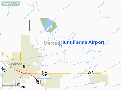
Location
& QuickFacts
|
FAA
Information Effective: |
2006-09-28 |
|
Airport
Identifier: |
15CL |
|
Longitude/Latitude: |
120-24-12.6750W/37-20-33.7850N
-120.403521/37.342718 (Estimated) |
|
Elevation: |
223 ft / 67.97 m (Estimated) |
|
Land: |
0 acres |
|
From
nearest city: |
4 nautical miles NE of Merced, CA |
|
Location: |
Merced County, CA |
|
Magnetic Variation: |
15E (1985) |
Owner
& Manager
|
Ownership: |
Privately owned |
|
Owner: |
L. W. Hunt |
|
Address: |
3758 N. Lake Road
Merced, CA 95340 |
|
Manager: |
James K. Hunt |
|
Address: |
3758 N Lake Road
Merced, CA 95340 |
|
Phone number: |
209-383-2662 |
Airport
Operations and Facilities
|
Airport Use: |
Private |
|
Wind indicator: |
No |
|
Segmented Circle: |
No |
|
Control Tower: |
No |
|
Attendance Schedule: |
UNATNDD |
|
Landing fee charge: |
No |
|
Sectional chart: |
San Francisco |
|
Region: |
AWP - Western-Pacific |
|
Boundary ARTCC: |
ZOA - Oakland |
|
Tie-in FSS: |
RIU - Rancho Murieta |
|
FSS on Airport: |
No |
|
FSS Phone: |
916-354-0161 |
|
FSS Toll Free: |
1-800-WX-BRIEF |
Airport
Services
|
Airframe
Repair: |
NONE |
|
Power
Plant Repair: |
NONE |
|
Runway Information
Runway 16/34
|
Dimension: |
2300 x 50 ft / 701.0 x 15.2 m |
|
Surface: |
DIRT, |
|
|
Runway 16 |
Runway 34 |
|
Traffic
Pattern: |
Left |
Left |
|
Obstruction: |
5 ft fence |
5 ft fence |
|
Radio Navigation
Aids
|
ID |
Type |
Name |
Ch |
Freq |
Var |
Dist |
|
FCH |
NDB |
Chandler |
|
344.00 |
15E |
46.2 nm |
|
HYP |
VOR/DME |
El Nido |
089X |
114.20 |
15E |
7.4 nm |
|
MOD |
VOR/DME |
Modesto |
093X |
114.60 |
17E |
31.5 nm |
|
CZQ |
VORTAC |
Clovis |
076X |
112.90 |
15E |
39.4 nm |
|
FRA |
VORTAC |
Friant |
103X |
115.60 |
17E |
41.2 nm |
|
PXN |
VORTAC |
Panoche |
073X |
112.60 |
16E |
41.8 nm |
|
ECA |
VORTAC |
Manteca |
107X |
116.00 |
17E |
47.0 nm |
Remarks
- FILED
FOR RECORD PURPOSES.
Hunt Farms Airport
Address:
Merced County, CA
Tel:
209-383-2662
Images
and information placed above are from
http://www.airport-data.com/airport/15CL/
We
thank them for the data!
| General
Info |
| Country |
United
States |
| State |
CALIFORNIA
|
| FAA ID |
15CL
|
| Latitude |
37-20-33.785N
|
| Longitude |
120-24-12.675W
|
| Elevation |
223 feet
|
| Near City |
MERCED
|
We don't guarantee the information is fresh and accurate. The data may
be wrong or outdated.
For more up-to-date information please refer to other sources.
|
|


