 |
|
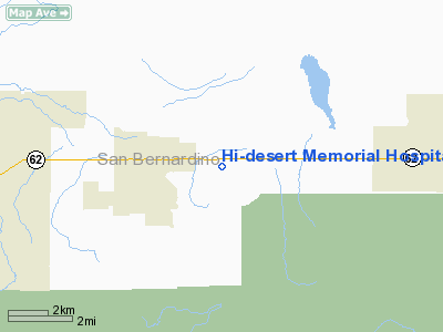
Hi-desert Memorial Hospital Heliport |
|
|
Location
& QuickFacts
|
FAA
Information Effective: |
2006-06-08 |
|
Airport
Identifier: |
9CA4 |
|
Longitude/Latitude: |
116-16-35.0360W/34-07-54.0200N
-116.276399/34.131672 (Estimated) |
|
Elevation: |
2652 ft / 808.33 m (Estimated) |
|
Land: |
0 acres |
|
From
nearest city: |
2 nautical miles W of Joshua Tree, CA |
|
Location: |
San Bernardino County, CA |
|
Magnetic Variation: |
14E (1985) |
Owner
& Manager
|
Ownership: |
Privately owned |
|
Owner: |
Hi-desert Meml Hospital Dist. |
|
Address: |
6601 Whitefeather Rd
Joshua Tree, CA 92252 |
|
Phone
number: |
619-366-3711 |
|
Manager: |
Joann O'boyle |
|
Address: |
6601 Whitefeather Rd
Joshua Tree, CA 92252 |
|
Phone number: |
619-366-3711 |
Airport
Operations and Facilities
|
Airport
Use: |
Private
MEDICAL. |
|
Wind
indicator: |
Yes |
|
Segmented
Circle: |
No |
|
Control
Tower: |
No |
|
Attendance
Schedule: |
UNATNDD |
|
Landing
fee charge: |
No |
|
Sectional
chart: |
Los Angeles |
|
Region: |
AWP - Western-Pacific |
|
Boundary
ARTCC: |
ZLA - Los Angeles |
|
Tie-in
FSS: |
RAL - Riverside |
|
FSS
on Airport: |
No |
|
FSS
Phone: |
951-351-3020 |
|
FSS
Toll Free: |
1-800-WX-BRIEF |
|
Runway Information
Helipad H1
|
Dimension: |
40 x 40 ft / 12.2 x 12.2 m |
|
Surface: |
ASPH, |
|
|
Runway H1 |
Runway |
|
Traffic
Pattern: |
Left |
Left |
|
Radio Navigation
Aids
|
ID |
Type |
Name |
Ch |
Freq |
Var |
Dist |
|
SJY |
NDB |
San Jacinto |
|
227.00 |
14E |
41.3 nm |
|
NXP |
TACAN |
Coyote |
063X |
|
14E |
11.5 nm |
|
PSP |
VORTAC |
Palm Springs |
102X |
115.50 |
13E |
17.5 nm |
|
TNP |
VORTAC |
Twentynine Palms |
089X |
114.20 |
15E |
25.2 nm |
|
TRM |
VORTAC |
Thermal |
109X |
116.20 |
13E |
30.8 nm |
|
HEC |
VORTAC |
Hector |
074X |
112.70 |
15E |
41.0 nm |
Hi-desert Memorial Hospital Heliport
Address:
San Bernardino County, CA
Tel:
619-366-3711
Images
and information placed above are from
http://www.airport-data.com/airport/9CA4/
We
thank them for the data!
| General
Info |
| Country |
United
States |
| State |
CALIFORNIA
|
| FAA ID |
9CA4
|
| Latitude |
34-07-54.020N
|
| Longitude |
116-16-35.036W
|
| Elevation |
2652 feet
|
| Near City |
JOSHUA
TREE |
We don't guarantee the information is fresh and accurate. The data may
be wrong or outdated.
For more up-to-date information please refer to other sources.
|
|


