 |
|
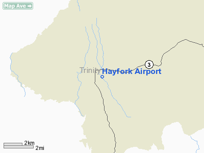
| Hayfork Airport |
| IATA: none – ICAO: none – FAA LID: F62 |
| Summary |
| Airport type |
Public |
| Operator |
County of Trinity |
| Location |
Hayfork, California |
| Elevation AMSL |
2,321 ft / 707.4 m |
| Coordinates |
40°32′50″N 123°10′54″W / 40.54722°N 123.18167°W / 40.54722; -123.18167Coordinates: 40°32′50″N 123°10′54″W / 40.54722°N 123.18167°W / 40.54722; -123.18167 |
| Runways |
| Direction |
Length |
Surface |
| ft |
m |
| 7/25 |
4,115 |
1,254 |
Asphalt |
Hayfork Airport (FAA LID: F62), formerly Q72, is a public airport located one mile (1.6 km) south of Hayfork, serving Trinity County, California, USA. The airport is mostly used for general aviation.
Facilities
Hayfork Airport covers 162 acres (66 ha) and has one runway:
- Runway 7/25: 4,115 x 60 ft. (1,254 x 18 m), Surface: Asphalt
The above content comes from Wikipedia and is published under free licenses – click here to read more.
Location
& QuickFacts
|
FAA
Information Effective: |
2006-06-08 |
|
Airport
Identifier: |
F62 |
|
Longitude/Latitude: |
123-10-54.1030W/40-32-49.5180N
-123.181695/40.547088 (Estimated) |
|
Elevation: |
2321 ft / 707.44 m (Surveyed) |
|
Land: |
162 acres |
|
From
nearest city: |
1 nautical miles S of Hayfork, CA |
|
Location: |
Trinity County, CA |
|
Magnetic Variation: |
17E (1985) |
Owner
& Manager
|
Ownership: |
Publicly owned |
|
Owner: |
County Of Trinity |
|
Address: |
Po Box 476
Weaverville, CA 96093-0476 |
|
Phone number: |
916-623-1354 |
|
Manager: |
Steven J. Roberts |
|
Address: |
Po Box 476
Weaverville, CA 96093-0476 |
|
Phone number: |
916-623-9585 |
Airport
Operations and Facilities
|
Airport
Use: |
Open to public |
|
Wind
indicator: |
Yes |
|
Segmented
Circle: |
Yes |
|
Control
Tower: |
No |
|
Attendance
Schedule: |
ALL/ALL/0800-1700 |
|
Lighting
Schedule: |
DUSK-DAWN
ACTVT MIRL RY 07/25 - CTAF. |
|
Beacon
Color: |
Clear-Green (lighted land airport) |
|
Landing
fee charge: |
No |
|
Sectional
chart: |
Klamath Falls |
|
Region: |
AWP - Western-Pacific |
|
Traffic
Pattern Alt: |
1000 ft |
|
Boundary
ARTCC: |
ZOA - Oakland |
|
Tie-in
FSS: |
RIU - Rancho Murieta |
|
FSS
on Airport: |
No |
|
FSS
Phone: |
916-354-0161 |
|
FSS
Toll Free: |
1-800-WX-BRIEF |
|
NOTAMs
Facility: |
RIU (NOTAM-d service avaliable) |
|
Federal Agreements: |
NGY |
Airport
Communications
|
CTAF: |
122.800 |
|
Unicom: |
122.800 |
Airport
Services
|
Airframe
Repair: |
MINOR |
|
Power
Plant Repair: |
MINOR |
|
Bottled
Oxygen: |
NONE |
|
Bulk
Oxygen: |
NONE |
|
Runway Information
Runway 07/25
|
Dimension: |
4115 x 60 ft / 1254.3 x 18.3 m |
|
Surface: |
ASPH, Good Condition |
|
Weight
Limit: |
Single wheel: 12500 lbs. |
|
Edge
Lights: |
Medium |
|
|
Runway 07 |
Runway 25 |
|
Traffic
Pattern: |
Left |
Right |
|
Markings: |
Basic, Good Condition |
Basic, Good Condition |
|
Runway
End Identifier: |
No |
No |
|
Obstruction: |
60 ft tree, 2240.0 ft from runway, 200 ft right
of centerline, 34:1 slope to clear |
125 ft tree, 2180.0 ft from runway, 220 ft
left of centerline, 15:1 slope to clear |
|
Radio Navigation
Aids
|
ID |
Type |
Name |
Ch |
Freq |
Var |
Dist |
|
RDD |
VOR/DME |
Redding |
021X |
108.40 |
18E |
40.7 nm |
|
ACV |
VOR/DME |
Arcata |
039X |
110.20 |
17E |
49.6 nm |
|
FOT |
VORTAC |
Fortuna |
087X |
114.00 |
19E |
48.6 nm |
Remarks
- HIGH
TERRAIN AROUND ARPT.
- ARPT
CLSD AT NIGHT.
Based Aircraft
|
Aircraft
based on field: |
16 |
|
Single
Engine Airplanes: |
15 |
|
Multi
Engine Airplanes: |
1 |
Operational Statistics
|
Aircraft
Operations: |
47/Day |
|
General
Aviation Local: |
29.4% |
|
General
Aviation Itinerant: |
70.6% |
Hayfork Airport
Address:
Trinity County, CA
Tel:
916-623-1354, 916-623-9585
Images
and information placed above are from
http://www.airport-data.com/airport/F62/
We
thank them for the data!
| General
Info |
| Country |
United
States |
| State |
CALIFORNIA
|
| FAA ID |
F62
|
| Latitude |
40.547089
40� 32' 49.52" N |
| Longitude |
-123.181694
123� 10' 54.10" W |
| Elevation |
2321 feet
707 meters |
| Magnetic
Variation |
015� E
(01/06) |
| Beacon |
Yes
|
| Operating
Agency |
U.S.CIVIL
AIRPORT WHEREIN PERMIT COVERS USE BY TRANSIT MILITARY AIRCRAFT
|
| Daylight
Savings Time |
First
Sunday in April at 0200 to last Sunday in October at 0200 local time
(Exception Arizona and that portion of Indiana in the Eastern Time
Zone) |
We don't guarantee the information is fresh and accurate. The data may
be wrong or outdated.
For more up-to-date information please refer to other sources.
|
|


