 |
|
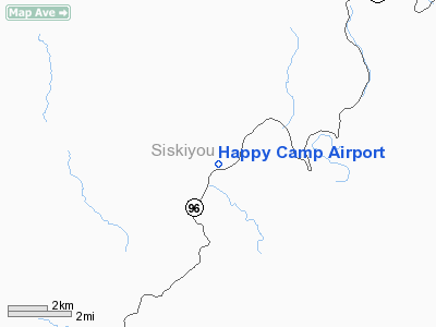
| Happy Camp Airport |
| IATA: none – ICAO: none – FAA LID: 36S |
| Summary |
| Airport type |
Public |
| Operator |
Siskiyou County |
| Location |
Happy Camp, California |
| Elevation AMSL |
1,209 ft / 369 m |
| Coordinates |
41°47′26.446″N 123°23′20.200″W / 41.79067944°N 123.388944°W / 41.79067944; -123.388944Coordinates: 41°47′26.446″N 123°23′20.200″W / 41.79067944°N 123.388944°W / 41.79067944; -123.388944 |
| Runways |
| Direction |
Length |
Surface |
| ft |
m |
| 4/22 |
3,000 |
914 |
Asphalt |
Happy Camp Airport (FAA LID: 36S) is a public airport located in the city of Happy Camp, serving Siskiyou County, California, USA. The airport has one runway and is mostly used for general aviation.
Facilities
Happy Camp Airport has one runway:
- Runway 4/22: 3,000 x 50 ft (914 x 15 m). Surface: Asphalt
The above content comes from Wikipedia and is published under free licenses – click here to read more.
Location
& QuickFacts
|
FAA
Information Effective: |
2006-06-08 |
|
Airport
Identifier: |
36S |
|
Longitude/Latitude: |
123-23-20.2000W/41-47-26.4460N
-123.388944/41.790679 (Estimated) |
|
Elevation: |
1209 ft / 368.50 m (Surveyed) |
|
Land: |
64 acres |
|
From
nearest city: |
0 nautical miles SW of Happy Camp, CA |
|
Location: |
Siskiyou County, CA |
|
Magnetic Variation: |
18E (1985) |
Owner
& Manager
|
Ownership: |
Publicly owned |
|
Owner: |
U S Dept Of Agri. Forest Serv
OPERD/MAINTD UNDER A SPECIAL USE PERMIT BY THE COUNTY OF
SISKIYOU. |
|
Address: |
|
|
Phone
number: |
530-842-8295 |
|
Manager: |
Thomas L. Anderson
COUNTY AIRPORT OFFICE - YREKA |
|
Address: |
305 Butte Street
Yreka, CA 96097 |
|
Phone number: |
530-842-8295 |
Airport
Operations and Facilities
|
Airport
Use: |
Open to public |
|
Wind
indicator: |
Yes |
|
Segmented
Circle: |
Yes |
|
Control
Tower: |
No |
|
Attendance
Schedule: |
UNATNDD |
|
Landing
fee charge: |
No |
|
Sectional
chart: |
Klamath Falls |
|
Region: |
AWP - Western-Pacific |
|
Traffic
Pattern Alt: |
1000 ft |
|
Boundary
ARTCC: |
ZSE - Seattle |
|
Tie-in
FSS: |
RIU - Rancho Murieta |
|
FSS
on Airport: |
No |
|
FSS
Phone: |
916-354-0161 |
|
FSS
Toll Free: |
1-800-WX-BRIEF |
|
NOTAMs
Facility: |
RIU (NOTAM-d service avaliable) |
|
Federal Agreements: |
NGY |
Airport
Communications
Airport
Services
|
Airframe
Repair: |
NONE |
|
Power
Plant Repair: |
NONE |
|
Bottled
Oxygen: |
NONE |
|
Bulk
Oxygen: |
NONE |
|
Runway Information
Runway 04/22
|
Dimension: |
3000 x 50 ft / 914.4 x 15.2 m |
|
Surface: |
ASPH, Good Condition |
|
Weight
Limit: |
Single wheel: 30000 lbs. |
|
|
Runway 04 |
Runway 22 |
|
Traffic
Pattern: |
Right |
Left |
|
Markings: |
Basic, Fair Condition |
Basic, Fair Condition |
|
Runway
End Identifier: |
No |
No |
|
Centerline
Lights: |
No |
No |
|
Touchdown
Lights: |
No |
No |
|
Obstruction: |
95 ft tree, 810.0 ft from runway, 45 ft left
of centerline, 6:1 slope to clear
30 FT TREE 95 FT FROM 85 FT L OF RY CNTRLN. |
60 ft trees, 600.0 ft from runway, 165 ft right
of centerline, 6:1 slope to clear |
|
Helipad H1
|
Dimension: |
180 x 80 ft / 54.9 x 24.4 m |
|
Surface: |
ASPH, Good Condition |
|
|
Runway H1 |
Runway |
|
Traffic
Pattern: |
Left |
Left |
|
Radio Navigation
Aids
|
ID |
Type |
Name |
Ch |
Freq |
Var |
Dist |
|
MOG |
NDB |
Montague |
|
404.00 |
19E |
40.9 nm |
|
MEF |
NDB |
Medford |
|
356.00 |
19E |
42.7 nm |
|
FJS |
VOR/DME |
Fort Jones |
033X |
109.60 |
19E |
33.2 nm |
|
CEC |
VORTAC |
Crescent City |
027X |
109.00 |
19E |
38.2 nm |
|
OED |
VORTAC |
Rogue Valley |
083X |
113.60 |
19E |
46.5 nm |
|
MFR |
VOT |
Medford-jackson County |
|
117.20 |
|
41.3 nm |
Remarks
- RWY
22 HAS +35' TREES 600' FROM THLD 125' EITHER SIDE OF CNTRLN.
- PUBLIC
USE; VFR COND.
Operational Statistics
|
Aircraft
Operations: |
116/Week |
|
General
Aviation Local: |
8.3% |
|
General
Aviation Itinerant: |
91.7% |
Happy Camp Airport
Address:
Siskiyou County, CA
Tel:
530-842-8295
Images
and information placed above are from
http://www.airport-data.com/airport/36S/
We
thank them for the data!
| General
Info |
| Country |
United
States |
| State |
CALIFORNIA
|
| FAA ID |
36S
|
| Latitude |
41-47-26.446N
|
| Longitude |
123-23-20.200W
|
| Elevation |
1209 feet
|
| Near City |
HAPPY
CAMP |
We don't guarantee the information is fresh and accurate. The data may
be wrong or outdated.
For more up-to-date information please refer to other sources.
|
|


