 |
|
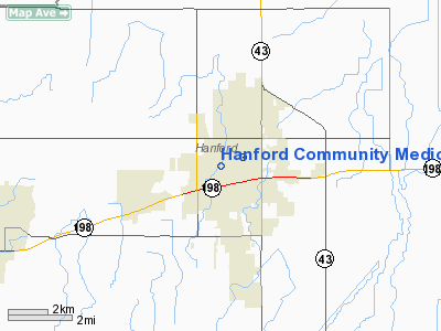
Hanford Community Medical Center Helistop Heliport |
|
|
Location
& QuickFacts
|
FAA
Information Effective: |
2006-06-08 |
|
Airport
Identifier: |
4CL8 |
|
Longitude/Latitude: |
119-39-34.4650W/36-19-47.8200N
-119.659574/36.329950 (Estimated) |
|
Elevation: |
251 ft / 76.50 m (Estimated) |
|
Land: |
10 acres |
|
From
nearest city: |
0 nautical miles N of Hanford, CA |
|
Location: |
Kings County, CA |
|
Magnetic Variation: |
15E (1990) |
Owner
& Manager
|
Ownership: |
Privately owned |
|
Owner: |
Hanford Community Medical Ctr |
|
Address: |
450 Greenfield Ave
Hanford, CA 93232 |
|
Phone number: |
209-582-9000 |
|
Manager: |
David Russell |
|
Address: |
450 Greenfield Ave
Hanford, CA 93232 |
|
Phone number: |
209-582-9000 |
Airport
Operations and Facilities
|
Airport
Use: |
Private |
|
Wind
indicator: |
Yes |
|
Segmented
Circle: |
No |
|
Control
Tower: |
No |
|
Attendance
Schedule: |
ALL/ALL/ALL |
|
Lighting
Schedule: |
PHONE REQ
FOR PERIMETER LGTS CALL 209-582-9000. |
|
Sectional
chart: |
San Francisco |
|
Region: |
AWP - Western-Pacific |
|
Boundary
ARTCC: |
ZOA - Oakland |
|
Tie-in
FSS: |
RIU - Rancho Murieta |
|
FSS
on Airport: |
No |
|
FSS
Phone: |
916-354-0161 |
|
FSS
Toll Free: |
1-800-WX-BRIEF |
|
Runway Information
Helipad H1
|
Dimension: |
55 x 55 ft / 16.8 x 16.8 m |
|
Surface: |
CONC, Good Condition |
|
|
Runway H1 |
Runway |
|
Traffic
Pattern: |
Left |
Left |
|
Radio Navigation
Aids
|
ID |
Type |
Name |
Ch |
Freq |
Var |
Dist |
|
COR |
NDB |
Salyer Farms |
|
205.00 |
16E |
16.9 nm |
|
CUK |
NDB |
Academy |
|
266.00 |
14E |
24.1 nm |
|
FCH |
NDB |
Chandler |
|
344.00 |
15E |
25.1 nm |
|
NLC |
TACAN |
Lemoore |
080X |
|
16E |
14.9 nm |
|
VIS |
VOR/DME |
Visalia |
031X |
109.40 |
16E |
8.9 nm |
|
TTE |
VOR/DME |
Tule |
029X |
109.20 |
16E |
39.9 nm |
|
CZQ |
VORTAC |
Clovis |
076X |
112.90 |
15E |
34.2 nm |
|
AVE |
VORTAC |
Avenal |
118X |
117.10 |
16E |
43.9 nm |
|
FRA |
VORTAC |
Friant |
103X |
115.60 |
17E |
46.7 nm |
Remarks
Hanford Community Medical Center Helistop
Heliport
Address:
Kings County, CA
Tel:
209-582-9000
Images
and information placed above are from
http://www.airport-data.com/airport/4CL8/
We
thank them for the data!
| General
Info |
| Country |
United
States |
| State |
CALIFORNIA
|
| FAA ID |
4CL8
|
| Latitude |
36-19-47.820N
|
| Longitude |
119-39-34.465W
|
| Elevation |
251 feet
|
| Near City |
HANFORD
|
We don't guarantee the information is fresh and accurate. The data may
be wrong or outdated.
For more up-to-date information please refer to other sources.
|
|


