 |
|
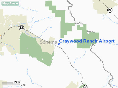
Location
& QuickFacts
|
FAA
Information Effective: |
2006-06-08 |
|
Airport
Identifier: |
CA39 |
|
Longitude/Latitude: |
122-33-48.9370W/38-26-04.6790N
-122.563594/38.434633 (Estimated) |
|
Elevation: |
450 ft / 137.16 m (Estimated) |
|
Land: |
0 acres |
|
From
nearest city: |
6 nautical miles E of Santa Rosa, CA |
|
Location: |
Sonoma County, CA |
|
Magnetic Variation: |
16E (1985) |
Owner
& Manager
|
Ownership: |
Privately owned |
|
Owner: |
L Gray |
|
Address: |
7935 Sonoma Hwy
Santa Rosa, CA 95409 |
|
Phone number: |
707-539-7935 |
|
Address: |
|
|
Phone number: |
707-523-8681 |
Airport
Operations and Facilities
|
Airport Use: |
Private |
|
Wind indicator: |
Yes |
|
Segmented Circle: |
No |
|
Control Tower: |
No |
|
Attendance Schedule: |
ALL/ALL/ALL |
|
Landing fee charge: |
No |
|
Sectional chart: |
San Francisco |
|
Region: |
AWP - Western-Pacific |
|
Boundary ARTCC: |
ZOA - Oakland |
|
Tie-in FSS: |
OAK - Oakland |
|
FSS on Airport: |
No |
|
FSS Phone: |
510-273-6111 |
|
FSS Toll Free: |
1-800-WX-BRIEF |
Airport
Services
|
Airframe
Repair: |
MINOR |
|
Power
Plant Repair: |
MINOR |
|
Runway Information
Runway E/W
|
Dimension: |
2500 x 70 ft / 762.0 x 21.3 m |
|
Surface: |
DIRT, |
|
|
Runway E |
Runway W |
|
Traffic
Pattern: |
Left |
Left |
|
Runway N/S
|
Dimension: |
1500 x 80 ft / 457.2 x 24.4 m |
|
Surface: |
DIRT, |
|
|
Runway N |
Runway S |
|
Traffic
Pattern: |
Left |
Left |
|
Radio Navigation
Aids
|
ID |
Type |
Name |
Ch |
Freq |
Var |
Dist |
|
LOP |
NDB |
Lampson |
|
217.00 |
16E |
36.9 nm |
|
SUU |
TACAN |
Travis |
113X |
|
17E |
31.3 nm |
|
TZZ |
VOR |
Travis |
|
116.40 |
17E |
35.9 nm |
|
STS |
VOR/DME |
Santa Rosa |
077X |
113.00 |
16E |
12.4 nm |
|
CCR |
VOR/DME |
Concord |
117X |
117.00 |
17E |
33.9 nm |
|
SFO |
VOR/DME |
San Francisco |
105X |
115.80 |
17E |
49.8 nm |
|
SGD |
VORTAC |
Scaggs Island |
058X |
112.10 |
17E |
17.8 nm |
|
PYE |
VORTAC |
Point Reyes |
084X |
113.70 |
17E |
25.7 nm |
|
SAU |
VORTAC |
Sausalito |
109X |
116.20 |
17E |
34.9 nm |
|
OAK |
VORTAC |
Oakland |
115X |
116.80 |
17E |
45.5 nm |
|
ILA |
VORTAC |
Williams |
091X |
114.40 |
18E |
45.8 nm |
|
SAC |
VORTAC |
Sacramento |
099X |
115.20 |
17E |
47.6 nm |
|
ENI |
VORTAC |
Mendocino |
070X |
112.30 |
16E |
49.9 nm |
|
SMF |
VOT |
Sacramento Metropolitan |
|
111.40 |
|
48.2 nm |
|
SFO |
VOT |
San Francisco Intl |
|
111.00 |
|
49.8 nm |
Remarks
- RWY
HAS X'S ON EACH END.
- FIRST
REPORTED 3/28/64-13 MI SE SONOMA CO ARPT.
Based Aircraft
|
Aircraft
based on field: |
1 |
|
Multi
Engine Airplanes: |
1 |
Graywood Ranch Airport
Address:
Sonoma County, CA
Tel:
707-539-7935, 707-523-8681
Images
and information placed above are from
http://www.airport-data.com/airport/CA39/
We
thank them for the data!
| General
Info |
| Country |
United
States |
| State |
CALIFORNIA
|
| FAA ID |
CA39
|
| Latitude |
38-26-04.679N
|
| Longitude |
122-33-48.937W
|
| Elevation |
450 feet
|
| Near City |
SANTA
ROSA |
We don't guarantee the information is fresh and accurate. The data may
be wrong or outdated.
For more up-to-date information please refer to other sources.
|
|


