 |
|
|
|
|
|
Location
& QuickFacts
|
FAA
Information Effective: |
2006-06-08 |
|
Airport
Identifier: |
1Q5 |
|
Longitude/Latitude: |
122-57-19.0040W/39-26-59.5740N]
-122.955279/39.449882 (Estimated) |
|
Elevation: |
1900 ft / 579.12 m (Estimated) |
|
Land: |
50 acres |
|
From
nearest city: |
17 nautical miles N of Upper Lake, CA |
|
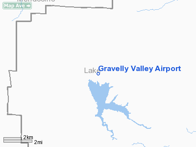
Location: |
Lake County, CA |
|
Magnetic Variation: |
17E (1985) |
Owner
& Manager
|
Ownership: |
Publicly owned |
|
Owner: |
U S Forest Service |
|
Address: |
10025 Elk Mtn Road
Upper Lake, CA 95485 |
|
Phone
number: |
707-275-2361 |
|
Manager: |
Blaine P. Baker
DISTRICT RANGER. |
|
Address: |
10025 Elk Mtn Road
Upper Lake, CA 95485 |
|
Phone
number: |
707-275-1401
UPPER LAKE RANGER DISTRICT, UPPER LAKE. |
Airport
Operations and Facilities
|
Airport
Use: |
Open to public |
|
Wind
indicator: |
Yes |
|
Segmented
Circle: |
Yes |
|
Control
Tower: |
No |
|
Attendance
Schedule: |
UNATNDD |
|
Landing
fee charge: |
No |
|
Sectional
chart: |
San Francisco |
|
Region: |
AWP - Western-Pacific |
|
Traffic
Pattern Alt: |
800 ft |
|
Boundary
ARTCC: |
ZOA - Oakland |
|
Tie-in
FSS: |
OAK - Oakland |
|
FSS
on Airport: |
No |
|
FSS
Phone: |
510-273-6111 |
|
FSS
Toll Free: |
1-800-WX-BRIEF |
|
NOTAMs
Facility: |
OAK (NOTAM-d service avaliable) |
Airport
Communications
Airport
Services
|
Airframe
Repair: |
NONE |
|
Power
Plant Repair: |
NONE |
|
Bottled
Oxygen: |
NONE |
|
Bulk
Oxygen: |
NONE |
|
Runway Information
Runway 01/19
|
Dimension: |
4050
x 200 ft / 1234.4 x 61.0 m
300' STOPWAY AT SOUTH END OF RWY.
BTWN
PARALLEL DIRT ROADS. |
|
Surface: |
GRAVEL, Good Condition |
|
Weight
Limit: |
Single wheel: 12500 lbs. |
|
|
Runway 01 |
Runway 19 |
|
Traffic
Pattern: |
Left |
Left |
|
Runway
End Identifier: |
No |
No |
|
Centerline
Lights: |
No |
No |
|
Touchdown
Lights: |
No |
No |
|
Obstruction: |
36 ft trees, 600.0 ft from runway, 125 ft right
of centerline, 16:1 slope to clear |
800 ft hill, 800.0 ft from runway, 1:1 slope
to clear |
|
Radio Navigation
Aids
|
ID |
Type |
Name |
Ch |
Freq |
Var |
Dist |
|
LOP |
NDB |
Lampson |
|
217.00 |
16E |
27.5 nm |
|
ENI |
VORTAC |
Mendocino |
070X |
112.30 |
16E |
28.1 nm |
|
MXW |
VORTAC |
Maxwell |
037X |
110.00 |
18E |
35.0 nm |
|
ILA |
VORTAC |
Williams |
091X |
114.40 |
18E |
48.8 nm |
Remarks
- NO
LNDG ON RY 19 DUE TO HILL NE OF ARPT.
- CAUTION:
HANG GLIDER OPERATION PARTICULARLY SUMMER MONTHS.
- CAUTION:
DO NOT LAND SOUTH OF HULL MOUNTAIN ROAD.
- NO
TKOF ON RY 01 DUE TO HILL NE OF ARPT.
- TALL
TREES ON BOTH SIDES OF RUNWAY.
- RY
01/19 NOT REGULARLY MAINTAINED, RUNWAY MAY BE ROUGH, UNEVEN AND RUTTED
- E111:
PREDATES 1958 FA ACT.
Operational Statistics
|
Aircraft
Operations: |
20/Week |
|
General
Aviation Itinerant: |
100.0% |
Gravelly Valley Airport
Address:
Lake County, CA
Tel:
707-275-2361,
707-275-1401
Images
and information placed above are from
http://www.airport-data.com/airport/1Q5/
We
thank them for the data!
| General
Info |
| Country |
United
States |
| State |
CALIFORNIA
|
| FAA ID |
1Q5
|
| Latitude |
39-26-59.574N
|
| Longitude |
122-57-19.004W
|
| Elevation |
1900 feet
|
| Near City |
UPPER
LAKE |
We don't guarantee the information is fresh and accurate. The data may
be wrong or outdated.
For more up-to-date information please refer to other sources.
|
|


