|
|
Coordinates: 32°49′34″N 116°58′21″W / 32.82611°N 116.9725°W / 32.82611; -116.9725
| Gillespie Field |
 |
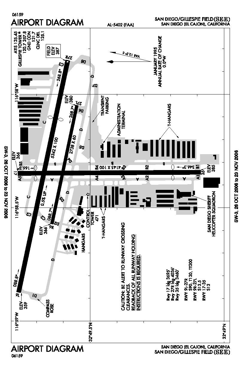
| FAA airport diagram |
| IATA: SEE – ICAO: KSEE – FAA LID: SEE |
| Summary |
| Airport type |
Public |
| Owner |
County of San Diego |
| Serves |
San Diego, California |
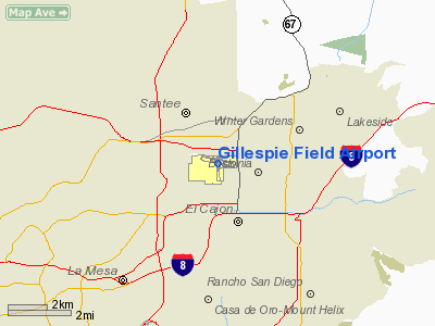
| Location |
El Cajon, California |
| Elevation AMSL |
388 ft / 118 m |
| Website |
co.san-diego.ca.us/dpw/... |
| Runways |
| Direction |
Length |
Surface |
| ft |
m |
| 9L/27R |
5,342 |
1,628 |
Asphalt |
| 9R/27L |
2,738 |
835 |
Asphalt |
| 17/35 |
4,145 |
1,263 |
Asphalt |
| Statistics (2005) |
| Aircraft operations |
244,475 |
| Based aircraft |
739 |
| Source: Federal Aviation Administration |
Gillespie Field (IATA: SEE, ICAO: KSEE, FAA LID: SEE) is a county-owned public-use airport located 10 miles (16 km) northeast of the central business district of San Diego, in El Cajon, San Diego County, California, United States. History
- Section reference dates.
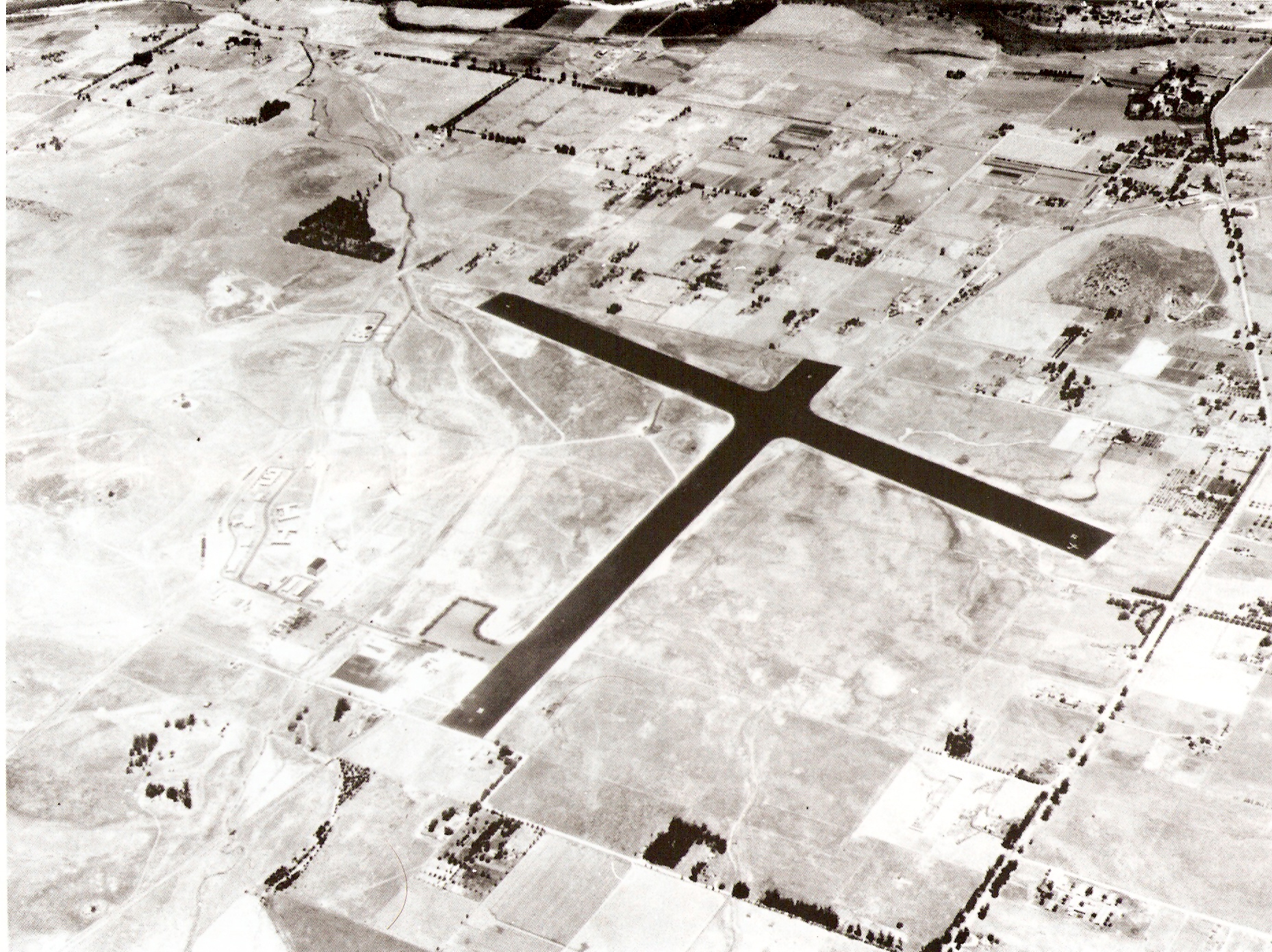
In 1942 the United States Marine Corps chose a 688-acre (2.78 km) site east of San Diego to conduct parachute training for the newly forming Parachute battalions. In September 1942 Camp Gillespie was completed and named in honor of Lieutenant Archibald H. Gillespie, a Marine officer who played a prominent role in the effort to separate California from Mexico in the 1840s.
In February 1944, the camp was commissioned as Marine Corps Auxiliary Airfield Gillespie falling under the command of Marine Corps Air Station El Toro. MCAAF Gillespie soon became responsible for Camp Pendleton Outlying Air Field. Among the units that transited and trained at MCCAF Gillespie were VMSB-141, Air Warning Squadron 10 and the Navy's VT-37.
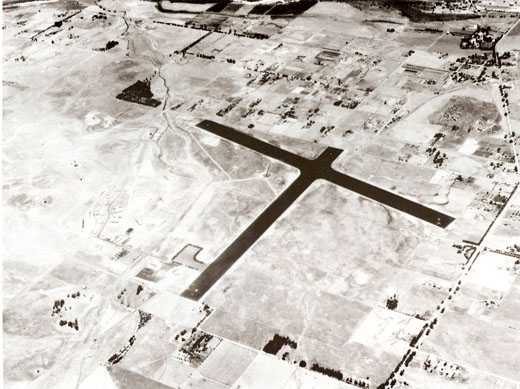 | |
Overhead view of MCAAF Gillespie in June 1944. |
In 1946, the airfield was turned over to San Diego County and was turned into a general aviation facility. In 1952, the County granted ownership of the facility by the federal government. In 1971, the County Sheriff stationed ASTREA, a helicopter law enforcement base at the airport. And in 1993, the San Diego Aerospace Museum located its restoration operations and a special exhibit at the field. Facilities and aircraft
Gillespie Field covers an area of 852 acres (345 ha) which contains three asphalt paved runways:
- Runway 9L/27R: 5,342 x 100 ft (1,628 x 30 m)
- Runway 9R/27L: 2,738 x 60 ft (835 x 18 m)
- Runway 17/35: 4,145 x 100 ft (1,263 x 30 m)
For the 12-month period ending December 31, 2005, the airport had 244,475 aircraft operations, an average of 669 per day: 99.9% general aviation, <1% air taxi and <1% military. There are 739 aircraft based at this airport: 90% single-engine, 4% multi-engine, 4% helicopter, 1% jet and 1% glider.
Museum
Gillespie is also the home of the restoration facility Gillispie Field Annex for the San Diego Air and Space Museum(formerly San Diego Aerospace Museum). It is open to the public and has on display many vintage and modern aircraft; and has an Atlas ICBM rocket as it's gate guard, replica of the Spirit of St. Louis, and a recently restored F-102A Delta Dagger with drop tanks.
The above content comes from Wikipedia and is published under free licenses – click here to read more.
Location
& QuickFacts
|
FAA
Information Effective: |
2006-06-08 |
|
Airport
Identifier: |
SEE |
|
Longitude/Latitude: |
116-58-20.8000W/32-49-34.4000N
-116.972444/32.826222 (Estimated) |
|
Elevation: |
388 ft / 118.26 m (Surveyed) |
|
Land: |
852 acres |
|
From
nearest city: |
10 nautical miles NE of San Diego/el Cajon,
CA |
|
Location: |
San Diego County, CA |
|
Magnetic Variation: |
13E (1985) |
Owner
& Manager
|
Ownership: |
Publicly owned |
|
Owner: |
County Of San Diego |
|
Address: |
Dept Public Works-airports, 1960 Joe Crosson
Dr
El Cajon, CA 92020-1236 |
|
Phone
number: |
619-956-4800 |
|
Manager: |
Roger Griffiths
MARC BASKEL, ARPT OPNS, 619-956-4810 |
|
Address: |
Gillespie Field Airport, 1960 Joe Crosson
Dr
El Cajon, CA 92020-1235 |
|
Phone number: |
619-956-4805 |
Airport
Operations and Facilities
|
Airport
Use: |
Open to public |
|
Wind
indicator: |
Yes |
|
Segmented
Circle: |
Yes |
|
Control
Tower: |
Yes |
|
Attendance
Schedule: |
ALL/ALL/0700-2100 |
|
Lighting
Schedule: |
DUSK-DAWN
WHEN ATCT CLSD ACTVT MIRL RY 09L/27R & RY 17/35 AND
VASI RYS 17; 35; 09L - CTAF . |
|
Beacon
Color: |
Clear-Green (lighted land airport) |
|
Landing
fee charge: |
No |
|
Sectional
chart: |
Los Angeles |
|
Region: |
AWP - Western-Pacific |
|
Boundary
ARTCC: |
ZLA - Los Angeles |
|
Tie-in
FSS: |
SAN - San Diego |
|
FSS
on Airport: |
No |
|
FSS
Phone: |
858-277-7043 |
|
FSS
Toll Free: |
1-800-WX-BRIEF |
|
NOTAMs
Facility: |
SEE (NOTAM-d service avaliable) |
|
Federal Agreements: |
NGPY |
Airport
Communications
|
CTAF: |
120.700 |
|
Unicom: |
123.050 |
Airport
Services
|
Fuel
available: |
100LLA
FOR FUEL SVC OR ASSISTANCE DURING BUSINESS HRS, CTC FREQ
123.05 |
|
Airframe
Repair: |
MAJOR |
|
Power
Plant Repair: |
MAJOR |
|
Bottled
Oxygen: |
HIGH/LOW |
|
Bulk
Oxygen: |
HIGH/LOW |
|
Runway Information
Runway 09L/27R
|
Dimension: |
5342 x 100 ft / 1628.2 x 30.5 m |
|
Surface: |
ASPH, Good Condition |
|
Weight
Limit: |
Single wheel: 90000 lbs.
Dual wheel: 120000 lbs.
Dual
tandem wheel: 200000 lbs. |
|
Edge
Lights: |
Medium |
|
|
Runway 09L |
Runway 27R |
|
Longitude: |
116-58-52.5038W |
116-57-51.2891W |
|
Latitude: |
32-49-46.0537N |
32-49-34.9929N |
|
Elevation: |
359.00 ft |
388.00 ft |
|
Alignment: |
102 |
127 |
|
ILS
Type: |
|
LOCALIZER |
|
Traffic
Pattern: |
Left |
Right |
|
Markings: |
Basic, Good Condition |
Non-precision instrument, Good Condition
RUNWAY MARKINGS OBLITERATED AND FADED |
|
Crossing
Height: |
35.00 ft |
45.00 ft |
|
Displaced
threshold: |
0.00 ft |
1306.00 ft |
|
VASI: |
2-box on left side |
4-light PAPI on left side |
|
Visual
Glide Angle: |
3.50� |
4.50� |
|
Runway
End Identifier: |
|
No |
|
Obstruction: |
100 ft tree, 2200.0 ft from runway, 20:1 slope
to clear |
40 ft road, 530.0 ft from runway, 300 ft right
of centerline, 8:1 slope to clear
APCH RATIO 45:1 TO DSPLCD THR.
+10
FT SERVICE ROAD 20 FT FM RY THR 70 FT RIGHT. |
|
Runway 09R/27L
|
Dimension: |
2738 x 60 ft / 834.5 x 18.3 m |
|
Surface: |
ASPH, Good Condition |
|
Weight
Limit: |
Single wheel: 12000 lbs. |
|
|
Runway 09R |
Runway 27L |
|
Longitude: |
116-58-34.4547W |
116-58-03.0796W |
|
Latitude: |
32-49-38.5719N |
32-49-32.8978N |
|
Elevation: |
366.00 ft |
380.00 ft |
|
Alignment: |
102 |
127 |
|
Traffic
Pattern: |
Left |
Left |
|
Markings: |
Basic, Good Condition |
Basic, Good Condition |
|
Obstruction: |
, 50:1 slope to clear |
60 ft sign, 1700.0 ft from runway, 75 ft left
of centerline, 25:1 slope to clear |
|
Runway 17/35
|
Dimension: |
4145 x 100 ft / 1263.4 x 30.5 m |
|
Surface: |
ASPH, Good Condition |
|
Weight
Limit: |
Single wheel: 12000 lbs. |
|
Edge
Lights: |
Medium |
|
|
Runway 17 |
Runway 35 |
|
Longitude: |
116-58-20.9412W |
116-58-20.6156W |
|
Latitude: |
32-49-46.2477N |
32-49-05.2395N |
|
Elevation: |
366.00 ft |
385.00 ft |
|
Alignment: |
127 |
127 |
|
Traffic
Pattern: |
Left |
Left |
|
Markings: |
Basic, Good Condition |
Basic, Good Condition |
|
Crossing
Height: |
43.00 ft |
35.00 ft |
|
Displaced
threshold: |
450.00 ft |
685.00 ft |
|
VASI: |
2-box on left side |
2-box on left side |
|
Visual
Glide Angle: |
4.00� |
4.00� |
|
Obstruction: |
8 ft fence, 200.0 ft from runway, 83 ft left
of centerline
RWY 17 APCH RATIO 50:1 TO DSPLCD THLD.
RWY 17 +8 FT FENCE AT 20 FT FM RY END, 30 FT LEFT. |
30 ft pole, 516.0 ft from runway, 30 ft left
of centerline, 10:1 slope to clear
RWY 35 APC APCH RATIO TO DSPLCD THLD OVER +30 FT POLE 1203
FT FM DSPLCD THLD 30 FT LEFT 40:1.
8 FT FENCE 1 FT SOUTH OF RY END; +30 FT TREES AT 100-200 FT
FM RY END 100 FT LEFT. |
|
Radio Navigation
Aids
|
ID |
Type |
Name |
Ch |
Freq |
Var |
Dist |
|
SAN |
FAN MARKER |
Encat |
|
|
15E |
9.2 nm |
|
UN |
NDB |
Tijuana |
|
381.00 |
14E |
17.9 nm |
|
NKX |
TACAN |
Miramar |
033X |
|
15E |
9.6 nm |
|
NZY |
TACAN |
North Island |
117X |
|
14E |
14.4 nm |
|
NRS |
TACAN |
Imperial Beach |
029X |
|
14E |
17.2 nm |
|
NFG |
TACAN |
Camp Pendleton |
055X |
|
13E |
34.1 nm |
|
NKX |
UHF/NDB |
Miramar |
|
352.00 |
15E |
9.0 nm |
|
TIJ |
VOR/DME |
Tijuana |
112X |
116.50 |
14E |
17.2 nm |
|
PGY |
VORTAC |
Poggi |
035X |
109.80 |
14E |
13.0 nm |
|
MZB |
VORTAC |
Mission Bay |
125X |
117.80 |
15E |
13.1 nm |
|
JLI |
VORTAC |
Julian |
087X |
114.00 |
15E |
27.1 nm |
|
OCN |
VORTAC |
Oceanside |
100X |
115.30 |
15E |
33.5 nm |
|
SEE |
VOT |
Gillespie Field |
|
110.00 |
|
0.1 nm |
|
SAN |
VOT |
Mount Soledad |
|
109.00 |
|
14.2 nm |
Remarks
- NOISE
ABATEMENT PROCEDURES IN EFFECT, PLEASE CONTACT AIRPORT MANAGEMENT AT
619-956-4800.
- WEST
PORTIONS OF TWY DELTA NOT VISIBLE FROM ATCT.
- RY
17 PREFERRED NOISE ABATEMENT DEP WHEN TWR CLSD.
- RY
17/35 TPA 800 FT AGL DAWN-DUSK; 1000 FT AGL DUSK-DAWN.
- PAPI
RY 27R BAFFLED HORIZONTALLY 6.0 DEG N OF CNTRLN; LATERAL COVERAGE HAS
BEEN NARROWED TO AVOID OBSTACLES; CLOSE ALIGNMENT TO RY CNTRLN NECESSARY;
USE OF LOCALIZER RECOMMENDED.
- FORMATION
DEPS AVBL AS TFC PERMITS; LTD TO NO MORE THAN 3 ACFT PER FORMATION TKOF.
PPR FOR VFR LOW APCHS BLO 1000 FT AGL FM ARPT DIRECTOR.
- RY
27R TPA 1200 FT AGL RIGHT TFC DAWN-DUSK; TPA 1000 FT AGL LEFT TFC DUSK-DAWN
(DUE TO 893 FT AGL MOUNTAIN 2.1 NM ENE OF ARPT.) RWY
27L 800 FT AGL LEFT TFC DAWN-DUSK.
- PPR
FOR ALL MILITARY ACFT CALL AMGR (619) 956-4800. HELICOPTER TRAINING
OPS USE "PIONEER " PATTERN, CONTACT AIRPORT MANAGEMENT FOR
FURTHER INFORMATION 619-956-4800.
Based Aircraft
|
Aircraft
based on field: |
739 |
|
Single
Engine Airplanes: |
667 |
|
Multi
Engine Airplanes: |
30 |
|
Jet Engine
Airplanes: |
11 |
|
Helicopters: |
26 |
|
Gliders: |
5 |
Operational Statistics
|
Aircraft
Operations: |
670/Day |
|
Air Taxi: |
0.0% |
|
General
Aviation Local: |
61.4% |
|
General
Aviation Itinerant: |
38.6% |
|
Military: |
0.0% |
Gillespie Field Airport
Address:
San Diego County, CA
Tel:
619-956-4800,
619-956-4805
Images
and information placed above are from
http://www.airport-data.com/airport/SEE/
We
thank them for the data!
| General
Info |
| Country |
United
States |
| State |
CALIFORNIA
|
| FAA ID |
SEE
|
| Latitude |
32-49-34.432N
|
| Longitude |
116-58-20.819W
|
| Elevation |
387 feet
|
| Near City |
SAN DIEGO/EL
CAJON |
We don't guarantee the information is fresh and accurate. The data may
be wrong or outdated.
For more up-to-date information please refer to other sources.
|
|