 |
|
| Gansner Field |
| IATA: none – ICAO: none – FAA LID: 2O1 |
| Summary |
| Airport type |
Public |
| Operator |
Plumas County |
| Location |
Quincy, California |
| Elevation AMSL |
3,415 ft / 1,040.9 m |
| Coordinates |
39°56′38″N 120°56′43″W / 39.94389°N 120.94528°W / 39.94389; -120.94528Coordinates: 39°56′38″N 120°56′43″W / 39.94389°N 120.94528°W / 39.94389; -120.94528 |
| Runways |
| Direction |
Length |
Surface |
| ft |
m |
| 6/24 |
4,105 |
1,251 |
Asphalt |
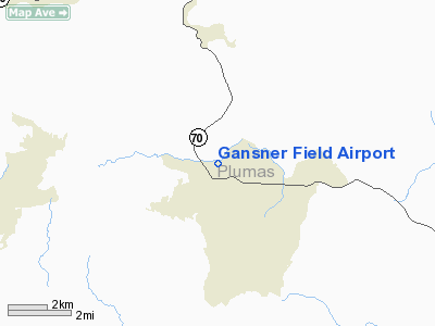
Gansner Airport (FAA LID: 2O1) is a public airport located one mile (1.6 km) north of Quincy, serving Plumas County, California, USA. This general aviation airport covers 88 acres (360,000 m) and has one runway.
The above content comes from Wikipedia and is published under free licenses – click here to read more.
Location
& QuickFacts
|
FAA
Information Effective: |
2006-06-08 |
|
Airport
Identifier: |
2O1 |
|
Longitude/Latitude: |
120-56-43.4000W/39-56-38.0000N
-120.945389/39.943889 (Estimated) |
|
Elevation: |
3415 ft / 1040.89 m (Estimated) |
|
Land: |
88 acres |
|
From
nearest city: |
1 nautical miles N of Quincy, CA |
|
Location: |
Plumas County, CA |
|
Magnetic Variation: |
17E (1985) |
Owner
& Manager
|
Ownership: |
Publicly owned |
|
Owner: |
County Of Plumas |
|
Address: |
555 Main St
Quincy, CA 95971-7007 |
|
Phone
number: |
530-283-6210 |
|
Manager: |
John Mcmorrow
DIRECTOR OF PLANNING. |
|
Address: |
555 Main St,
Quincy, CA 95971-7007 |
|
Phone
number: |
530-283-6210
PLANNING DEPT OFFICE IN QUINCY. FBO PHONE AT ARPT 530-283-2600. |
Airport
Operations and Facilities
|
Airport
Use: |
Open to public |
|
Wind
indicator: |
Yes |
|
Segmented
Circle: |
Yes |
|
Control
Tower: |
No |
|
Attendance
Schedule: |
UNATNDD |
|
Lighting
Schedule: |
DUSK-DAWN
ACTVT MIRL RY 06/24 - CTAF. |
|
Beacon
Color: |
Clear-Green (lighted land airport)
ROTG BCN LOCATED 2000 FT NORTH OF ARPT ON TOP OF HILL.
SECONDARY
WHITE BCN 3 MI SOUTH OF ARPT. |
|
Landing
fee charge: |
No |
|
Sectional
chart: |
San Francisco |
|
Region: |
AWP - Western-Pacific |
|
Traffic
Pattern Alt: |
1000 ft |
|
Boundary
ARTCC: |
ZOA - Oakland |
|
Tie-in
FSS: |
RIU - Rancho Murieta |
|
FSS
on Airport: |
No |
|
FSS
Phone: |
916-354-0161 |
|
FSS
Toll Free: |
1-800-WX-BRIEF |
|
NOTAMs
Facility: |
RIU (NOTAM-d service avaliable) |
|
Federal Agreements: |
NGY |
Airport
Communications
|
CTAF: |
122.700 |
|
Unicom: |
122.700 |
Airport
Services
|
Fuel
available: |
100LL
24 HR FUEL BY CREDIT CARD. |
|
Airframe
Repair: |
NONE |
|
Power
Plant Repair: |
NONE |
|
Bottled
Oxygen: |
NONE |
|
Bulk
Oxygen: |
NONE |
|
Runway Information
Runway 06/24
|
Dimension: |
4105 x 60 ft / 1251.2 x 18.3 m |
|
Surface: |
ASPH, Good Condition |
|
Weight
Limit: |
Single wheel: 12500 lbs. |
|
Edge
Lights: |
Medium |
|
|
Runway 06 |
Runway 24 |
|
Longitude: |
120-57-09.5060W |
120-56-17.3094W |
|
Latitude: |
39-56-35.3351N |
39-56-40.8767N |
|
Elevation: |
3418.00 ft |
3408.00 ft |
|
Alignment: |
82 |
127 |
|
Traffic
Pattern: |
Left |
Right |
|
Markings: |
Basic, Fair Condition |
Basic, Fair Condition |
|
Crossing
Height: |
0.00 ft |
27.00 ft |
|
VASI: |
|
2-box on left side |
|
Visual
Glide Angle: |
0.00� |
3.00� |
|
Runway
End Identifier: |
No |
No |
|
Centerline
Lights: |
No |
No |
|
Touchdown
Lights: |
No |
No |
|
Obstruction: |
19 ft road, 400.0 ft from runway, 10:1 slope
to clear
45 FT TREE 1500 FT FROM 210 FT LEFT 28:1 TO THLD. |
115 ft trees, 2500.0 ft from runway, 500 ft
left of centerline, 20:1 slope to clear |
|
Radio Navigation
Aids
|
ID |
Type |
Name |
Ch |
Freq |
Var |
Dist |
|
OVE |
NDB |
Oroville |
|
212.00 |
16E |
41.3 nm |
|
AHC |
VOR/DME |
Amedee |
027X |
109.00 |
17E |
41.3 nm |
|
CIC |
VOR/DME |
Chico |
035X |
109.80 |
16E |
42.6 nm |
Remarks
- CAUTION:
DUE TO PROXIMITY OF TERRAIN NRML OPNS ARE: FOR DEPS/TOUCH AND GO RWY
06. LDGS
ON RWYS 06 AND 24.
- ULTRALIGHTS
ON AND INVOF ARPT.
- RAPIDLY
RISING TERRAIN WITH 50 FT TREES ON NORTH SIDE OF RY.
- PREDATES
TO 1958 FA ACT.
Based Aircraft
|
Aircraft
based on field: |
32 |
|
Single
Engine Airplanes: |
28 |
|
Multi
Engine Airplanes: |
1 |
|
Gliders: |
2 |
|
Ultralights: |
1 |
Operational Statistics
|
Aircraft
Operations: |
252/Week |
|
Air Taxi: |
7.6% |
|
General
Aviation Local: |
45.8% |
|
General
Aviation Itinerant: |
45.8% |
|
Military: |
0.8% |
Gansner Field Airport
Address:
Plumas County, CA
Tel:
530-283-6210
Images
and information placed above are from
http://www.airport-data.com/airport/2O1/
We
thank them for the data!
| General
Info |
| Country |
United
States |
| State |
CALIFORNIA
|
| FAA ID |
2O1
|
| Latitude |
39-56-37.610N
|
| Longitude |
120-56-48.834W
|
| Elevation |
3415 feet
|
| Near City |
QUINCY
|
We don't guarantee the information is fresh and accurate. The data may
be wrong or outdated.
For more up-to-date information please refer to other sources.
|
|


