 |
|
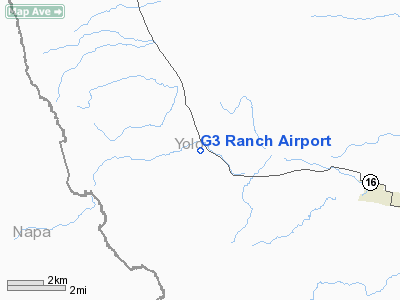
Location
& QuickFacts
|
FAA
Information Effective: |
2006-06-08 |
|
Airport
Identifier: |
63CL |
|
Longitude/Latitude: |
122-08-18.9040W/38-42-59.6520N
-122.138584/38.716570 (Estimated) |
|
Elevation: |
360 ft / 109.73 m (Estimated) |
|
Land: |
320 acres |
|
From
nearest city: |
4 nautical miles W of Capay, CA |
|
Location: |
Yolo County, CA |
|
Magnetic Variation: |
16E (1985) |
Owner
& Manager
|
Ownership: |
Privately owned |
|
Owner: |
C. M. Gordon |
|
Address: |
19725 Rd 78a
Capay, CA 95607 |
|
Phone number: |
916-796-4486 |
|
Manager: |
C. M. Gordon |
|
Address: |
19725 Rd 78a
Capay, CA 95607 |
|
Phone number: |
916-796-4486 |
Airport
Operations and Facilities
|
Airport Use: |
Private |
|
Wind indicator: |
No |
|
Segmented Circle: |
No |
|
Control Tower: |
No |
|
Attendance Schedule: |
UNATNDD |
|
Landing fee charge: |
No |
|
Sectional chart: |
San Francisco |
|
Region: |
AWP - Western-Pacific |
|
Boundary ARTCC: |
ZOA - Oakland |
|
Tie-in FSS: |
RIU - Rancho Murieta |
|
FSS on Airport: |
No |
|
FSS Phone: |
916-354-0161 |
|
FSS Toll Free: |
1-800-WX-BRIEF |
Airport
Services
|
Airframe
Repair: |
NONE |
|
Power
Plant Repair: |
NONE |
|
Runway
Information
Runway NW/SE
|
Dimension: |
2800 x 110 ft / 853.4 x 33.5 m |
|
Surface: |
TURF, |
|
|
Runway NW |
Runway SE |
|
Traffic
Pattern: |
Left |
Left |
|
Radio Navigation
Aids
|
ID |
Type |
Name |
Ch |
Freq |
Var |
Dist |
|
MY |
NDB |
Halow |
|
222.00 |
16E |
36.8 nm |
|
LOP |
NDB |
Lampson |
|
217.00 |
16E |
38.7 nm |
|
SUU |
TACAN |
Travis |
113X |
|
17E |
29.7 nm |
|
BAB |
TACAN |
Beale |
023X |
|
16E |
41.2 nm |
|
TZZ |
VOR |
Travis |
|
116.40 |
17E |
27.2 nm |
|
STS |
VOR/DME |
Santa Rosa |
077X |
113.00 |
16E |
34.0 nm |
|
MCC |
VOR/DME |
Mc Clellan |
029X |
109.20 |
17E |
34.6 nm |
|
MYV |
VOR/DME |
Marysville |
045X |
110.80 |
16E |
35.0 nm |
|
CCR |
VOR/DME |
Concord |
117X |
117.00 |
17E |
40.6 nm |
|
ILA |
VORTAC |
Williams |
091X |
114.40 |
18E |
21.9 nm |
|
SAC |
VORTAC |
Sacramento |
099X |
115.20 |
17E |
32.1 nm |
|
SGD |
VORTAC |
Scaggs Island |
058X |
112.10 |
17E |
34.1 nm |
|
MXW |
VORTAC |
Maxwell |
037X |
110.00 |
18E |
36.3 nm |
|
SMF |
VOT |
Sacramento Metropolitan |
|
111.40 |
|
25.7 nm |
|
SAC |
VOT |
Sacramento Executive |
|
111.40 |
|
32.4 nm |
Remarks
- FAA
FORM 7480-1 SUBMITTED-ANALYSIS NOT RQRD.
G3 Ranch Airport
Address:
Yolo County, CA
Tel:
916-796-4486
Images
and information placed above are from
http://www.airport-data.com/airport/63CL/
We
thank them for the data!
| General
Info |
| Country |
United
States |
| State |
CALIFORNIA
|
| FAA ID |
63CL
|
| Latitude |
38-42-59.652N
|
| Longitude |
122-08-18.904W
|
| Elevation |
360 feet
|
| Near City |
CAPAY
|
We don't guarantee the information is fresh and accurate. The data may
be wrong or outdated.
For more up-to-date information please refer to other sources.
|
|


