 |
|
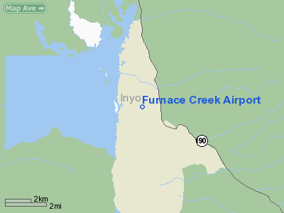
| Furnace Creek Airport |
| IATA: none – ICAO: none – FAA LID: L06 |
| Summary |
| Operator |
U.S. Dept. of the Interior |
| Coordinates |
36°27′50″N 116°52′53″W / 36.46389°N 116.88139°W / 36.46389; -116.88139Coordinates: 36°27′50″N 116°52′53″W / 36.46389°N 116.88139°W / 36.46389; -116.88139 |
Furnace Creek Airport (FAA LID: L06) is a public airport located 0.75 miles (1 km) west of Furnace Creek, Death Valley, serving Inyo County, California, USA. This general aviation airport covers 40 acres (16 ha) and has one runway. At -210 feet (−64 m) MSL, it is the lowest elevation airport in North America.
The above content comes from Wikipedia and is published under free licenses – click here to read more.
Location
& QuickFacts
|
FAA
Information Effective: |
2006-06-08 |
|
Airport
Identifier: |
L06 |
|
Longitude/Latitude: |
116-52-53.1930W/36-27-49.8130N
-116.881443/36.463837 (Estimated) |
|
Elevation: |
-210 ft / -64.01 m (Estimated) |
|
Land: |
40 acres |
|
From
nearest city: |
0 nautical miles N of Death Valley National
Park, CA |
|
Location: |
Inyo County, CA |
|
Magnetic Variation: |
14E (1985) |
Owner
& Manager
|
Ownership: |
Publicly owned |
|
Owner: |
Us Dept Of Interior/park Svc |
|
Address: |
Death Valley Natl Park
Death Valley, CA 92328 |
|
Phone
number: |
760-786-2331 |
|
Manager: |
Edward Forner |
|
Address: |
Death Valley Natl Park
Death Valley, CA 92328 |
|
Phone number: |
760-786-3248 |
Airport
Operations and Facilities
|
Airport
Use: |
Open to public |
|
Wind
indicator: |
Yes |
|
Segmented
Circle: |
Yes |
|
Control
Tower: |
No |
|
Attendance
Schedule: |
UNATNDD |
|
Lighting
Schedule: |
DUSK-DAWN
ACTVT BCN - CTAF; 5 CLICKS ON 7 CLICKS OFF. |
|
Beacon
Color: |
Clear-Green (lighted land airport) |
|
Landing
fee charge: |
No |
|
Sectional
chart: |
Las Vegas |
|
Region: |
AWP - Western-Pacific |
|
Traffic
Pattern Alt: |
1000 ft |
|
Boundary
ARTCC: |
ZLA - Los Angeles |
|
Tie-in
FSS: |
RAL - Riverside |
|
FSS
on Airport: |
No |
|
FSS
Phone: |
951-351-3020 |
|
FSS
Toll Free: |
1-800-WX-BRIEF |
|
NOTAMs
Facility: |
RAL (NOTAM-d service avaliable) |
|
Federal Agreements: |
N |
Airport
Communications
Airport
Services
|
Fuel
available: |
100LL
FOR FUEL CTC FURNACE CREEK RANCH (760) 786-2343. |
|
Airframe
Repair: |
NONE |
|
Power
Plant Repair: |
NONE |
|
Bottled
Oxygen: |
NONE |
|
Bulk
Oxygen: |
NONE |
|
Runway Information
Runway 15/33
|
Dimension: |
3065 x 70 ft / 934.2 x 21.3 m |
|
Surface: |
ASPH, Good Condition |
|
Weight
Limit: |
Single wheel: 4000 lbs. |
|
Edge
Lights: |
Low |
|
|
Runway 15 |
Runway 33 |
|
Traffic
Pattern: |
Right |
Left |
|
Markings: |
Basic, Good Condition |
Basic, Good Condition |
|
Runway
End Identifier: |
No |
No |
|
Centerline
Lights: |
No |
No |
|
Touchdown
Lights: |
No |
No |
|
Obstruction: |
5 ft brush, 300.0 ft from runway, 150 ft right
of centerline, 20:1 slope to clear |
15 ft brush, 360.0 ft from runway, 100 ft left
of centerline, 10:1 slope to clear |
|
Radio Navigation
Aids
|
ID |
Type |
Name |
Ch |
Freq |
Var |
Dist |
|
MCY |
NDB |
Mercury |
|
326.00 |
16E |
42.4 nm |
|
BTY |
VORTAC |
Beatty |
094X |
114.70 |
16E |
21.2 nm |
Remarks
- USE
ONLY MKD RY FOR GROUND OPNS.
SAFETY AREA ROUGH & SOFT.
- NO
TIEDOWN ROPES OR CHAINS AVBL.
- DITCH
145 FT RIGHT OF RY 33.
- SAFETY
AREAS ADJ RY CLSD, STAY ON PAVED AREA ONLY DUE TO EXTREMELY SOFT DIRT.
- ESTABD
PRIOR TO 5/15/59.
Based Aircraft
|
Aircraft
based on field: |
3 |
|
Single
Engine Airplanes: |
3 |
Operational Statistics
|
Aircraft
Operations: |
197/Week |
|
General
Aviation Local: |
2.0% |
|
General
Aviation Itinerant: |
98.0% |
Furnace Creek Airport
Address:
Inyo County, CA
Tel:
760-786-2331,
760-786-3248
Images
and information placed above are from
http://www.airport-data.com/airport/L06/
We
thank them for the data!
| General
Info |
| Country |
United
States |
| State |
CALIFORNIA
|
| FAA ID |
L06
|
| Latitude |
36-27-49.813N
|
| Longitude |
116-52-53.193W
|
| Elevation |
-210 feet
|
| Near City |
DEATH
VALLEY NATIONAL PARK |
We don't guarantee the information is fresh and accurate. The data may
be wrong or outdated.
For more up-to-date information please refer to other sources.
|
|


