 |
|
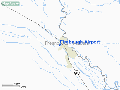
| Firebaugh Airport |
| IATA: none – ICAO: none – FAA LID: F34 |
| Summary |
| Airport type |
Public |
| Operator |
City of Firebaugh |
| Location |
Firebaugh, California |
| Elevation AMSL |
157 ft / 47.9 m |
| Coordinates |
36°51′36″N 120°27′52″W / 36.86°N 120.46444°W / 36.86; -120.46444Coordinates: 36°51′36″N 120°27′52″W / 36.86°N 120.46444°W / 36.86; -120.46444 |
| Runways |
| Direction |
Length |
Surface |
| ft |
m |
| 12/30 |
3,102 |
945 |
Asphalt |
Firebaugh Airport (FAA LID: F34), formerly Q49, is a public airport located one mile (1.6 km) west of Firebaugh, serving Fresno County, California, USA. The airport is mostly used for general aviation.
Facilities
Firebaugh Airport covers 37 acres and has one runway:
- Runway 12/30: 3,102 x 60 ft (945 x 18 m), Surface: Asphalt
The above content comes from Wikipedia and is published under free licenses – click here to read more.
Location
& QuickFacts
|
FAA
Information Effective: |
2006-06-08 |
|
Airport
Identifier: |
F34 |
|
Longitude/Latitude: |
120-27-52.0830W/36-51-35.9590N
-120.464467/36.859989 (Estimated) |
|
Elevation: |
157 ft / 47.85 m (Surveyed) |
|
Land: |
37 acres |
|
From
nearest city: |
1 nautical miles W of Firebaugh, CA |
|
Location: |
Fresno County, CA |
|
Magnetic Variation: |
15E (1985) |
Owner
& Manager
|
Ownership: |
Publicly owned |
|
Owner: |
City Of Firebaugh |
|
Address: |
1575 11th St
Firebaugh, CA 93622 |
|
Phone
number: |
209-659-2043 |
|
Manager: |
Jose Ramirez
CITY MGR. MAINTENACE CONTACT PUBLIC WORKS, RAY AMALDNALDO
559-269-7735 |
|
Address: |
1575 11th Street
Firebaugh, CA 93622 |
|
Phone number: |
209-659-2043 |
Airport
Operations and Facilities
|
Airport
Use: |
Open to public |
|
Wind
indicator: |
Yes |
|
Segmented
Circle: |
Yes |
|
Control
Tower: |
No |
|
Attendance
Schedule: |
UNATNDD |
|
Lighting
Schedule: |
DUSK-DAWN |
|
Beacon
Color: |
Clear-Green (lighted land airport) |
|
Landing
fee charge: |
No |
|
Sectional
chart: |
San Francisco |
|
Region: |
AWP - Western-Pacific |
|
Traffic
Pattern Alt: |
850 ft |
|
Boundary
ARTCC: |
ZOA - Oakland |
|
Tie-in
FSS: |
RIU - Rancho Murieta |
|
FSS
on Airport: |
No |
|
FSS
Phone: |
916-354-0161 |
|
FSS
Toll Free: |
1-800-WX-BRIEF |
|
NOTAMs
Facility: |
RIU (NOTAM-d service avaliable) |
|
Federal Agreements: |
N |
Airport
Communications
Airport
Services
|
Airframe
Repair: |
NONE |
|
Power
Plant Repair: |
NONE |
|
Bottled
Oxygen: |
NONE |
|
Bulk
Oxygen: |
NONE |
|
Runway Information
Runway 12/30
|
Dimension: |
3102 x 60 ft / 945.5 x 18.3 m |
|
Surface: |
ASPH, Good Condition |
|
Weight
Limit: |
Single wheel: 12000 lbs. |
|
Edge
Lights: |
Medium |
|
|
Runway 12 |
Runway 30 |
|
Longitude: |
120-28-04.4530W |
120-27-39.7150W |
|
Latitude: |
36-51-47.6400N |
36-51-24.2770N |
|
Elevation: |
157.00 ft |
157.00 ft |
|
Alignment: |
127 |
127 |
|
Traffic
Pattern: |
Right |
Left |
|
Markings: |
Basic, Fair Condition |
Basic, Fair Condition |
|
Crossing
Height: |
0.00 ft |
29.00 ft |
|
VASI: |
|
2-box on left side
VASI OTS INDEFLY. |
|
Visual
Glide Angle: |
0.00� |
3.00� |
|
Runway
End Identifier: |
No |
No |
|
Centerline
Lights: |
No |
No |
|
Touchdown
Lights: |
No |
No |
|
Obstruction: |
10 ft road, 400.0 ft from runway, 20:1 slope
to clear
+2' BERM & 5' DITCH 80'-120' FM RWY END 125'L TO 125'R. |
15 ft road, 700.0 ft from runway, 33:1 slope
to clear |
|
Radio Navigation
Aids
|
ID |
Type |
Name |
Ch |
Freq |
Var |
Dist |
|
FCH |
NDB |
Chandler |
|
344.00 |
15E |
31.4 nm |
|
CUK |
NDB |
Academy |
|
266.00 |
14E |
40.6 nm |
|
NLC |
TACAN |
Lemoore |
080X |
|
16E |
39.2 nm |
|
ROM |
VOR |
Priest |
|
110.00 |
16E |
44.3 nm |
|
HYP |
VOR/DME |
El Nido |
089X |
114.20 |
15E |
21.8 nm |
|
PXN |
VORTAC |
Panoche |
073X |
112.60 |
16E |
17.4 nm |
|
CZQ |
VORTAC |
Clovis |
076X |
112.90 |
15E |
31.3 nm |
|
FRA |
VORTAC |
Friant |
103X |
115.60 |
17E |
44.2 nm |
Based Aircraft
|
Aircraft
based on field: |
20 |
|
Single
Engine Airplanes: |
19 |
|
Multi
Engine Airplanes: |
1 |
Operational Statistics
|
Aircraft
Operations: |
193/Week |
|
General
Aviation Local: |
60.0% |
|
General
Aviation Itinerant: |
40.0% |
Firebaugh Airport
Address:
Fresno County, CA
Tel:
209-659-2043
Images
and information placed above are from
http://www.airport-data.com/airport/F34/
We
thank them for the data!
| General
Info |
| Country |
United
States |
| State |
CALIFORNIA
|
| FAA ID |
F34
|
| Time |
UTC-8(-7DT)
|
| Latitude |
36.859989
36� 51' 35.96" N |
| Longitude |
-120.464467
120� 27' 52.08" W |
| Elevation |
157 feet
48 meters |
| Magnetic
Variation |
014� E
(01/06) |
| Beacon |
Yes
|
| Operating
Agency |
U.S.CIVIL
AIRPORT WHEREIN PERMIT COVERS USE BY TRANSIT MILITARY AIRCRAFT
|
| Operating
Hours |
SEE REMARKS
FOR OPERATING HOURS OR COMMUNICATIONS FOR POSSIBLE HOURS |
| Daylight
Savings Time |
First
Sunday in April at 0200 to last Sunday in October at 0200 local time
(Exception Arizona and that portion of Indiana in the Eastern Time
Zone) |
We don't guarantee the information is fresh and accurate. The data may
be wrong or outdated.
For more up-to-date information please refer to other sources.
|
|


