 |
|
| MCAS El Toro |
 |
| MCAS El Toro in 1993 |
IATA: NZJ – ICAO: KNZJ – FAA LID: NZJ |
| Summary |
| Airport type |
Military |
| Operator |
United States Marine Corps |
| Location |
Orange County, California |
| Built |
1942 |
| In use |
1943 - 1999 |
| Occupants |
3rd Marine Aircraft Wing |
| Elevation AMSL |
383 ft / 117 m |
| Coordinates |
33°40′34″N 117°43′52″W / 33.67611°N 117.73111°W / 33.67611; -117.73111 |
| Runways |
| Direction |
Length |
Surface |
| ft |
m |
3/21 |
3,900 |
1,189 |
Asphalt (Closed) |
7L/25R |
8,000 |
2,438 |
Asphalt (Closed) |
7R/25L |
8,000 |
2,438 |
Asphalt (Closed) |
16L/34R |
10,000 |
3,048 |
Concrete(Closed) |
16R/34L |
10,000 |
3,048 |
Concrete(Closed) |
| Source: Federal Aviation Administration |
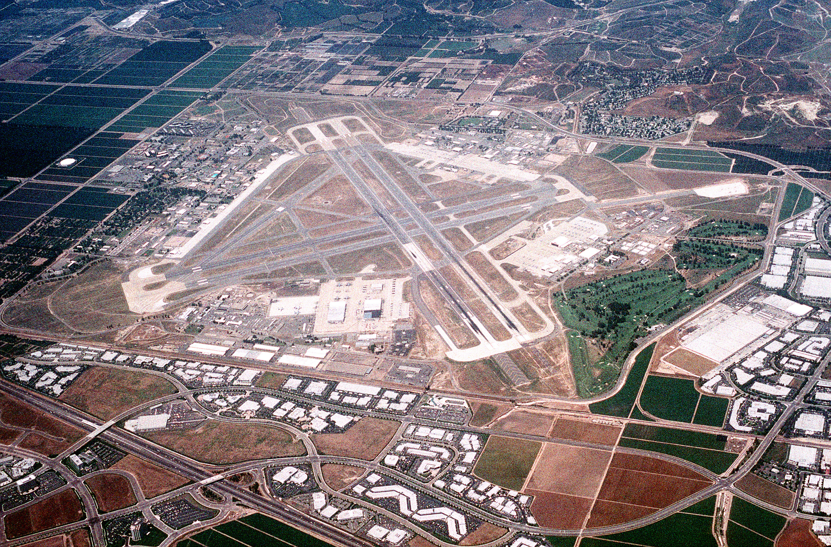
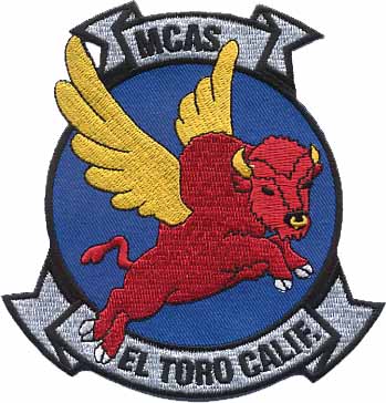
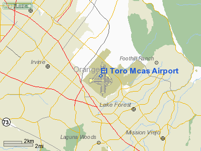
Overhead shot of MCAS El Toro taken in December of 1944. Marine Corps Air Station El Toro (IATA: NZJ, ICAO: KNZJ, FAA LID: NZJ) was a United States Marine Corps Air Station located near Irvine, California.
Before it was decommissioned in 1999, it was the 4,682 acres (19 km) home of Marine Corps aviation on the West Coast. Designated as a Master Jet Station, its four runways (two of 8,000 feet (2,400 m) and two of 10,000 feet (3,000 m)) could handle the largest aircraft in the U.S. military inventory. While it was active, all U.S. Presidents in the post-WWII era landed in Air Force One at this airfield. The El Toro "Flying Bull" patch was designed by Walt Disney Studios in 1944. It survived virtually unchanged until the close of the Air Station.
The land area originally taken by the air station is planned to be converted into a large recreational center, the Orange County Great Park. History
In May 1942, Lieutenant Colonel William Fox was directed to select the sites for all of the Marine Corps' West Coast air stations. Fox sought the most expeditious and low cost option and thus chose the already existing airports of El Centro, Mojave and Santa Barbara. For the fourth station he chose land that had previously been looked at by the Navy for a blimp base. The Marine Corps gave the owner of the land, a farmer named James Irvine Sr., $100,000 for 4,000 acres (20 km) including 1,600 acres (6.5 km) designated for a blimp base. Construction of MCAS El Toro began on August 3, 1942 on land previously owned by the Irvine Company. The company greatly resisted the station's construction at this site, which at the time contained the largest lima bean field in North America, which was the company's prime source of revenue.. The name El Toro came from the nearby small community which in 1940 only had a population of 130 people.
The base headquarters was established on November 4, 1942 and the first landing occurred in late November when a Major Micheal Carmichael, flying from Camp Kearny, was forced to make an emergency landing amongst the construction equipment. January 1943 saw the first operational units arriving at MCAS El Toro. First aboard were Marine Base Defense Aircraft Group 41 and VMF-113. They were followed later in the month by VMF-224, VMSB-231 and VMSB-232 who were returning from fighting during the Battle of Guadalcanal in order to re-organize, re-equip and train. Soon after its opening El Toro was handling the largest tactical aerodrome traffic on the Pacific Coast
Already the largest Marine air station on the West Coast, in 1944, funds were approved to double its size and operations. By the end of 1944, the base would be home to 1,248 officers and 6,831 enlisted personnel.
In 1950, El Toro was selected as a permanent Master Jet Station for the Fleet Marine Forces, Pacific. To support this new role, the aviation infrastructure at El Toro was again expanded significantly. For most of the ensuing years, El Toro served as the primary base for Marine Corps west coast fighter squadrons. In 1958, Marine Corps Air Station Miami was closed which brought the 3rd Marine Aircraft Wing to El Toro
During the presidency of Richard M. Nixon, MCAS El Toro was used for flights to and from his "Western White House" at San Clemente, California.
The land originally surrounding the base was mostly at agricultural use when it first opened, but it the late 1980s and early 90s, residential development started to begin in the area: most of it being directly in the path of the base's runways which proved to be a major problem as the constant loud noise produced by jets and choppers passing overhead was very irritating to those living in the area. Few desired to move there because of this, causing the new neighboorhoods to struggle.
In 1993, MCAS El Toro was designated for closing by the Base Realignment and Closure Commission and all of its activities were to be transferred to Marine Corps Air Station Miramar. The station officially closed on July 2, 1999 .
Base conversion controversy
The closing of MCAS El Toro ignited a political firestorm over the eventual fate of the facility. With its existing infrastructure, some favored converting the base into an international airport. Those favoring the new airport tended to come from northern Orange County, (desiring the convenience of a closer airport), and from areas in Newport Beach that are within the arrival and departure noise zones surrounding John Wayne Airport, (hoping to close that airport in favor of the new one at El Toro).
Those against the airport proposal were largely residents of the cities in the immediate vicinity of El Toro, such as Irvine, Lake Forest, Laguna Niguel, Laguna Woods, Dana Point, and Mission Viejo, where residents were alarmed at the idea of the aircraft noise. The cities opposed to the airport created a joint powers authority, the El Toro Reuse Planning Authority (ETRPA) to oppose the project. They were joined in the effort by grass-roots organizations that collected record numbers of signatures on petitions to place anti-airport initiatives on the ballot and raised funds for the election campaigns. The volunteer-run El Toro Info Site [1] was the Internet voice of the movement and one of the first political blogs.
This faction lobbied strongly in favor of other uses for the property. The city of Irvine sought to annex the property for park and related uses.
 | |
Air station insignia designed by Walt Disney Studios. |
The battle between pro-airport and anti-airport groups dominated Orange County politics for much of the late 1990s and early 2000s. Airport proposals were defeated in two hotly-contested ballot initiatives, and further challenges took place in the courts. Eventually the airport opponents prevailed, and in March 2002, the Department of Defense announced that it would sell the land to private interests to be developed into Orange County Great Park. This decision came right after the military stated that it wanted to return to the base.
Environmental remediation
Before the site could be developed for civilian use, the Department of the Navy (which oversees both the Navy and the Marine Corps) was required to perform environmental remediation to clean up contaminated soil on the site. The contamination was caused by volatile organic compounds (VOCs), primarily industrial solvents that had been used over the years for purposes such as degreasing, paint stripping, and the cleaning of aircraft.
Over the years, the VOCs had seeped into the groundwater, resulting in a plume of contaminated groundwater extending for three miles (5 km) to the west of the station. In July 2005, the Department of the Navy's Base Realignment and Closure (BRAC) Program Management Office (PMO) issued a public notice stating that the cleanup of the contaminated soil was complete. The cleanup of the groundwater is being handled by the Irvine Desalter Project, a project of two local water authorities that has financial backing from the Navy and the State of California.
Sale of El Toro
The Department of the Navy hired the General Services Administration and Los Angeles-based Colliers International to assist in the sale of MCAS El Toro. Colliers branded the project as Heritage Fields combining the long standing history of the base and what the future of the base will be to the community and the generations to come. An online auction was conducted and in February 2005, the final bid of $650 million was accepted for the four parcels of land comprising the former MCAS El Toro. The winning bidder was Heritage Fields LLC, a joint venture between developer Lennar Corporation and several other firms. Development plans for the 3,724 acres (15 km) site include residential, golf, commercial, R&D, and schools. 1,375 acres (5.6 km) of the site will be dedicated to the Great Park. A ceremony to formally transfer ownership of the property to Heritage Fields LLC was held on August 29, 2005.
Other facts
- The MCAS El Toro Air Show took place annually from the 1950s until 1997. It featured the U.S. Navy Blue Angels, as well as the USAF Thunderbirds. It also featured new aircraft that were coming into active service, such as the B-2 stealth bomber. Other displays featured military vehicles. The show also had a large gathering of vendors of military items and memorabilia. The final show in 1997 drew an estimated two million visitors.
- El Toro was twice the final stop for former President Richard Nixon, first when he landed there upon resigning the White House in 1974, and again after his death in 1994 when his body was flown to California for burial. He flew both times in his Air Force One, SAM 27000.
- On April 24, 1988, Marine Corps Colonel Jerry Cadick, then commanding officer of MAG-11, was performing a tactical aerial demonstration at the MCAS El Toro Air Show before a crowd of 300,000 when he crashed his F/A-18 Hornet at the bottom of a loop that was too close to the ground. The aircraft was in a nose-high attitude, but still carrying too much energy toward the ground when it impacted at more than 300 mph (480 km/h). Col. Cadick was subjected to extremely high G forces that resulted in his face making contact with the control stick and sustaining serious injury. He broke his arm, elbow and ribs, exploded a vertebra and collapsed a lung. Col. Cadick survived and retired from the Marine Corps. The F/A-18 remained largely intact but was beyond repair.
- On June 25, 1965, a U.S. Air Force Boeing C-135A bound for Okinawa crashed on takeoff, killing all 85 on board. After attaining an altitude of 1,000 feet (300 m), the plane failed to make a left turn and flew into rising terrain. Cause unknown.
- From July to September 1957, and from December 1958 to the spring of 1959, Lee Harvey Oswald was assigned to El Toro in the same radar operator unit as Kerry Wendell Thornley[2].
- Mercedes Benz used the unused runways in October 2002 road test event called "E-Motion" to let people test drive the new 2003 E-Class cars. Courses were configured to allow drivers to test turning, acceleration, and braking (in an area with sand on the road).
- Lexus used the large unused strips of paved runways for their test-drive event called the "Taste of Lexus" during the summers of 2006 and 2007.
- The air station served as the Los Angeles area registration and polling center location for the January 28–30, 2005 Iraq Out-of-Country Voting Program
- BICYCLE RACING On April 15, 2010 El Toro was the venue for a bicycle race, the first in a series of races scheduled to run every Thursday evening until some time in September, 2010. http://www.californiabicycleracing.org/igpcr.pdf
In popular culture
- The 1986 Sci-Fi movie Invaders From Mars was filmed on location at MCAS El Toro, mostly using the Air Control tower and its entrance as background for the movie.
- The 1986 television movie, The B.R.A.T. Patrol, starring Sean Astin and Nia Long, was filmed at El Toro however in the movie the base was referred to as Marine Corps Air Station El Diablo.
- The Marines from El Toro were featured in the 1953 film The War of the Worlds.
- In the science fiction film Independence Day (1996), Will Smith played a Marine Corps pilot from VMFA-314, Captain Steven Hiller, stationed at El Toro. In the movie, the base was completely destroyed in an alien attack, and later became a congregation point for refugees from a devastated Los Angeles.
- The television series 24 was scheduled to film at El Toro but it was cancelled due to the October 2007 California Wild Fires.
- The American version of Top Gear (current format) would have been filmed at El Toro had it not been canceled.
- In late 2007, stunt driver Rhys Millen was seriously injured at El Toro during a practice run to backflip an off-road truck.
- In the 1986 movie, Heartbreak Ridge, starring Clint Eastwood, even though the base was listed as MCAS Cherry Point, NC, the final "homecoming" scene was filmed on the flightline in front of the VMGR-352 hangar. The squadron's aircraft numbers #019, #689, #815 were used in the final scene.
- In 2007 the site was used as the shooting location for Ken Block's Gymkhana Practice video.
The above content comes from Wikipedia and is published under free licenses – click here to read more.
Location
& QuickFacts
|
FAA
Information Effective: |
2006-06-08 |
|
Airport
Identifier: |
NZJ |
|
Longitude/Latitude: |
117-43-52.1890W/33-40-34.0740N
-117.731164/33.676132 (Estimated) |
|
Elevation: |
383 ft / 116.74 m (Estimated) |
|
Land: |
0 acres |
|
From
nearest city: |
0 nautical miles of Santa Ana, CA |
|
Location: |
Orange County, CA |
|
Magnetic Variation: |
14E (1985) |
Owner
& Manager
|
Ownership: |
Navy owned |
|
Owner: |
Airtfccontofficer (code 2df4) |
|
Address: |
Atc Div Ops Dept
Mcas(h) Tustin, CA 92710 |
|
Address: |
|
Airport
Operations and Facilities
|
Airport Use: |
Private |
|
Segmented Circle: |
No |
|
Control Tower: |
Yes |
|
Sectional chart: |
Los Angeles |
|
Region: |
AWP - Western-Pacific |
|
Boundary ARTCC: |
ZLA - Los Angeles |
|
Tie-in FSS: |
RAL - Riverside |
|
FSS Phone: |
951-351-3020 |
|
FSS Toll Free: |
1-800-WX-BRIEF |
|
NOTAMs Facility: |
NZJ |
Airport
Services
|
Runway Information
Runway 03/21
|
Dimension: |
3900 x 250 ft / 1188.7 x 76.2 m |
|
Surface: |
ASPH, |
|
Edge
Lights: |
Low |
|
|
Runway 03 |
Runway 21 |
|
Traffic
Pattern: |
Left |
Left |
|
Runway 07L/25R
|
Dimension: |
8000 x 200 ft / 2438.4 x 61.0 m |
|
Surface: |
ASPH, |
|
Weight
Limit: |
Single wheel: 55000 lbs.
Dual wheel: 121000 lbs.
Dual tandem wheel: 350000 lbs.
Dual dual tandem wheel: 800000 lbs. |
|
Edge
Lights: |
Medium |
|
|
Runway 07L |
Runway 25R |
|
Traffic
Pattern: |
Left |
Left |
|
Arresting: |
E28(B) |
|
|
Runway 07R/25L
|
Dimension: |
8000 x 200 ft / 2438.4 x 61.0 m |
|
Surface: |
ASPH, |
|
Weight
Limit: |
Single wheel: 55000 lbs.
Dual wheel: 121000 lbs.
Dual tandem wheel: 350000 lbs.
Dual dual tandem wheel: 800000 lbs. |
|
Edge
Lights: |
Medium |
|
|
Runway 07R |
Runway 25L |
|
Traffic
Pattern: |
Left |
Left |
|
Arresting: |
E28/E5 |
|
|
Runway 16L/34R
|
Dimension: |
10000 x 200 ft / 3048.0 x 61.0 m |
|
Surface: |
CONC, |
|
Weight
Limit: |
Single wheel: 55000 lbs.
Dual wheel: 121000 lbs.
Dual tandem wheel: 350000 lbs.
Dual dual tandem wheel: 800000 lbs. |
|
Edge
Lights: |
High |
|
|
Runway 16L |
Runway 34R |
|
Traffic
Pattern: |
Left |
Left |
|
Arresting: |
E28(B) |
|
|
Approach
lights: |
|
ALSF2 |
|
Runway 16R/34L
|
Dimension: |
10000 x 200 ft / 3048.0 x 61.0 m |
|
Surface: |
CONC, |
|
Weight
Limit: |
Single wheel: 55000 lbs.
Dual wheel: 121000 lbs.
Dual tandem wheel: 350000 lbs.
Dual dual tandem wheel: 800000 lbs. |
|
Edge
Lights: |
Medium |
|
|
Runway 16R |
Runway 34L |
|
Traffic
Pattern: |
Left |
Left |
|
Arresting: |
|
E28(B) |
|
Radio Navigation
Aids
|
ID |
Type |
Name |
Ch |
Freq |
Var |
Dist |
|
CPM |
NDB |
Compton |
|
378.00 |
15E |
28.8 nm |
|
EMT |
NDB |
El Monte |
|
359.00 |
15E |
28.9 nm |
|
SB |
NDB |
Petis |
|
397.00 |
14E |
29.2 nm |
|
SJY |
NDB |
San Jacinto |
|
227.00 |
14E |
37.3 nm |
|
PAI |
NDB |
Pacoima |
|
370.00 |
15E |
48.9 nm |
|
RIV |
TACAN |
March |
077X |
|
14E |
26.7 nm |
|
NFG |
TACAN |
Camp Pendleton |
055X |
|
13E |
29.7 nm |
|
RAL |
VOR |
Riverside |
|
112.40 |
15E |
21.8 nm |
|
HDF |
VOR |
Homeland |
|
113.40 |
14E |
27.9 nm |
|
SMO |
VOR/DME |
Santa Monica |
045X |
110.80 |
15E |
41.4 nm |
|
SLI |
VORTAC |
Seal Beach |
104X |
115.70 |
15E |
17.4 nm |
|
PDZ |
VORTAC |
Paradise |
059X |
112.20 |
15E |
17.7 nm |
|
POM |
VORTAC |
Pomona |
041X |
110.40 |
15E |
24.3 nm |
|
OCN |
VORTAC |
Oceanside |
100X |
115.30 |
15E |
30.5 nm |
|
LAX |
VORTAC |
Los Angeles |
083X |
113.60 |
15E |
38.3 nm |
|
SXC |
VORTAC |
Santa Catalina |
051X |
111.40 |
15E |
39.0 nm |
|
SNA |
VOT |
Santa Ana |
|
110.00 |
|
6.9 nm |
|
LAX |
VOT |
San Pedro Hill |
|
113.90 |
|
30.5 nm |
Remarks
- 900'X125'
OVERRUN SOUTH END RWY 16L/34R.
- A-GEAR
E-28 CABLES APCH END RY 16L AND 34L ARE CONNECTED AT ALL TIMES, 30 MIN
PN RQR TO DISCONNECT CABLES.
DO NOT LAND DIRECTLY ON A-GEAR CABLE.
- 24
HR PN RQR FOR MULTIPLE TRAINING TRAPS.
- OPER
MON-FRI BY NOTAM; CLSD SAT-SUN AND HOL.
- (ARPT
STATUS) ARPT CLSD INDEFLY.
- CAUTION:
ALL ACFT APCH EL TORO MCAS USE LNDG LGTS.
- PRACTICE
INSTRUMENT APPROACHES ARE NOT AUTHORIZED WHEN EL TORO TOWER IS CLOSED.
- TOUCH
AND GO LNDGS & LOW APCHS NOT AUTH FOR ACFT OTHER THAN EL TORO AERO
CLUB ACFT & SAR H-L'S PRIOR TO 0800 OR AFT 2200 DAILY NOR PRIOR
TO 1200 ON SUN.
- RWY
03/21 RSTRD TO VFR DALGT OPNS FOR MCAS EL TORO AERO CLUB AND MIL HELICOPTERS.
- ALL
MULTI-ENG JET ACFT WILL SHUTDOWN OUTBOARD ENGS WHILE TAXING.
El Toro Mcas Airport
Address:
Orange County, CA
Tel:
Images
and information placed above are from
http://www.airport-data.com/airport/NZJ/
We
thank them for the data!
| General
Info |
| Country |
United
States |
| State |
CALIFORNIA
|
| FAA ID |
NZJ
|
| Latitude |
33-40-34.074N
|
| Longitude |
117-43-52.189W
|
| Elevation |
383 feet
|
| Near City |
SANTA
ANA |
Thanks to: www.worldaerodata.com
We don't guarantee the information is fresh and accurate. The data may
be wrong or outdated.
For more up-to-date information please refer to other sources.
|
 |