 |
|
|
|
Location
& QuickFacts
|
FAA
Information Effective: |
2006-06-08 |
|
Airport
Identifier: |
68CL |
|
Longitude/Latitude: |
119-38-48.4520W/36-02-44.8260N
-119.646792/36.045785 (Estimated) |
|
Elevation: |
181 ft / 55.17 m (Estimated) |
|
Land: |
0 acres |
|
From
nearest city: |
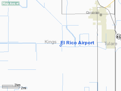
5 nautical miles SW of Corcoran, CA |
|
Location: |
Kings County, CA |
|
Magnetic Variation: |
15E (1985) |
Owner
& Manager
|
Ownership: |
Privately owned |
|
Owner: |
J. G. Boswell, Co. |
|
Address: |
Po Box 877
Corcoran, CA 93212 |
|
Phone number: |
209-992-5011 |
|
Manager: |
John Lichty |
|
Address: |
Po Box 877
Corcoran, CA 93212 |
|
Phone number: |
209-992-5011 |
Airport
Operations and Facilities
|
Airport
Use: |
Private |
|
Wind
indicator: |
Yes |
|
Segmented
Circle: |
No |
|
Control
Tower: |
No |
|
Attendance
Schedule: |
ALL/MON-FRI/0815-1645 |
|
Lighting
Schedule: |
RDO-CTL
ACTVT MIRL RY 16/34 - 123.05. |
|
Landing
fee charge: |
No |
|
Sectional
chart: |
San Francisco |
|
Region: |
AWP - Western-Pacific |
|
Boundary
ARTCC: |
ZOA - Oakland |
|
Tie-in
FSS: |
RIU - Rancho Murieta |
|
FSS
on Airport: |
No |
|
FSS
Phone: |
916-354-0161 |
|
FSS
Toll Free: |
1-800-WX-BRIEF |
|
Runway Information
Runway 16/34
|
Dimension: |
4500 x 50 ft / 1371.6 x 15.2 m |
|
Surface: |
ASPH, |
|
Edge
Lights: |
Medium |
|
|
Runway 16 |
Runway 34 |
|
Traffic
Pattern: |
Right |
Left |
|
Obstruction: |
15 ft berm, 200.0 ft from runway |
|
|
Radio Navigation
Aids
|
ID |
Type |
Name |
Ch |
Freq |
Var |
Dist |
|
COR |
NDB |
Salyer Farms |
|
205.00 |
16E |
5.5 nm |
|
CUK |
NDB |
Academy |
|
266.00 |
14E |
41.1 nm |
|
FCH |
NDB |
Chandler |
|
344.00 |
15E |
41.8 nm |
|
NLC |
TACAN |
Lemoore |
080X |
|
16E |
23.7 nm |
|
ROM |
VOR |
Priest |
|
110.00 |
16E |
49.8 nm |
|
VIS |
VOR/DME |
Visalia |
031X |
109.40 |
16E |
20.9 nm |
|
TTE |
VOR/DME |
Tule |
029X |
109.20 |
16E |
31.5 nm |
|
AVE |
VORTAC |
Avenal |
118X |
117.10 |
16E |
28.9 nm |
|
EHF |
VORTAC |
Shafter |
101X |
115.40 |
14E |
43.1 nm |
|
BFL |
VOT |
Bakersfield |
|
111.20 |
|
47.4 nm |
Remarks
- BLDGS,
TREES & FLAG POLE EAST SIDE OF RWY, HEIGHT APRX 45'.
- POWER
POLE APPROXIMATELY 1 1/4 MILES SOUTH STROBE LIGHTED.
Based Aircraft
|
Aircraft
based on field: |
2 |
|
Single
Engine Airplanes: |
1 |
|
Helicopters: |
1 |
El Rico Airport
Address:
Kings County, CA
Tel:
209-992-5011
Images
and information placed above are from
http://www.airport-data.com/airport/68CL/
We
thank them for the data!
| General
Info |
| Country |
United
States |
| State |
CALIFORNIA
|
| FAA ID |
68CL
|
| Latitude |
36-02-44.826N
|
| Longitude |
119-38-48.452W
|
| Elevation |
181 feet
|
| Near City |
CORCORAN
|
We don't guarantee the information is fresh and accurate. The data may
be wrong or outdated.
For more up-to-date information please refer to other sources.
|
|


