 |
|
|
|
|
|
Location
& QuickFacts
|
FAA
Information Effective: |
2006-06-08 |
|
Airport
Identifier: |
14L |
|
Longitude/Latitude: |
118-31-53.3110W/34-15-25.0100N
-118.531475/34.256947 (Estimated) |
|
Elevation: |
1012
ft / 308.46 m (Estimated) |
|
Land: |
0
acres |
|
From
nearest city: |
0 nautical miles N of Los Angeles, CA |
|
Location: |
Los Angeles County, CA |
|
Magnetic Variation: |
14E (1985) |
Owner
& Manager
|
Ownership: |
Publicly owned |
|
Owner: |
City Of Los Angeles |
|
Address: |
555 Ramirez St. Space 475
Los Angeles, CA 90012 |
|
Manager: |
Lapd Air Support Division |
|
Address: |
150 N. Los Angeles St
Los Angeles, CA 90012 |
|
Phone number: |
213-485-2011 |
Airport
Operations and Facilities
|
Airport
Use: |
Private |
|
Wind
indicator: |
Yes |
|
Segmented
Circle: |
No |
|
Control
Tower: |
No |
|
Attendance
Schedule: |
ALL/ALL/ALL |
|
Lighting
Schedule: |
PHONE REQ
FOR RWY LGTS, PHONE 213-485-2600. |
|
Landing fee charge: |
No |
|
Sectional chart: |
Los Angeles |
|
Region: |
AWP - Western-Pacific |
|
Boundary ARTCC: |
ZLA - Los Angeles |
|
Tie-in FSS: |
HHR - Hawthorne |
|
FSS on Airport: |
No |
|
FSS Phone: |
310-970-0102 |
|
FSS Toll Free: |
1-800-WX-BRIEF |
Airport
Communications
Airport
Services
|
Airframe
Repair: |
NONE |
|
Power
Plant Repair: |
NONE |
|
Runway Information
Helipad H1
|
Dimension: |
50 x 40 ft / 15.2 x 12.2 m |
|
Surface: |
CONC, |
|
|
Runway H1 |
Runway |
|
Traffic
Pattern: |
Left |
Left |
|
Radio Navigation
Aids
|
ID |
Type |
Name |
Ch |
Freq |
Var |
Dist |
|
PAI |
NDB |
Pacoima |
|
370.00 |
15E |
5.9 nm |
|
CPM |
NDB |
Compton |
|
378.00 |
15E |
26.3 nm |
|
EMT |
NDB |
El Monte |
|
359.00 |
15E |
26.9 nm |
|
GWF |
NDB |
Gen William J Fox |
|
282.00 |
15E |
32.9 nm |
|
NTD |
TACAN |
Point Mugu |
043X |
|
15E |
30.4 nm |
|
VNY |
VOR/DME |
Van Nuys |
078X |
113.10 |
15E |
2.8 nm |
|
SMO |
VOR/DME |
Santa Monica |
045X |
110.80 |
15E |
15.3 nm |
|
VTU |
VOR/DME |
Ventura |
019X |
108.20 |
15E |
27.1 nm |
|
CMA |
VOR/DME |
Camarillo |
105X |
115.80 |
15E |
28.1 nm |
|
FIM |
VORTAC |
Fillmore |
072X |
112.50 |
15E |
18.4 nm |
|
LAX |
VORTAC |
Los Angeles |
083X |
113.60 |
15E |
20.1 nm |
|
LHS |
VORTAC |
Lake Hughes |
021X |
108.40 |
15E |
25.7 nm |
|
PMD |
VORTAC |
Palmdale |
092X |
114.50 |
15E |
32.3 nm |
|
GMN |
VORTAC |
Gorman |
108X |
116.10 |
16E |
36.7 nm |
|
SLI |
VORTAC |
Seal Beach |
104X |
115.70 |
15E |
37.1 nm |
|
POM |
VORTAC |
Pomona |
041X |
110.40 |
15E |
38.5 nm |
|
LAX |
VOT |
San Pedro Hill |
|
113.90 |
|
32.2 nm |
|
SNA |
VOT |
Santa Ana |
|
110.00 |
|
48.0 nm |
Remarks
- RSTRD
LNDG--POLICE BUSINESS ONLY. PHONE AIR SUPPORT DIV WATCH COMMANDER 213-485-2600
PRIOR TO FLIGHT; THEN CTC KMB-7 ON 123.050 PRIOR TO LNDG AT HELIPORT.
- PRIVATE
USE.
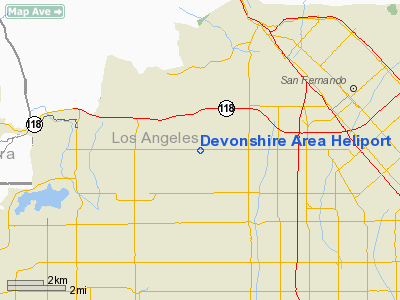
Devonshire Area Heliport
Address:
Los Angeles County, CA
Tel:
213-485-2011
Images
and information placed above are from
http://www.airport-data.com/airport/14L/
We
thank them for the data!
| General
Info |
| Country |
United
States |
| State |
CALIFORNIA
|
| FAA ID |
14L
|
| Latitude |
34-15-25.010N
|
| Longitude |
118-31-53.311W
|
| Elevation |
1012 feet
|
| Near City |
LOS ANGELES
|
We don't guarantee the information is fresh and accurate. The data may
be wrong or outdated.
For more up-to-date information please refer to other sources.
|
|


